Curate The City
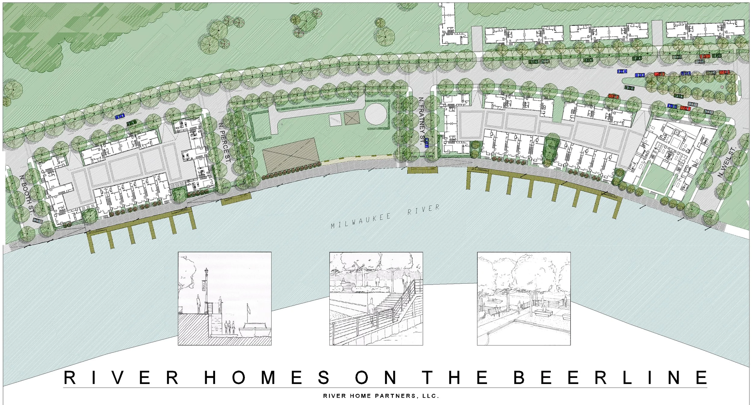
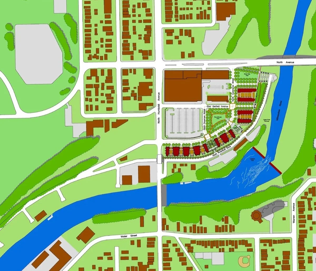
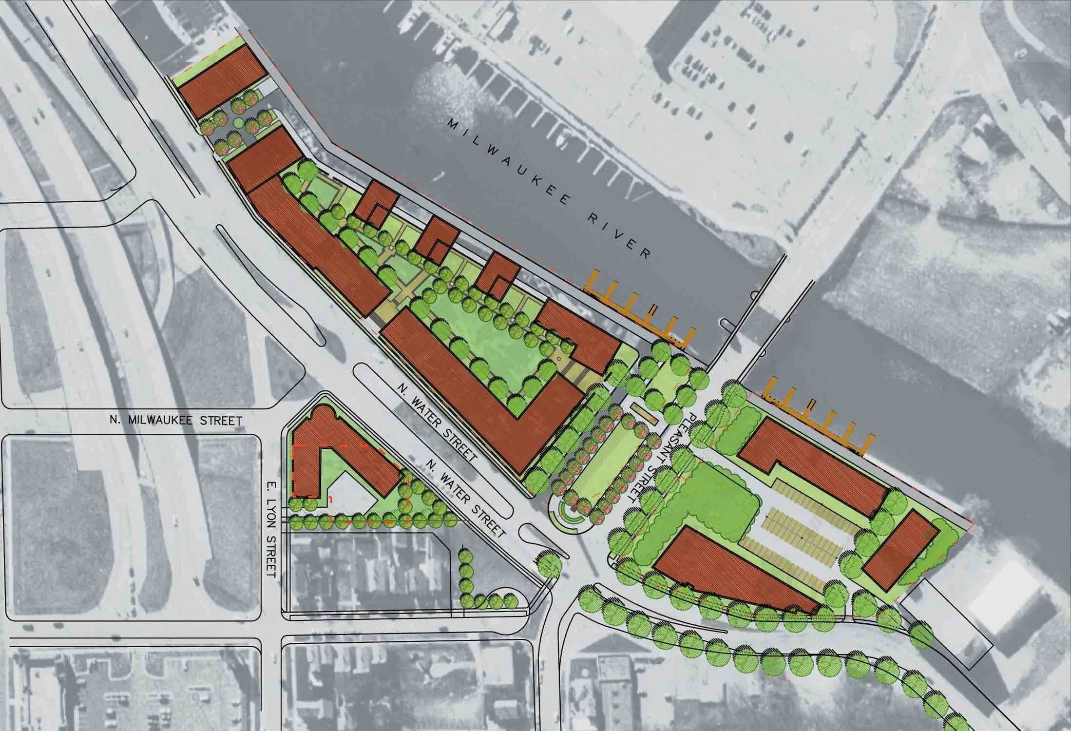
While the same city planning team (Planning and Design Institute) helped design all three projects, each had a different architects. This section of Milwaukee’s riverfront might be called a “curated” neighborhood of streets, buildings, and places. The buildings have different styles but fit together well. Over time additional buildings and places have been added.
Collage City and TheUrban Design Legacy of Colin Rowe will help design good places, but how do we sustain good places? Who makes and manages good buildings and places – our century’s version of the town burghers and estate nobles? In one case, a single benefactor may create and manage an entire public place and district (Rockefeller) while in another case, places were created by individuals with good intentions went awry (Robert Moses). Most importantly, how do planners collect and implement good urban places over time? A pragmatic answer to this question might come from applying Collage City’s metaphor of seeing the city as a museum of “places”.
Ongoing urban curators and custodians of places are like the cultural ”guardians“ Jane Jacob’s describes in Systems of Survival. Her so-called “guardians” most go beyond professionals with talent — they must actively pursue effective places. “Guardians” — the practicing city planners and urban designers — cannot always tell us if a proposed street or neighborhood is a “good” design. Over time, however, these professionals should maintain and “guard” the places we know to be good, including the social and economic opportunities in those places. This is where the application of Collage City and TheUrban Design Legacy Colin Rowe becomes muddy and difficult. This is where the city as a “museum” might need “curators” and “custodians”.
Support Implementation With Resources, Policies & Management
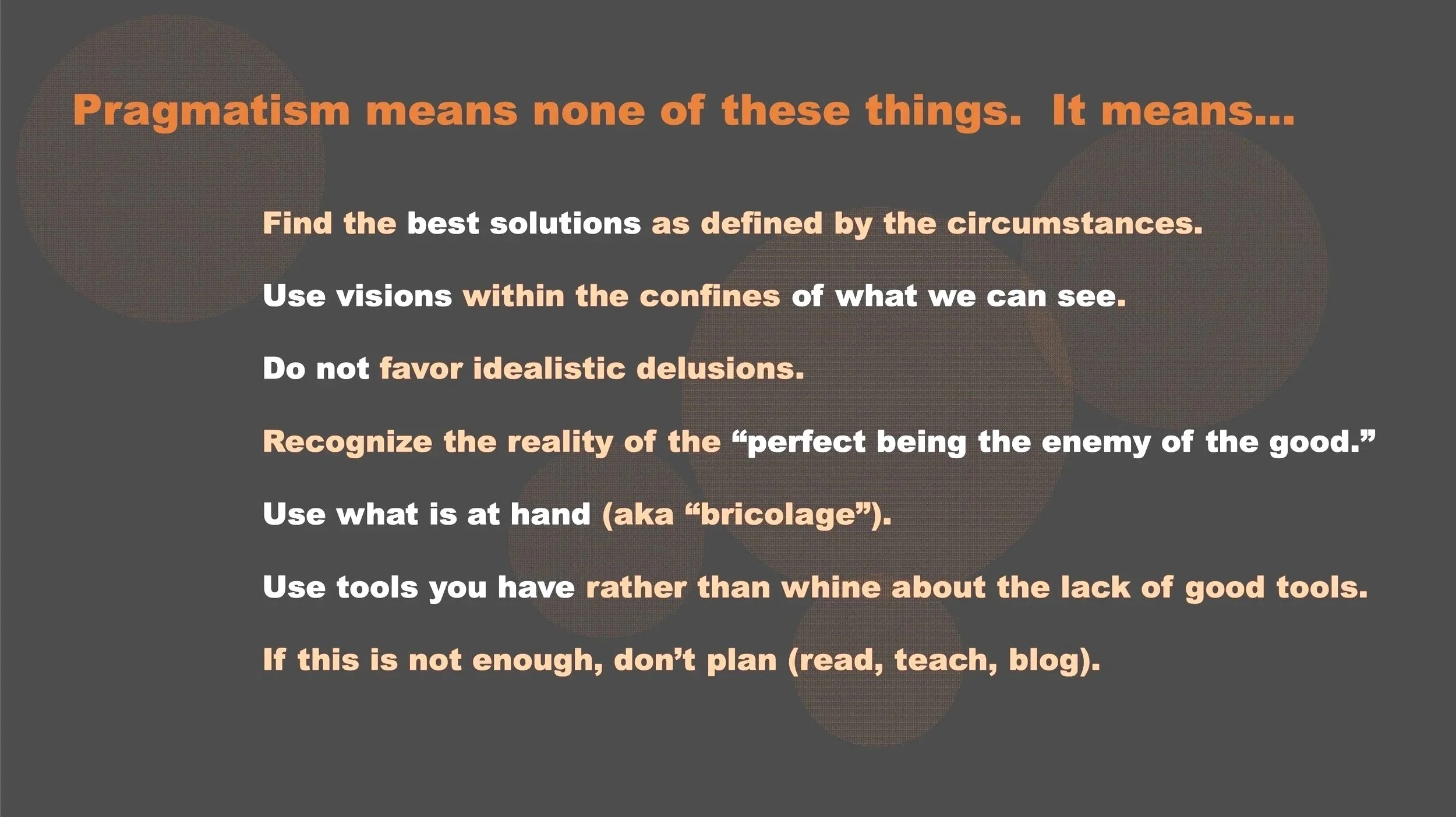
The city as “museum” requires a type of bricolage that integrates design with intentions, character, and the politics of implementation. As noted previously, if a museum’s board directors wanted an exhibit of open space concepts, the curator might decide to hang empty picture frames on the wall. The city as a “museum” should have valuable cultural public places, not empty picture frames. Can urban designers make beautiful paintings while planners find the resources to show them to the public? Are these forever two distinct tasks that combine simple by accident or can they become one stream of self-conscious decision-making?
A few years ago, my colleagues and I presented a concept called transpartisan planning (see diagram below) suggesting that good planners have to solve problems with whatever is possible politically and economically at a specific time and place – a political and economic bricolage. This might entail a public policy from those on the political right at one moment, combined with a different policy from those on the political left as the next step in implementation.
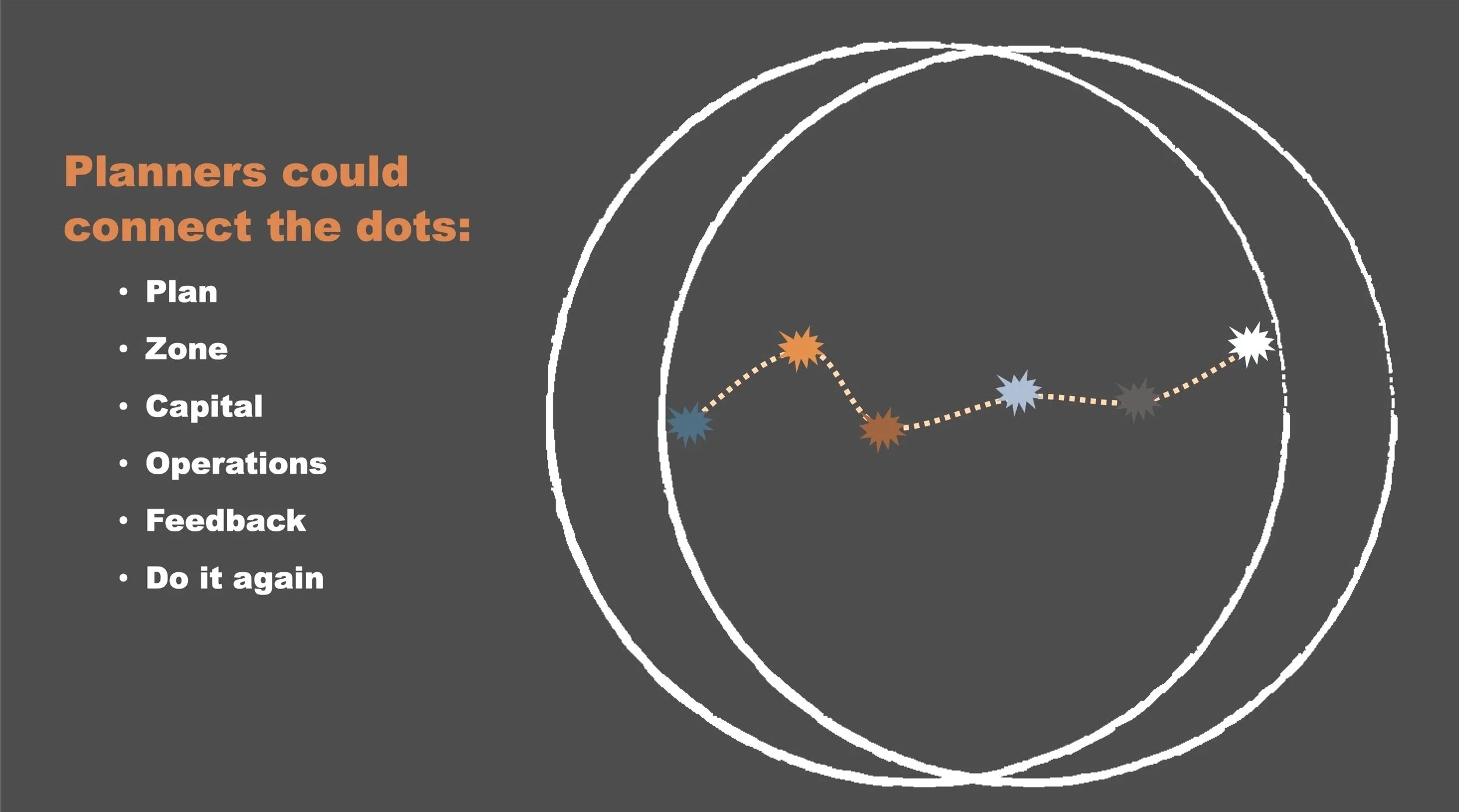
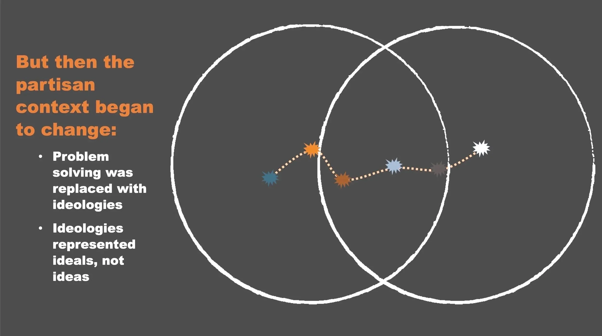
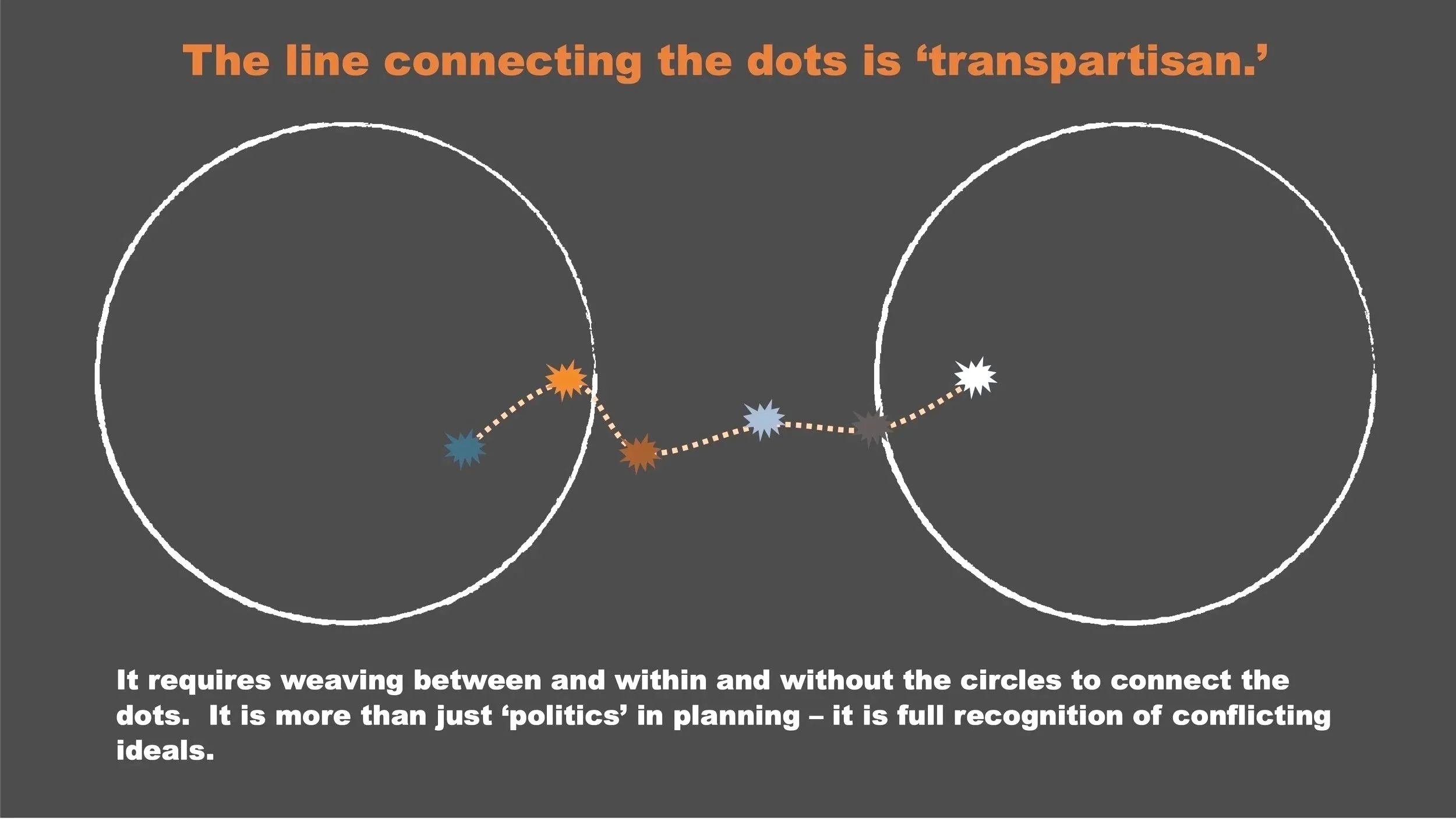
This type of balancing act is a common experience for city planners. Planners may need to champion historic preservation for implementing one place but avoid it in the next project. The same is true for the creation of good outcomes related to climate change, social justice, and economic development. There are always occasions when the end justifies the means – but it is always difficult.
As parts of the city collide, urban designers and city planners must use available resources to integrate the pieces as best they can. In so doing, many questions need to be answered. based on both effective theories and expertise.
Is a plaza managed by a private corporation, city government, a special district agency, public-private partnership, community groups or a combination?
Who pays for long-term operations? Are costs shared? If so, by whom?
Which populations are helped by a place and which harmed?
Do landowners use leases, deeds, easements or covenants on the land?
Who selects designers, engineers, contractors, staff and volunteers?
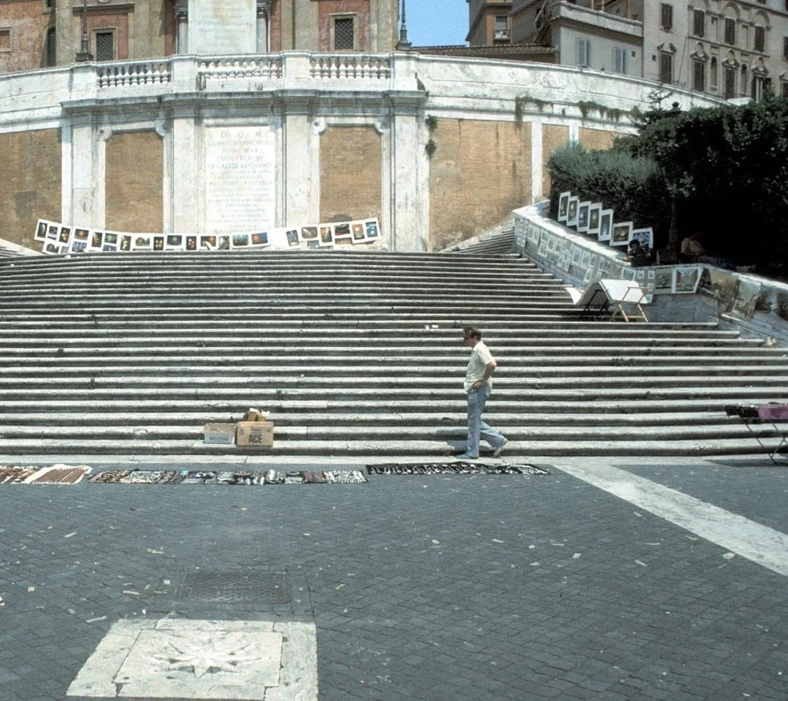
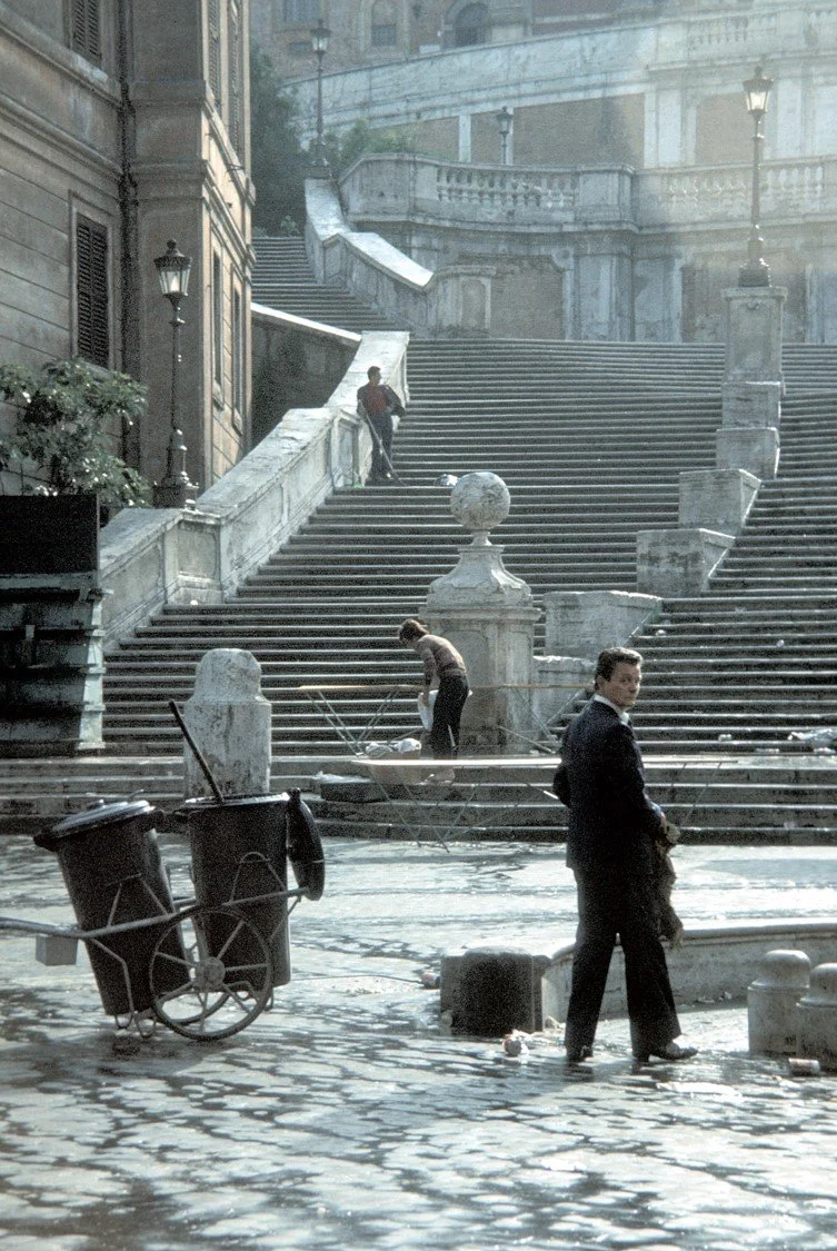
Someone funds the managers who hire personnel to clean the Spanish Steps. Do we call them planners, designers, custodians, curators? Should we just ignore them?
If we think of the ‘city as museum’ we should also realize that each place in the museum, once implemented, must be managed and programmed. Buildings and good places are not managed and programmed by architects, but by other professionals and consultants. These consultants include members in large associations such as the Building Owners and Managers Association and the International Facilities Managers Association — both with memberships exceeding professional architects and planners. That is, the professionals who are the custodians of our cities far outnumber the people who design and plan our cities, yet those of us who are designers and planners know very little about how the custodians (or “guardians” as noted above) actually practice. This ignorance of who takes care of our good urban places is not trivial. In conventional language, the word “custodian” is used with great reverence when applied to the “custodians of children” but the same word is used with a sense of servitude when we refer to janitors who are the “custodians of buildings”. Are cities children or buildings or both?
The set of tasks needed to care for cities has no single unifying group of professionals. Instead, these tasks fall to city managers, public administrators, parks departments, public works, neighborhood associations, library and school districts, and so forth. Each “type” of public place is a bit different – the village square, the town main street, a neighborhood main street, a scenic drive, courtyards, gardens, terraces and so forth.
In practice, we always face the use of bricolage, transpartisan decision-making, the non-stop changes in regulations and policies, and the evolution of urban forms and opportunities. To face this challenge, and still dovetail urban design and city planning, we need to borrow and reinterpret multiple concepts from all of the authors who promote more benevolent planning actions and good urban places. Put another way, the theory and practice of dovetailing urban design and planning never stops.
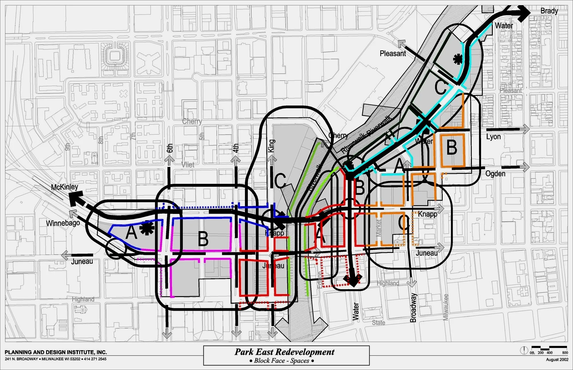
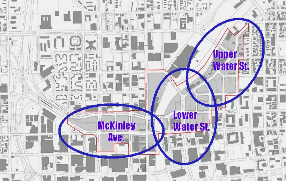
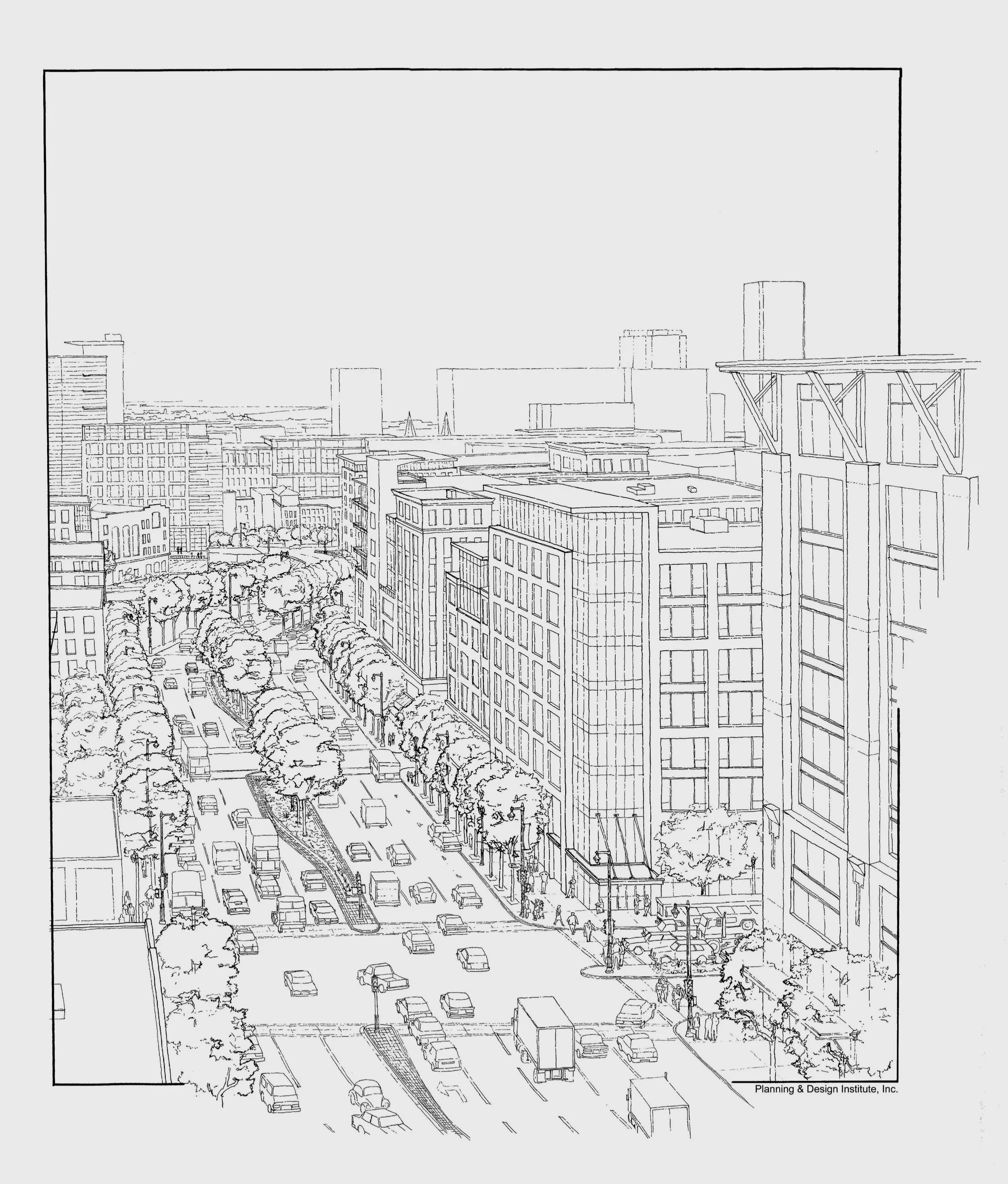
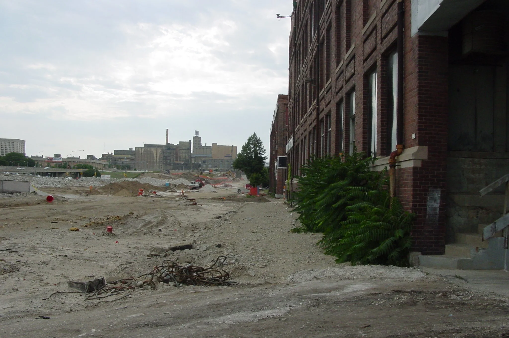
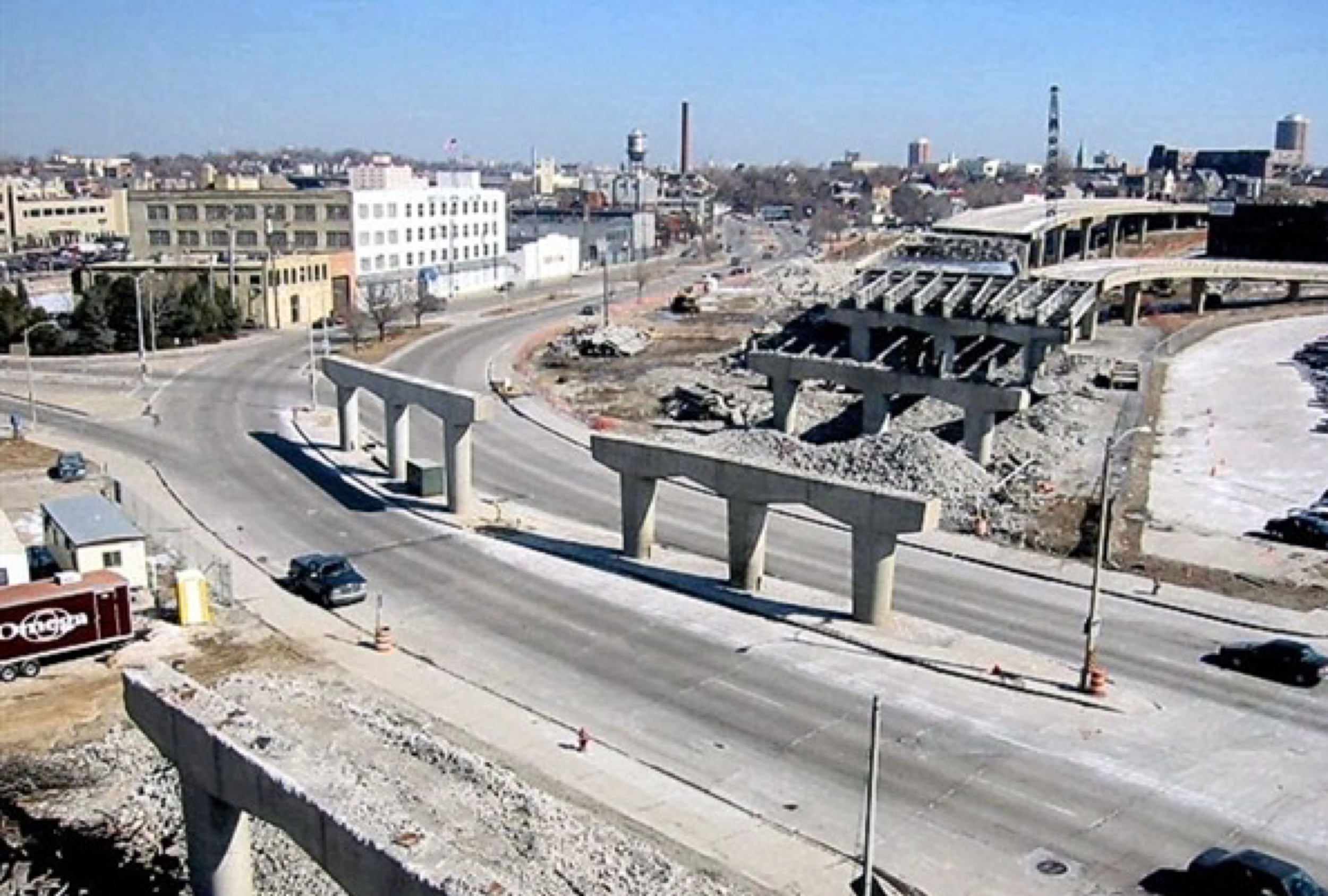
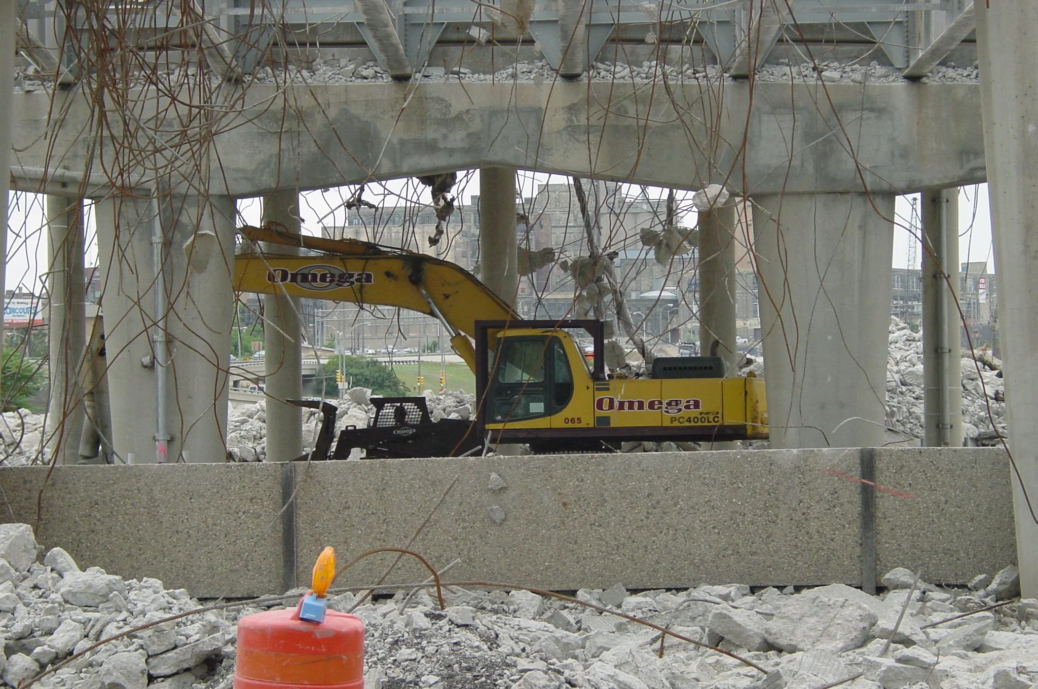
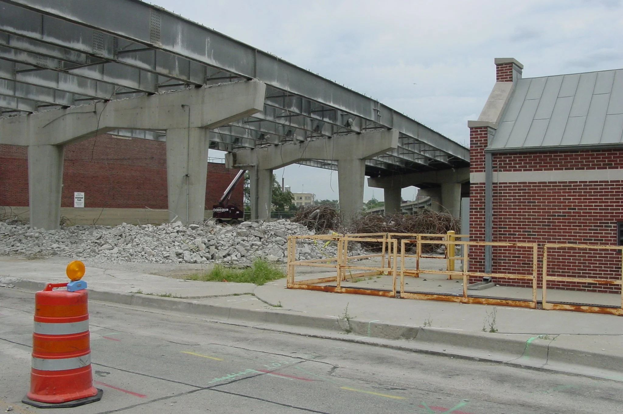
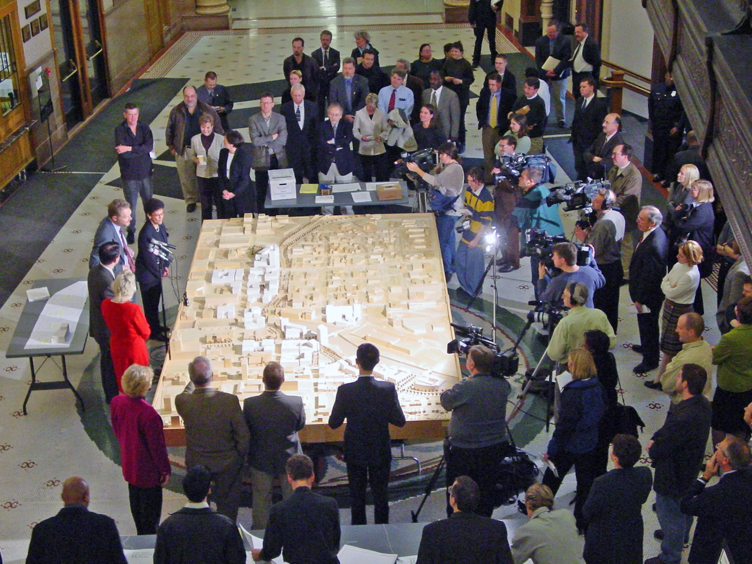
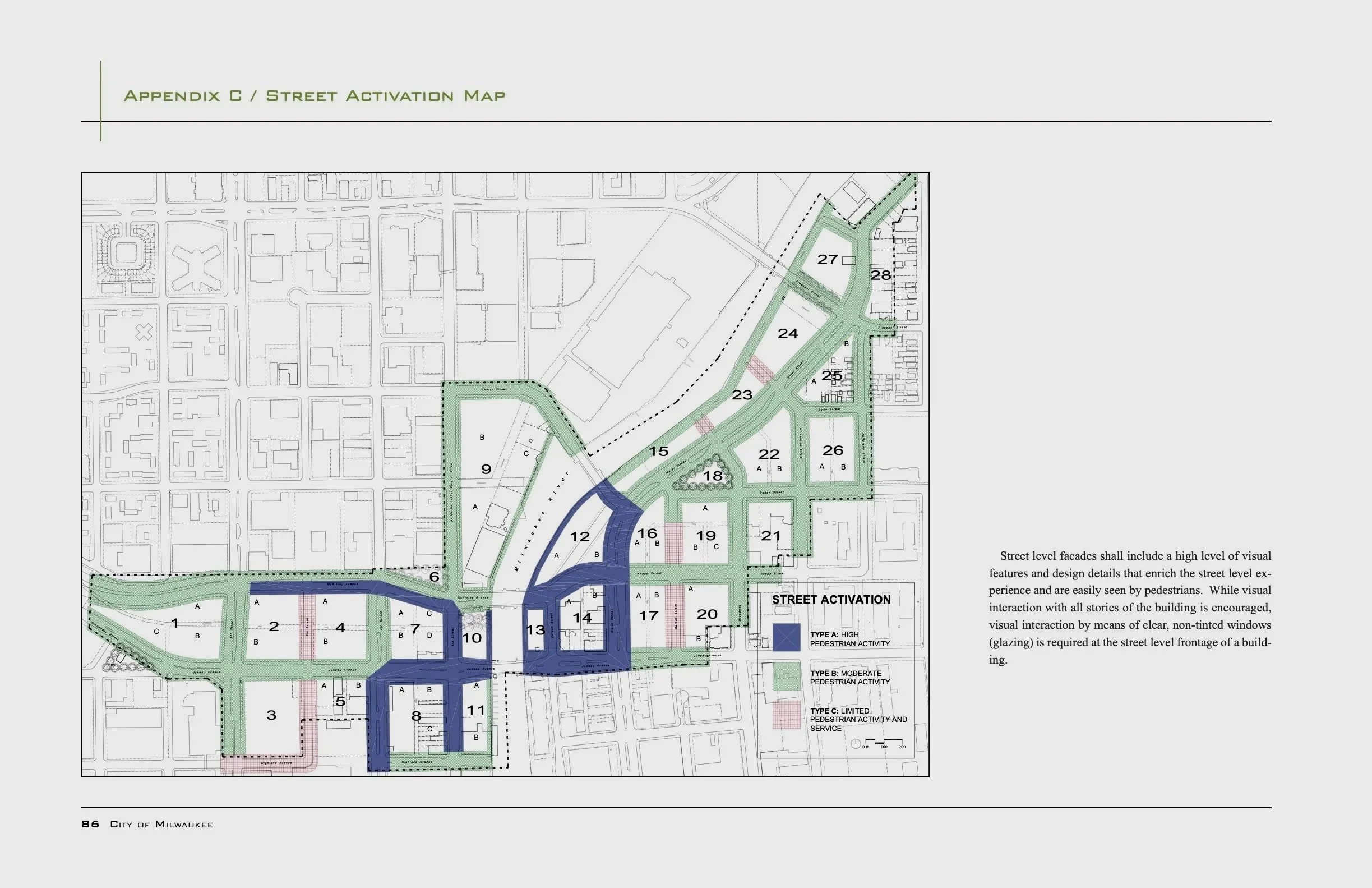
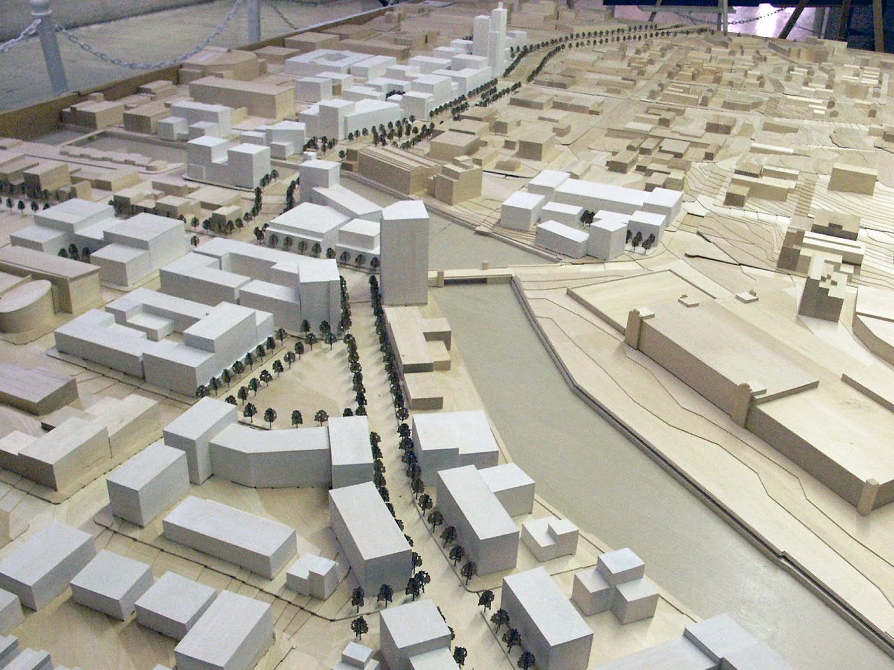
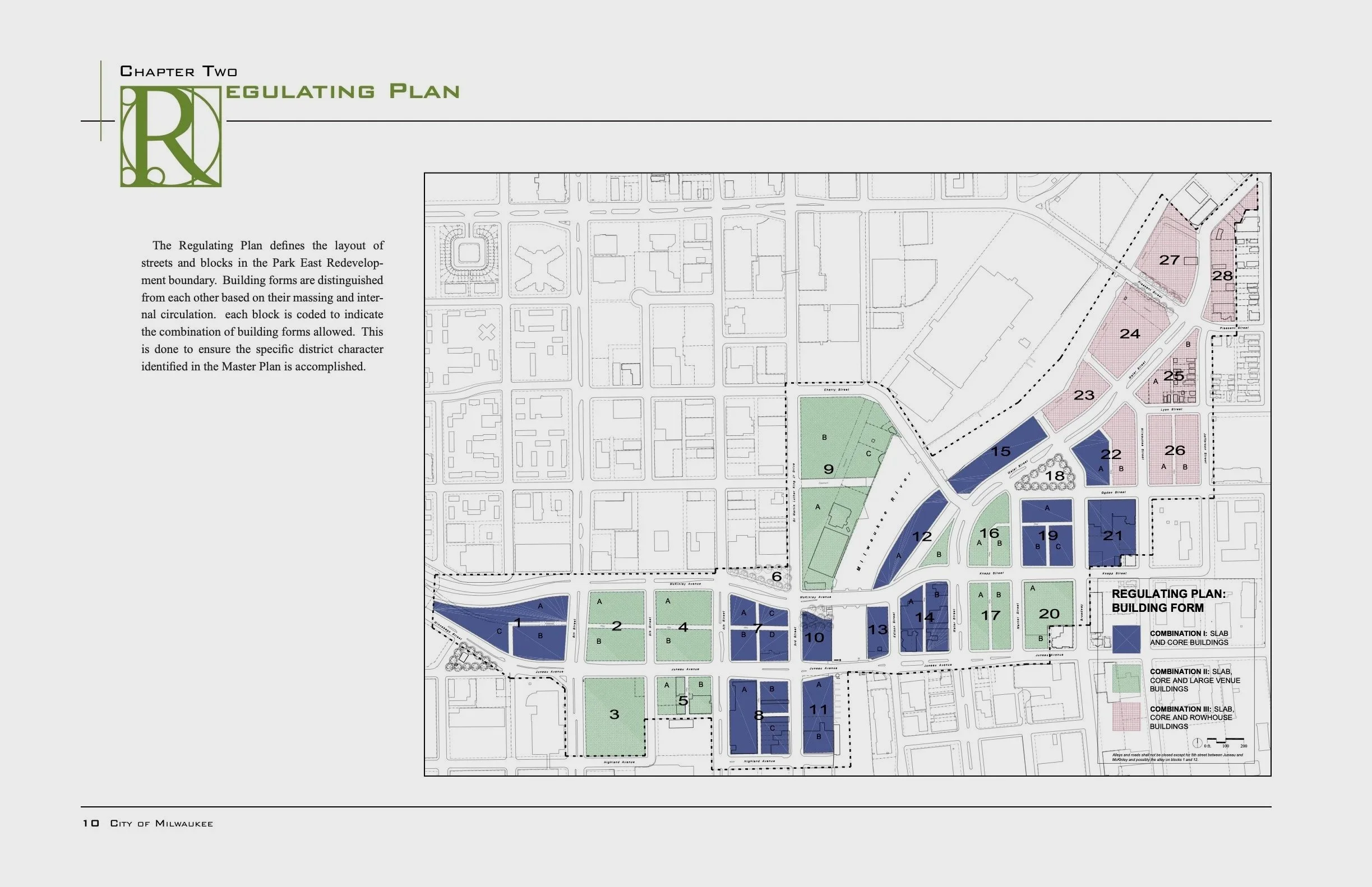
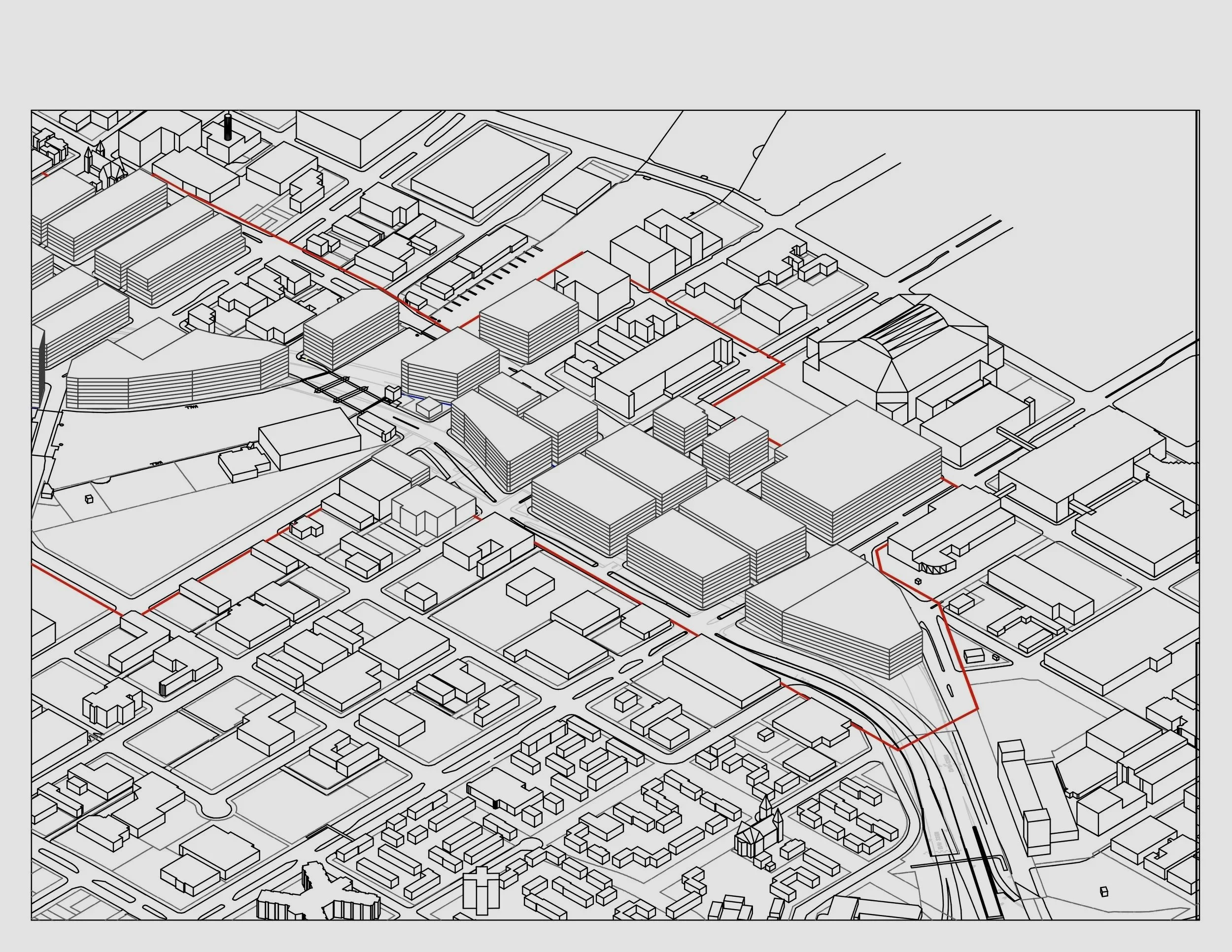
All of these images, above and below, are part of the decades-long narrative for “curating” the Park East freeway redevelopment: meeting with staff to define boundaries; talking to community members to define neighborhoods; planning for demolition; generating public support; describing legal lot and block pattrs; crating regulating plan; getting plans approved; negating construction contracts; finding and negotiating with investors; doing it over and over; meeting with new elected officials and developers. The drawing below which depicts one urban design outcome was not actually part of the project — just an occasion when we wished to see what might happen.
Think From Theory To Practice & Back Again
Collage City and The Urban Design Legacy of Colin Rowe include recommendations for “praxis”, the application of theory to practice. Theory, however, actually begins with the results of practice; that is, the history of cities provides the evidence for the theory. This cycle requires us to constantly evaluate current practice, look at the results, and modify the theories as needed.
This cyclical pattern of thought and action occurs in most disciplines. For city planners and urban designers, the cycle should begin with the evaluation of the existing urban context – the starting point for each theoretical finding. The need to evaluate the actual urban context within this cycle is frequently avoided by theorists (in both fields), because it often produces “inconvenient” facts. — inconvenient because they cannot be generalized in a reliable or valid manner. That is, a close analysis of context usually shows some aspect of a community – from detailed physical conditions to broad cultural and historical concepts – that does not fit easily within a preferred theoretical system.
The urban context almost always reveals fallacies in urban design and urban planning, especially when we take a theory of one place and assume it transfers to the next (from the west coast to the east coast, from the southwest to the Midwest, from the cities to the suburbs to the farms). If the theories do not transfer then we have to change both the theory and possibly the practice. More problematic is the situation when a practical decisions seems effective but does not fit the theory.
In Milwaukee there is a street called Burnham Street, with no apparent relationship to the City Beautiful, that contains several homes designed by Frank Lloyd Wright with no apparent relationship to the Living City. Yet both the street and the houses seem to fit the neighborhood well from a practical standpoint — they just do not fit the theory.
Find & Avoid Eleven Fallacies
Perhaps the best example of finding fallacies behind the theoretical curtains is Geoffrey Scott’s The Architecture of Humanism (1914). He defines multiple fallacies made by architectural theorists (including Ruskin), most of which could apply to today’s urban planners. These fallacies suggest that architecture (and by extension urban design) should not be based on any of Scott’s four fallacies (paraphrased):
buildings (or cities) are not “good” just because they represent the most recent technological or mechanical prowss
buildings (or cities) are not “good” just because they provide romantic illusions of personal freedom
buildings (or cities) are not “good” just because they symbolize ethical or moral ideologies
buildings (or cities) are not “good” just because they support biological necessities
Scott does not argue that these issues have no place in architectural design, just that they should not be the sole basis of an architectural ideology. Of course, Scott still has to recommend a theory. He argues succinctly that architecture should follow humanism – his explanation is imprecise but probably closer to what planners should hope to achieve than the other fallacies. Perhaps Scott’s version of humanism is just another fallacy waiting to be unmasked by the next critic.
Planners should not subscribe to the latest popular cause. Planners should learn to recognize fallacies, especially when taken to the extreme. For example, sustainability, climate-based design, access-based design, social justice-based design – all of these legitimate goals should be addressed, but never to the exclusion of the others.
Today we have our own version of these fallacies, especially those that appear in zoning, public health, open space, and transportation. These issues belong in any urban plan, but they lead to fallacies when they are taken to extremes. Overly zealous, usually exclusive, ideologies have plagued planning for decades. Open-ended concepts, less exclusive but based on well-reasoned subjective judgements, are typically labelled unscientific or too traditional and dismissed by quoting precisely measured facts thatdo not address genuine conditions and outcomes.
Here are some typical fallacies that come from my 50 years of planning practice informed by attempting to dovetail urban design and urban planning – other practitioners will disagree, but hopefully develop their own list to improve practice ASAP:
1. Land use is not the mainstay of good planning. (Map urban form, activity, and opportunity)
For decades land use classification has been used as an outmoded misleading way of describing cities. This methodis filled with jargon and directs planners to continue confusing ways of zoning and organizing cities. If city planners need to codify use of the land, they should establish a customized list that matches their existing neighbohoord, district, or corridor. Using a national standard because it “allows comparison” is a major fallacy because those comparisons produce irrelevant, even harmful conclusions.
In addition, the land uses or activities should be ascribed to specific buildings and outdoor places, not land owner purpose. For example, a single parcel, owned by one entity, might include housing, parking, stormwater management, and gardens — each “use” should be shown as distinct on the map along with the associated physical form. In addition, the label “mixed-use” produces misinterpretations when two different lots both have different types of mixed uses. A building lot with a mix of residential and office use is completely different than another mixed use lot with a gas station and restaurant. Even worse, planners often use color codes and patterns which prevent our ability to recognize geographic patterns. Land use categories are also used to support zoning categories which can impact property rights in harmful ways.
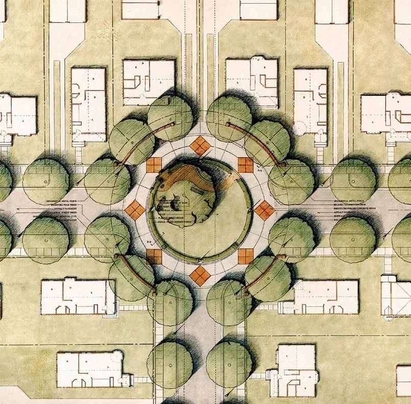
Avoid ignoring the context: The houses in this small Milwaukee subdivision (named City Homes) were intended to have 5’ setbacks because that matched another, completely separate, new urbanist project. The fallacy is simply that setbacks should not follow dimension from another context but from the local building pattern in the existing context.
2. Bigger public places are not better. (Base right-size places on context and culture)
Bigger places often use too much land that could be allocated to better community purposes like increasing density and socioeconomic value. Bigger public places actually separate activities rather than integrating activities. Bigger places are perceived as better simply because we equate them with wealth and the accumulation property as opposed to the accumulation of social experience. We do not consider a parking structure as “better” just because it may be bigger. For every use planners need to ask “Is it the right size?” In many communities citizens will routinely opine that the park is better if it is larger — not because more space is needed but because more park space limits other uses that residents wish to avoid.
3. Complete streets are incomplete. (Include all uses, activities, and opportunities with equal emphasis)
The concept of complete streets is professional jargon and refers to the activities for urban circulation that occur within the right-of-way lines on a street and, by definition are devoid of all the activities that occur outside of the right-of-way. A complete “right-of-way” is not a complete “street”. Planners must include all of the “context” outside the right-of-way including buildings, people, social and economic activity, aesthetic utilities, and the natural environment. It might be better to call such streets “multi-purpose” streets if they included all the activities that took place along the right-of-way.
4. Open spaces close opportunities. (Prevent open space designations - require meaningful activities and opportunities)
Open space devoid of the cultural attributes that create places, are usually dormant and harmful to cities. Unused open space may be considered an urban ornament when it is filled with grass or it may be considered a parking lot when filled with cars, but such space is not necessarily a meaningful garden or plaza unless it also has all of the attributes of the particular type of public place for which it is intended. Too often local residents advocate “open space” because they believe it will strengthen their community by preventing other uses.
5. Universal standards are harmful. (Always encourage customized modifications)
Standards for urban planning work only when the new place for which the standard is intended is congruent or at least has a high degree of correspondence with he original places used to define the standard. Identical circumstances may seem to be present for some systemwide uses, such as bus stops, or utility infrastructure. In most cases, however, variations in the application of standards can probalby help the local community. Consequently, universal standards should always include, at the outset, clear procedures for addressing modfications that improve local implementation. That is, planners should consider a standard as no more than a starting recommendation to be modified substantially by the existing context and the anticipated future context.
6. Innovation is not new. (Include past traditions as future innovations)
The cultural demand for innovation goes back centuries. Unfamiliar ideas may seem innovative but they are often the result of ignorance, not talent. True innovation comes from recombining and reinterpreting past places in ways that produce a new understanding of our community – such work is not copying or plagiarism, but it requires considerable talent.
7. Public places are not free. (Provide a long-term resource plan)
Once created a good public place must be sustained and managed by the users, owners, and others who consider it of value; too often planners assume that the management of a place will occur automatically and without self-conscious actions. Finding resources to support public places must be part of the initial desing. Great public places should be designed to experience both periods of scarcity and abundance.
8. Floor area ratios (FARs) are too low. (Set minimum FARs in cities).
The original intent of Floor Area Ratios (FARs) was to make sure that sites did not contain buildings that were too large (this would avoid overcrowding). In practice, overcrowding comes and goes regardless of FARs. Instead we have areas of American cities severely “undercrowded” without enough economic value to support the taxes needed for long term infrastructure. The value equation must be flipped — require higher FARs to ensure infrastructure resources. This is very similar to the way parking ratios have reversed in recent years — initially planners required more parking and then realized that such policies actually created urban failures.
9. The “context” is critical, not just a supplement. (Every plan must include an “extended” context plan. Always show a context - maybe a ½ mile).
For decades new city plan proposals avoided looking at the context. Applicants for new projects need only show the “new” items and relationship to existing conditions was presumed satisfactory and/or irrelevant. As computer software evolved designers were educated to begin with a blank slate (the tabula rasa). Plan commissions must require all proposals to show plans and elevations with surround form and character. — it adds costs for applicants but it saves communities from making irreversible, hihg-cost errors. Software advances, especially AI, should make this easier and planners should demand such submissions as soon as possisble.
10. Sustainable planning is not just about technology. (Use triple-bottom-line polcies).
Too often planners (and the public) equate sustainability exlusively with energy use and technological protection of the natural environment. This is easy to understand but not true. Cities and need much more than an effective technologies and healthy natural environments to endure. For example, sustainability requires increasing the cultural value of denser, multiple use communities. This saves energy and reduces wasteful resources. Overall, the triple-bottom-line concept for sustaining places requires (a) economic resources, (b) public/political approval and (c) environmental vitality. All three have become increasingly important.
11. Keeping it simple won’t work because it misleads the public. (Simple geometries, diagrams, and labels mislead the public. Show key complexities and find better ways to explain issues.)
From the time Ebeneezer Howard sowed his first diagram of the Garden City, and the “concentric rings” began to emerge as the accepted theory, planners and designers have enjoyed the oversimplification of urban form. Figure-ground maps prevent this from continuing. Simplicity is not necessarily a virtue. Oversimplification is a common error in planning because it is so difficult to explain complex issues. Planners must improve their communication skills. Most recently use of stories and narratives (closer to literature than slogans) have helped.

The image above is one of Ebeneezer Howard’s diagrams for an ideal garden city. This represents a profound fallacy imposed on planning practice that was embraced internationally — it is an oversimplification, a geographic impossibility, filled with major social and economic injustice, offers no understanding of real city form, and implies dictatorial top-down centralized authority. Howard’s work deserves consideration but it does not seem innovative.
Below is an excerpt from the poem Mannahatta by Walt Whitman that offers us an entirely different way of understanding a city — emotional, subjective, unsimplified, thoughtful and providing insights that help.
I was asking for something specific and perfect for my city,
Whereupon lo! upsprang the aboriginal name.
Now I see what there is in a name, a word, liquid, sane, unruly, musical, self-sufficient,
I see that the word of my city is that word from of old,
Because I see that word nested in nests of water-bays, superb,
Rich, hemm'd thick all around with sailships and steamships, an island sixteen miles long, solid-founded,
Numberless crowded streets, high growths of iron, slender, strong, light, splendidly uprising toward clear skies,
Tides swift and ample, well-loved by me, toward sundown,
The flowing sea-currents, the little islands, larger adjoining islands, the heights, the villas,
The countless masts, the white shore-steamers, the lighters, the ferry-boats, the black sea-steamers well-model'd,
The down-town streets, the jobbers' houses of business, the houses of business of the ship-merchants and money-brokers, the river-streets,
Immigrants arriving, fifteen or twenty thousand in a week, . . .