Start With Colin Rowe’s School Of Thought
New York’s Central Park has always linked urban design and city development.
Urban design and city planning were considered one subject near the start of the 20th century. Then the first official schools of urban planning began. The two disciplines started to split. Planning, increasingly, leaned to the social sciences and urban design to architecture. The spit continued through World War Two. In the 1960s new theories emerged, among them Colin Rowe’s studio teachings at Cornell. He created a new school of thought about cities from the view of urban design. His concepts grew with students and colleagues, and eventually emerged loudly in his book co-authored with Fred Koetter, Collage City (1978). The concepts grew further and this school of thought has been newly expanded with essays assembled by Stephen Hurtt and James Tice in TheUrban Design Legacy of Colin Rowe (2025).
My essay hopes to show how the powerful culture of urban form espoused by Rowe and his colleagues can support the social and economic framework of city planning. As a self-sufficient discipline, urban design offers the strongest theories about city formation, while the teaching of city planning provides the best approach to the pragmatic application of such knowledge. Urban design theory explains public places and then dovetails with city planning as a basis for practice – together they form one inseparable mode of thought and action.
During recent decades adherents to each discipline remained loyal to their ideas. Over time, however, the intellectual cracks surfaced within each world view. It may be time to see if they can be repaired and recombined. The Congress for the New Urbanism has helped heal the divisions but there is still more to do. These two disciplines must relax long enough to recognize their combined strength. This essay hopes to reexamine some of the issues and establish common ground for the integration of both fields.
The first step toward integration is to apply the theoretical model laid out in Collage City. The critical ideas reflected in Collage City’s chapter titles loosely represent key issues that must be addressed in order to dovetail urban design and city planning.
Chapter 1: “Utopia: Decline and Fall?”
The opening argument in Collage City parallels aspects of the City Beautiful movement in the United States. The City Beautiful movement conflicted with modern architecture’s views of cities. Unlike modern architectural thought, however, the City Beautiful movement highly popular with the general public starting with Burnham’s ambition to reproduce the wonder of Paris in the Columbian Exposition and the Plan of Chicago. The City Beautiful movement also included other, less well-recognized, but equally popular principles regarding city planning and development.
The City Beautiful became a favored American utopia, devoid of modernism. While the City Beautiful Movement received great public support, it still had flaws and did not work equally well in all circumstances. Some city centers based on the City Beautiful succeeded and some failed. Over time, not all planners and designers viewed it as a universal solution for city problems. William H Wilson, in his commentary about the City Beautiful movement, describes the disillusionment held by well known architect Cass Gilbert as follows:
In December 1909 architect Cass Gilbert flayed the City Beautiful at the annual meeting of the AlA. "If I were disposed to delay, interrupt, or confuse the progress of city development I would publish the phrase 'city beautiful' in big head lines in every newspaper," Gilbert declared. "Let us have the city useful, the city practical, the city livable, the city sensible, the city anything but the city beautiful." Gilbert called for "a city that is done, completed, a city sane and sensible that can be lived in comfortably. If it is to be a city beautiful it will be one naturally." Gilbert's tirade was a hit. "The sentiment against the 'city beautiful' term was unanimous." According to one account, the AIA delegates issued a search warrant for "the originator of 'city beautiful”.
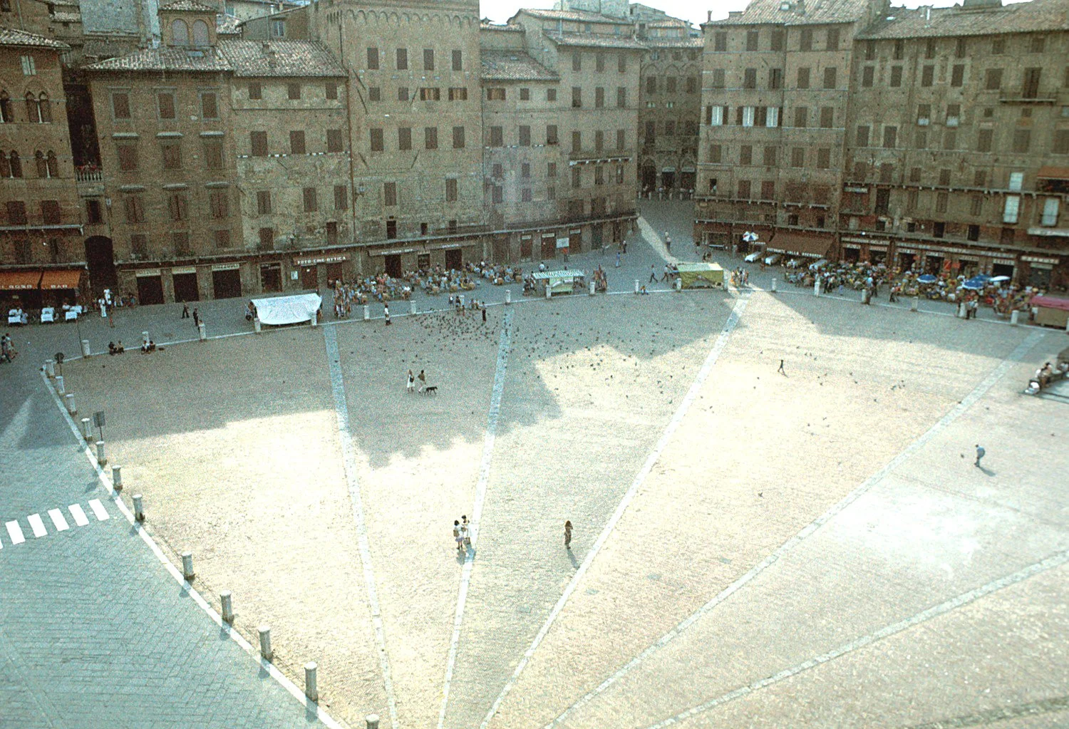
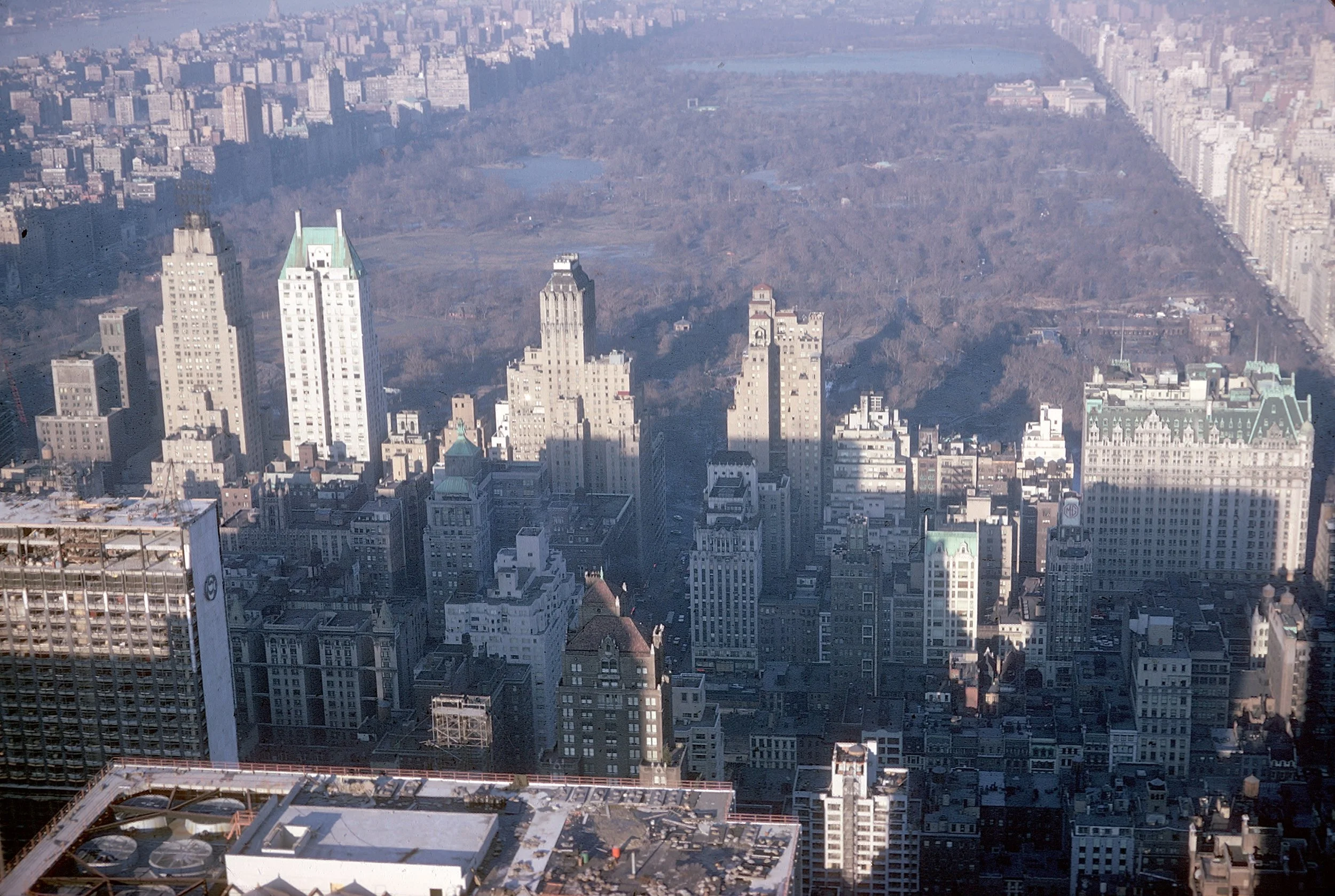
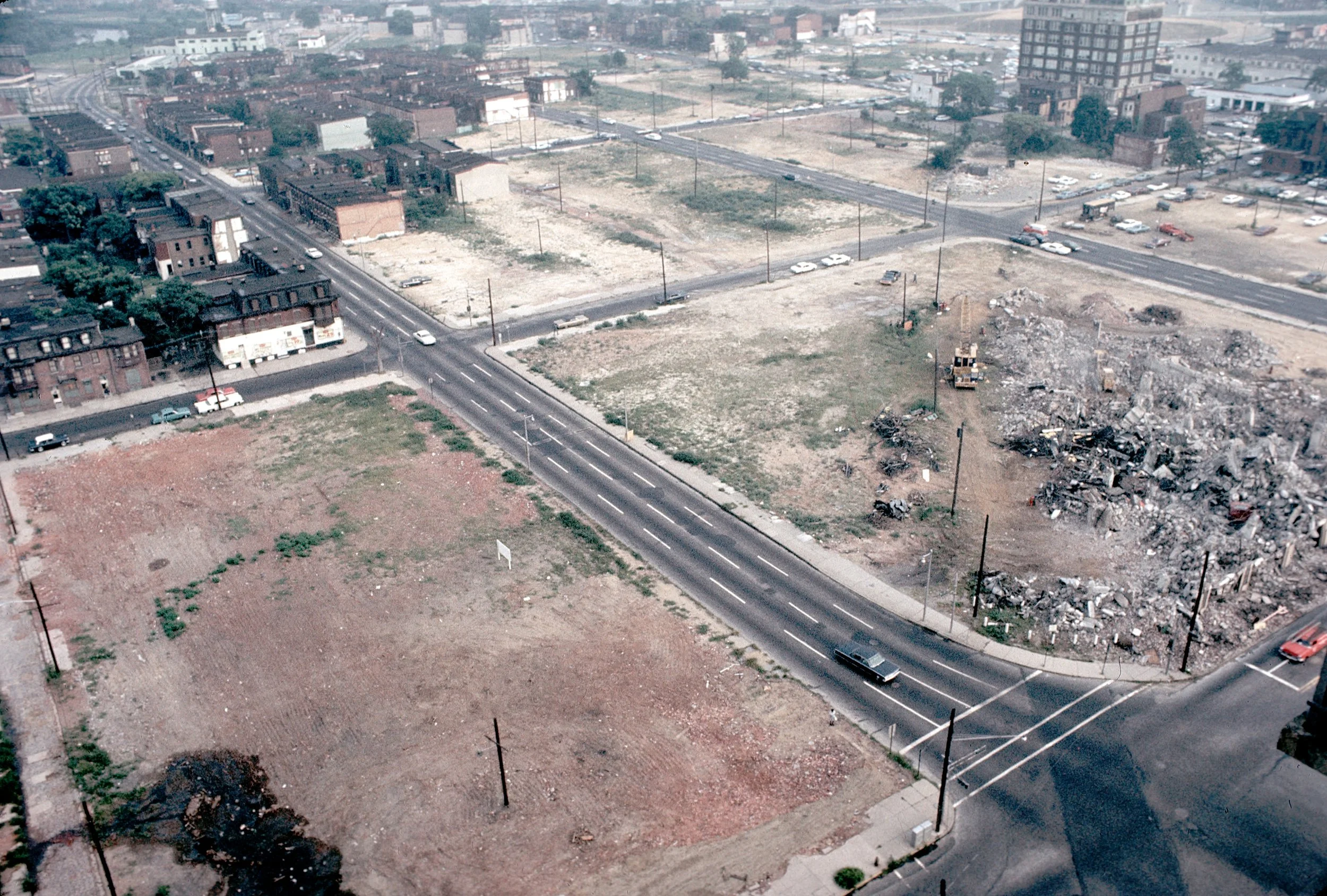
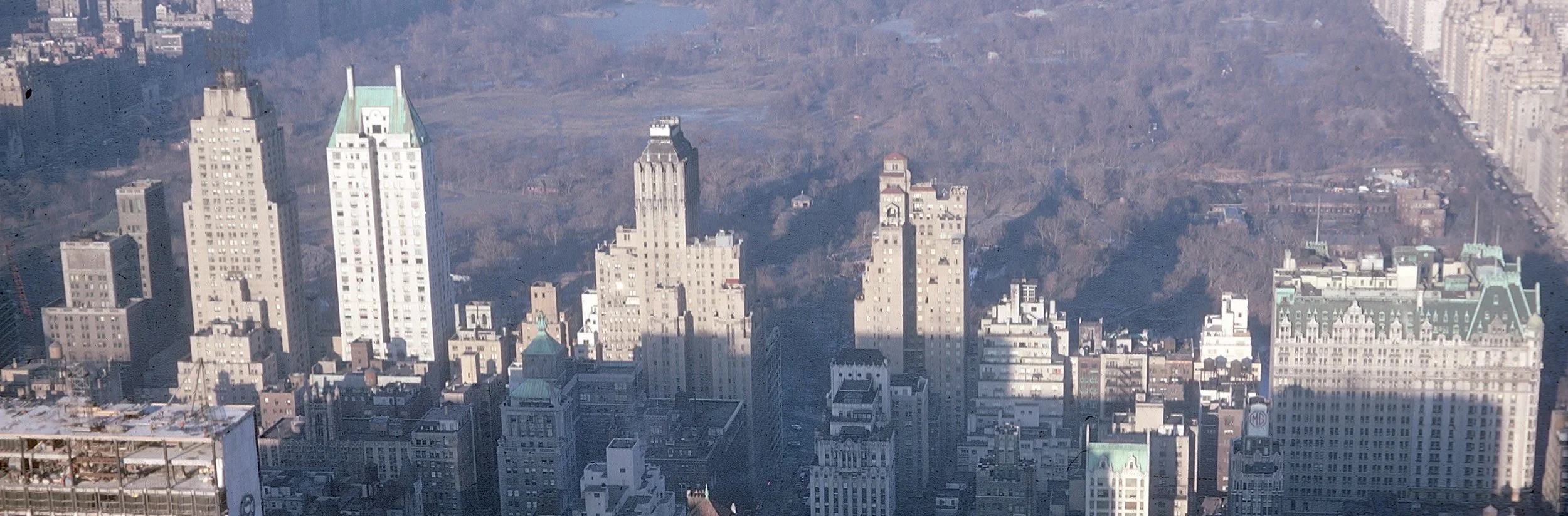
In Rowe’s school of thought, all public places, regardless of their origins, can be viewed as contemporaneous realities worthy of intellectual comparison. Each of these three places (Sienna’s Campo, New York’s Central Park, Camden’s 1969 Urban Renewal) offers lessons that reflect on each other. The two places on the left are recognized as paradigms of the public realm while the abandoned land on the right is viewed as bad city planning. Collage City helps explain how the outcome on the right might be avoided by understanding the outcomes on the left.
Chapter 2: “After The Millennium”
Collage City describes how the failures of architectural modernism precipitated intellectual vacuums filled by scientific and political methods for urban planning. After City Beautiful matured planners emphasized the “City Functional” and reliance on technical engineering. Functionality, in turn, reinforced differentiation (that is, divisions) among public issues like transportation, housing, health, and industr accompanied by land use friction that continues to this day. Public displeasure with self-inflicted land use battles produced demands for more public control. Collage City offers a blistering critique of this public strife due to overly narrowed science combined with misdirected public opinion:
“Now, which of these two prospective programmes for the future – the despotism of ‘science’ or the tyranny of the ‘majority’ – is the more completely repulsive is difficult to say; but that, taken separately or together, they can only extinguish all initiative should not require inordinate emphasis. Nor should it be necessary to say that these alternatives – Let science build the town and Let people build the town – are both of them profoundly neurotic. For, up to a point, science will and should build the town and, up to a point, so will and should collective opinion; but the never ending insistence on the incompetence of the architect, which increasingly becomes more true and which is a continuous insistence on the evil of self-conscious activity, should at least be recognized for the psychological maneuver that is – as a guilt-ridden attempt to shift the locus of responsibility.”
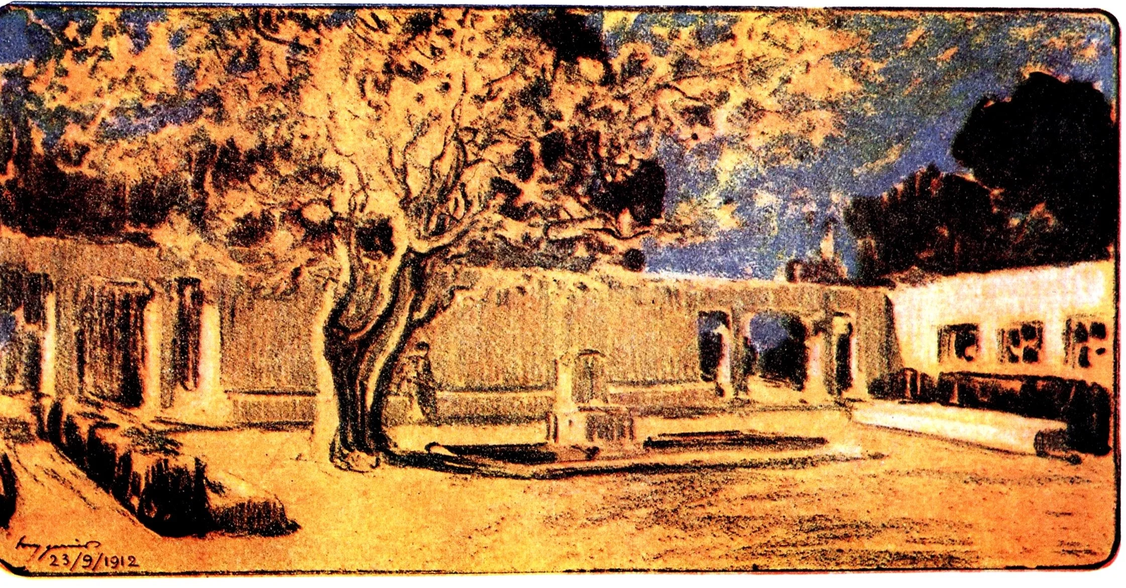
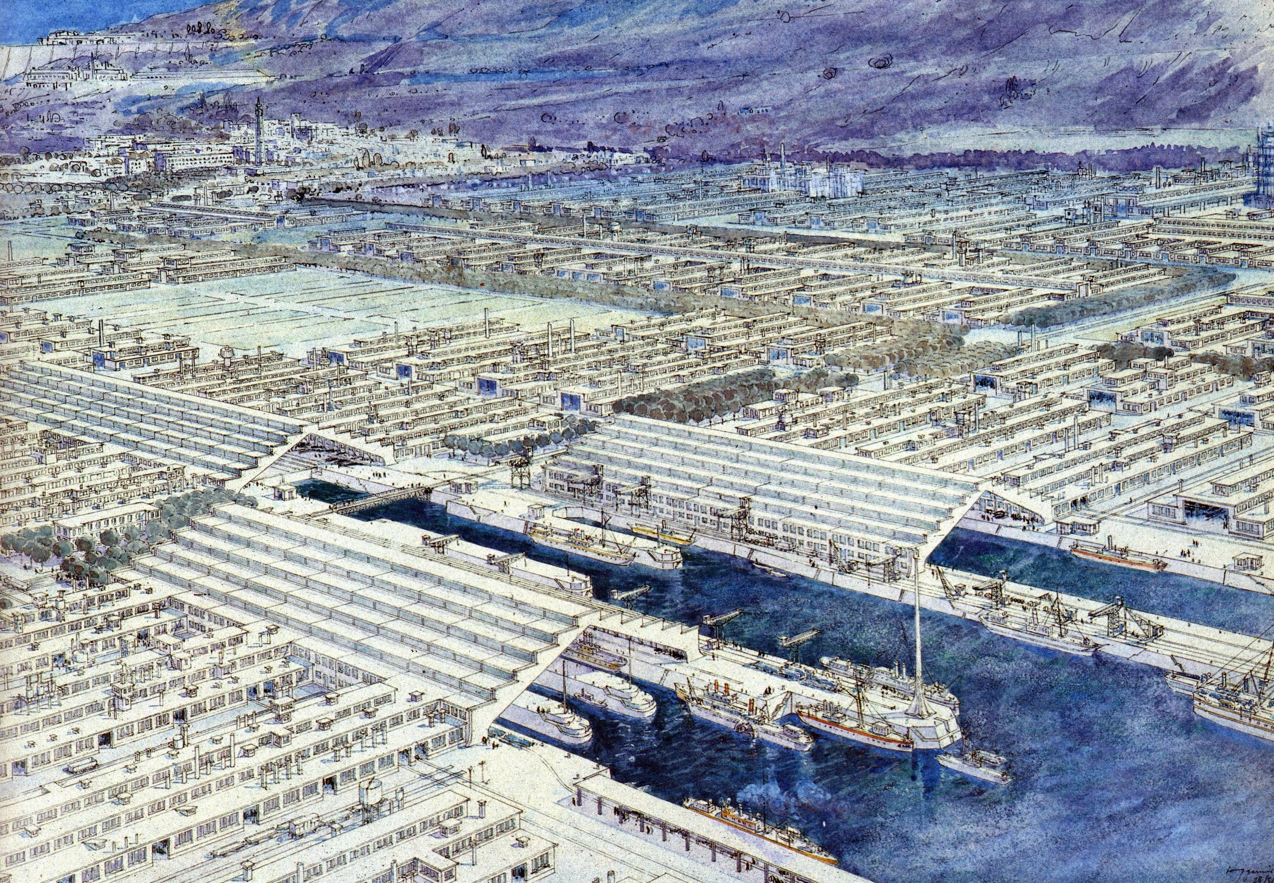
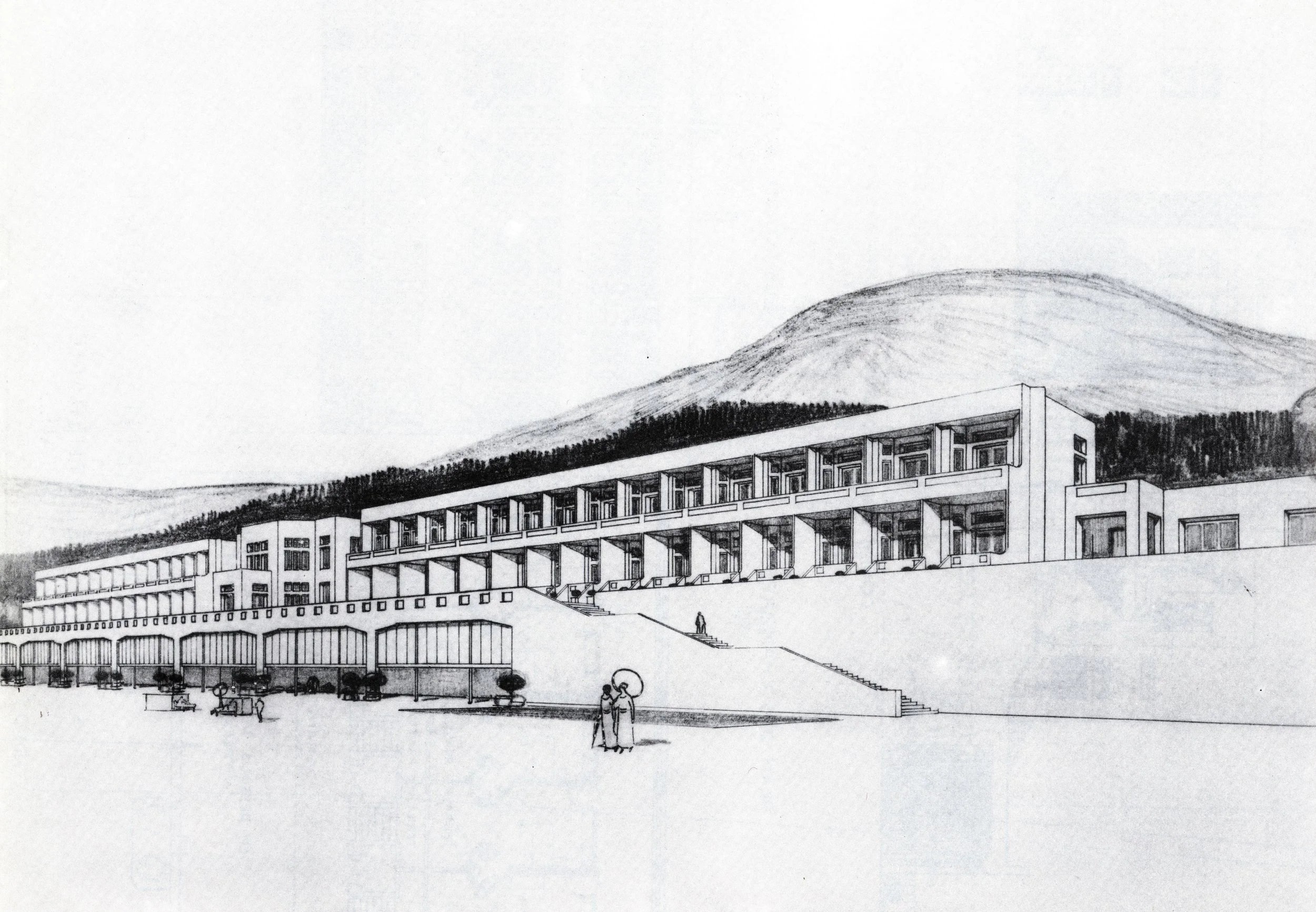
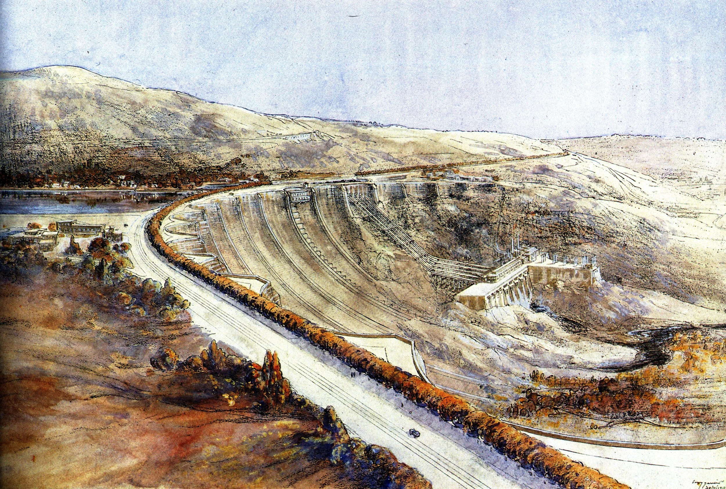

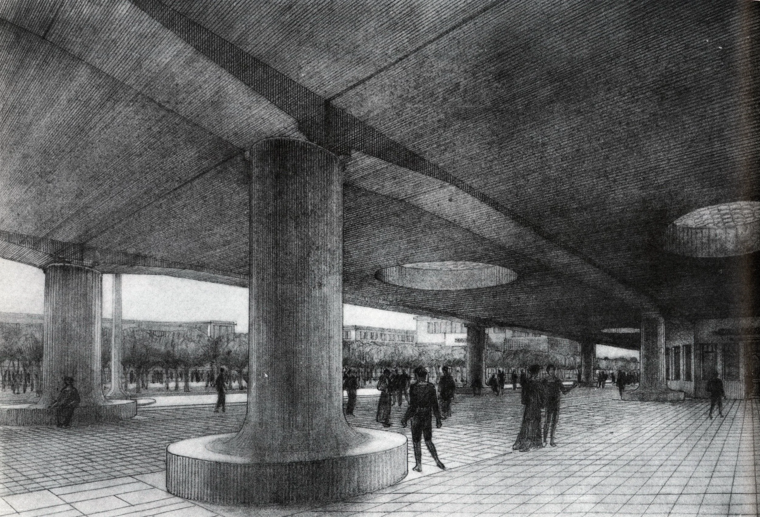
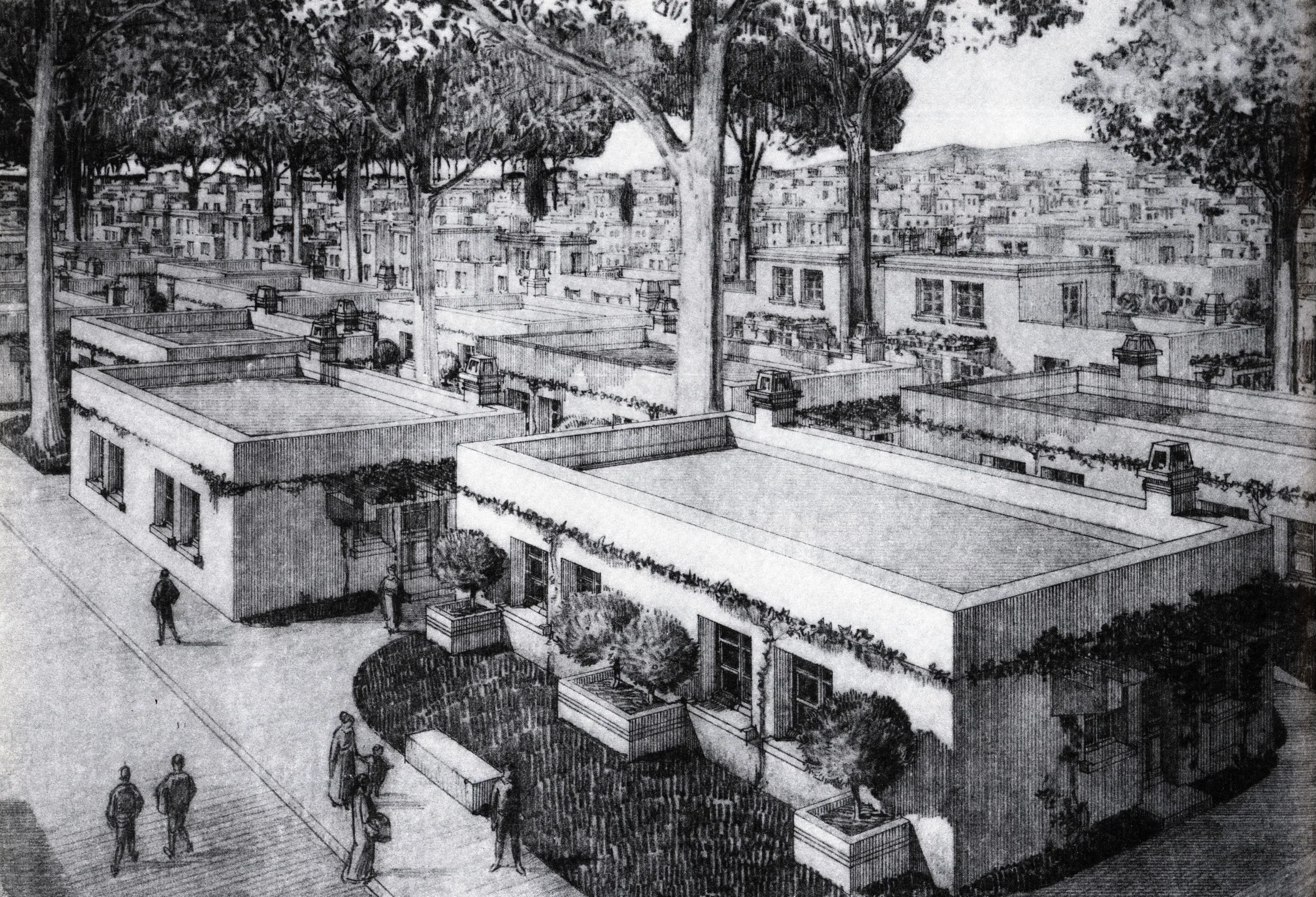
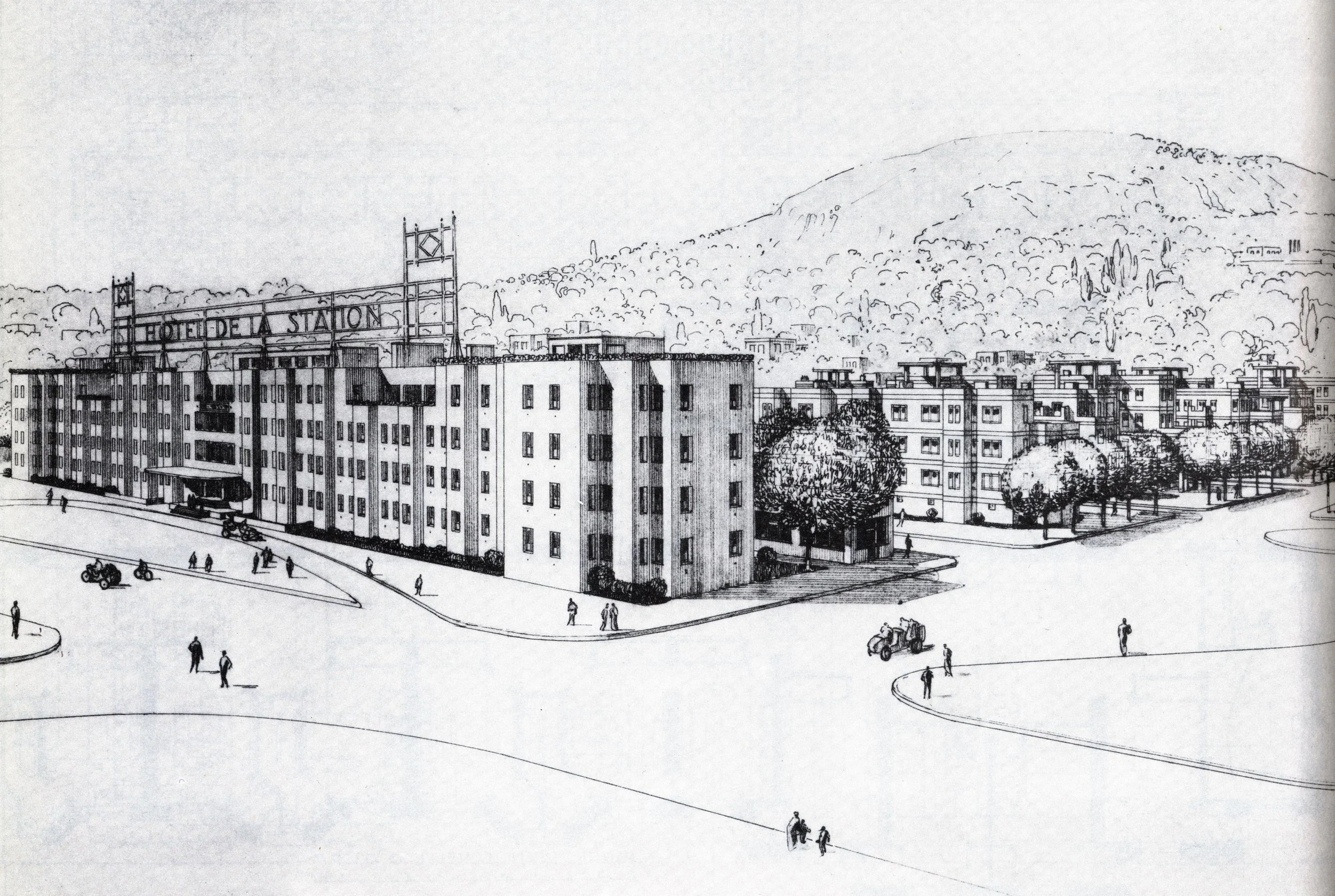
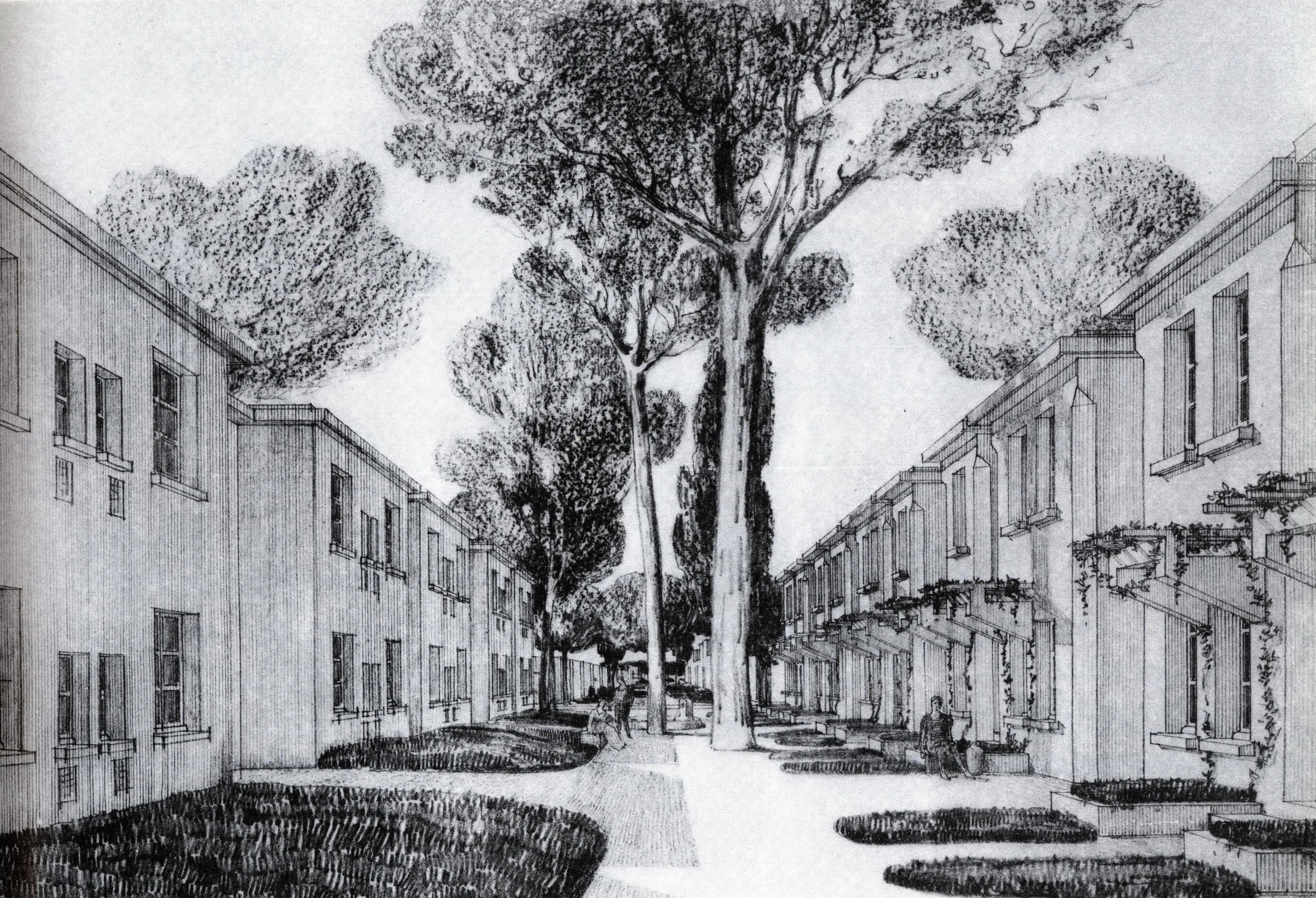
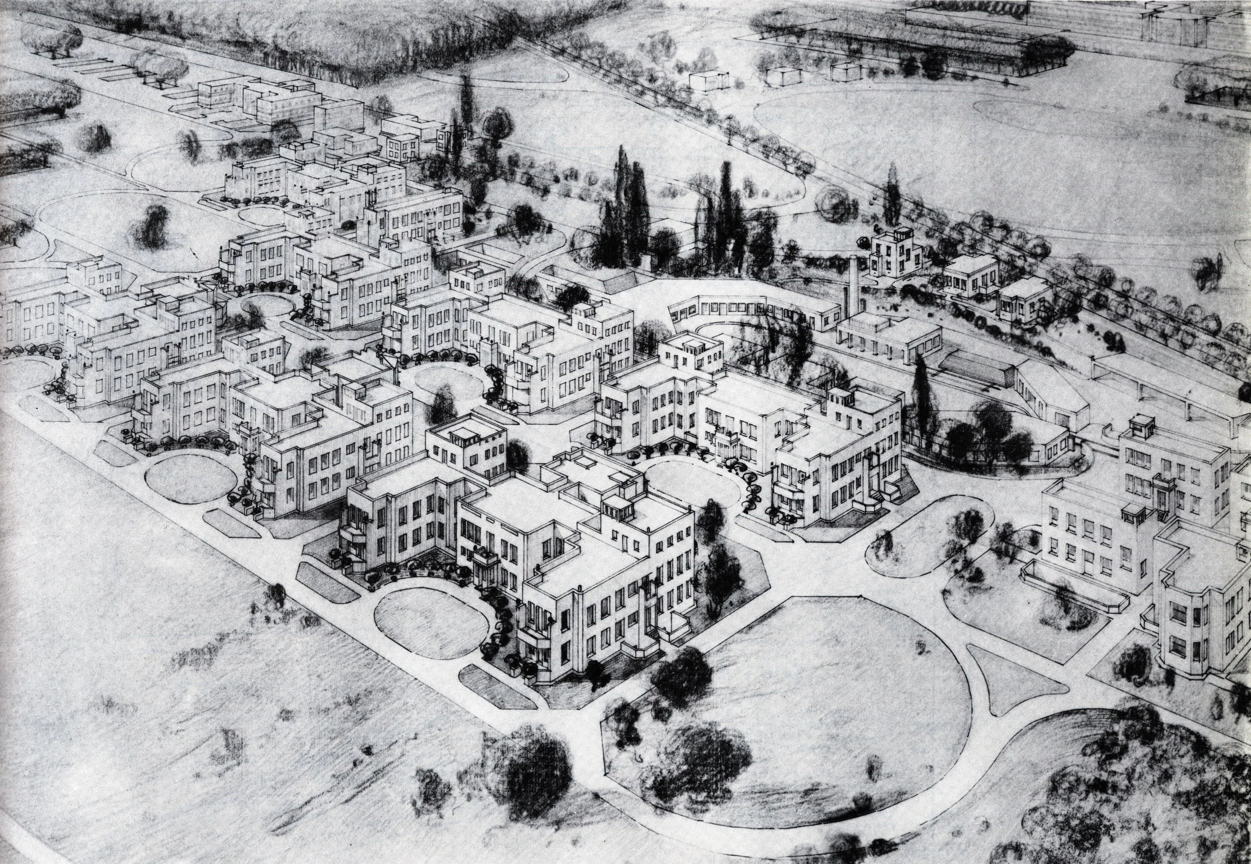
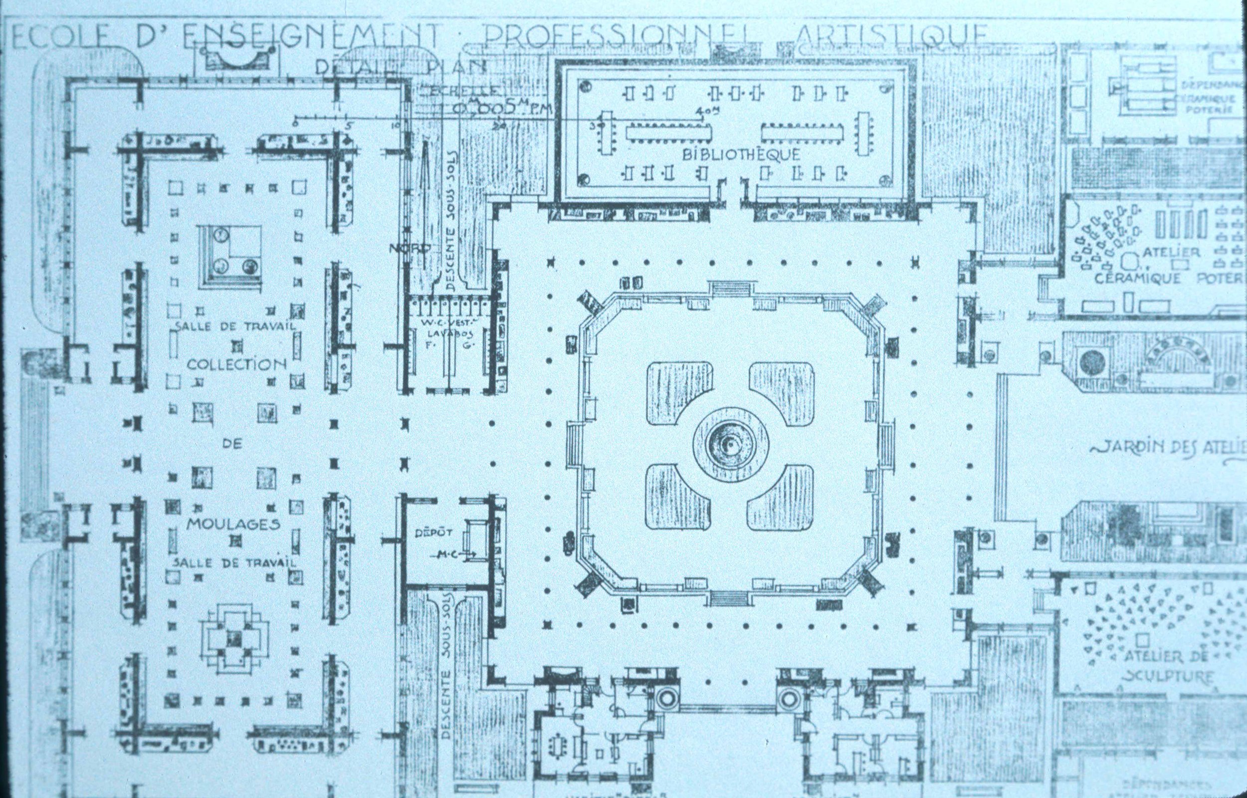
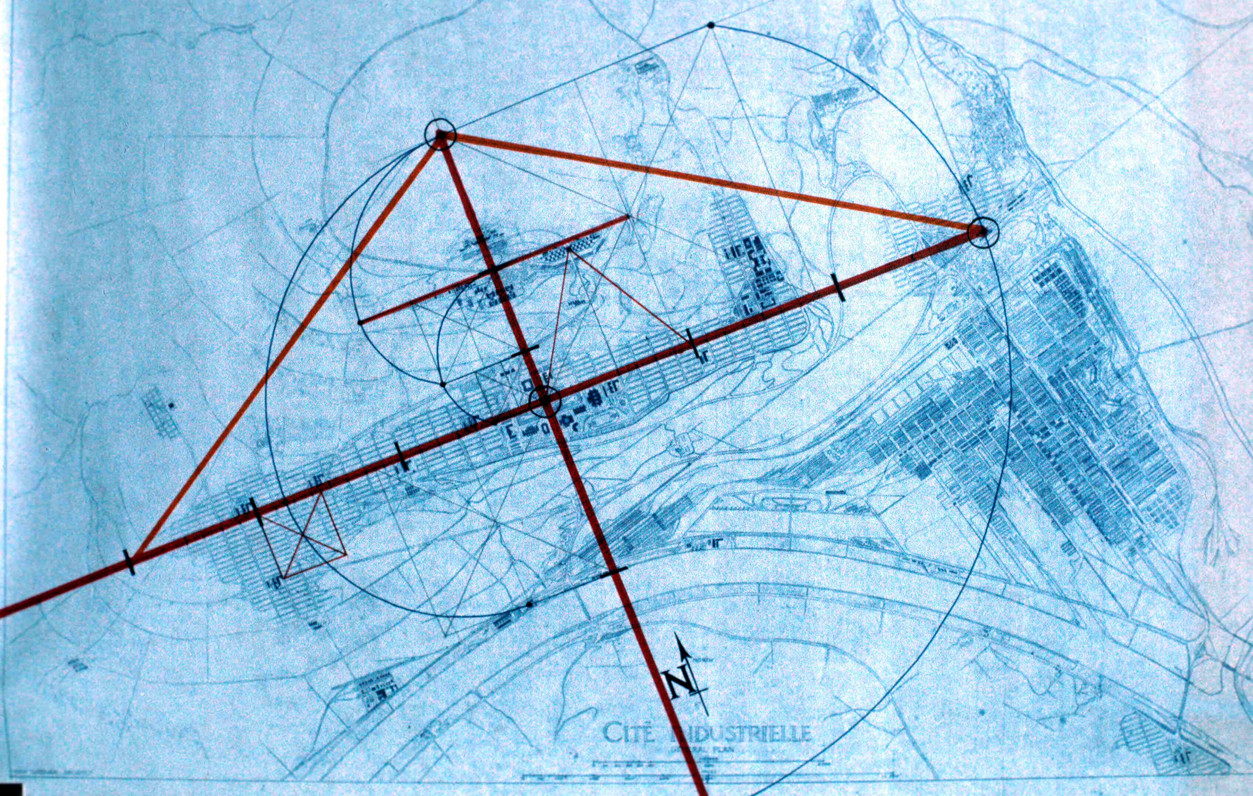
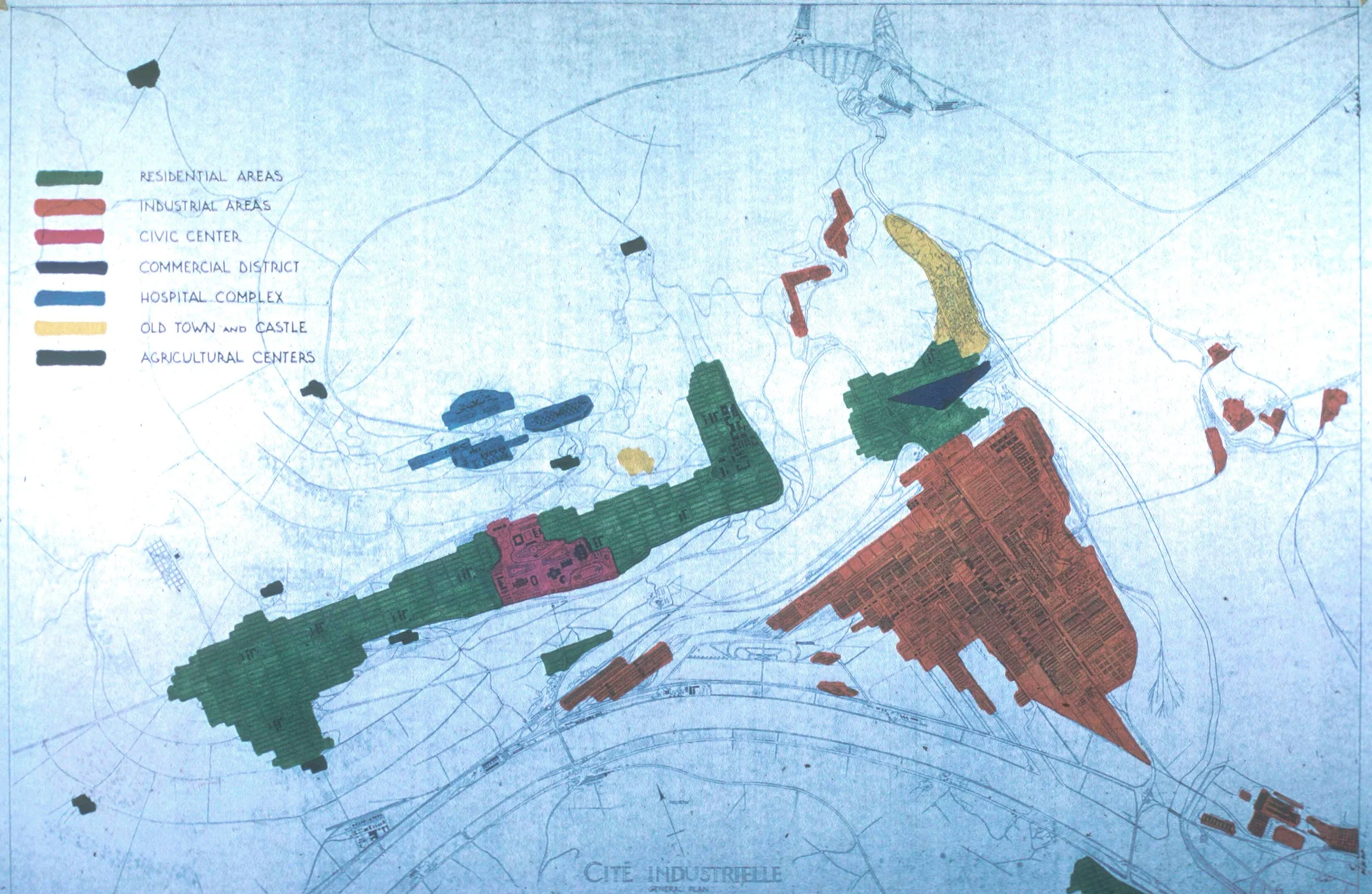

Tony Garnier’s Cite Industrielle was published in 2017. It holds a unique position in the evolution of modern architecture’s utopian cities: a position of balance and tradition. He included a new hydroelectric plant combined with conventional city blocks with single family and multifamily housings. He preserved an old city and drew complete streets and grand boulevards. He designed new concrete structures and modern architecture but with classical styles and a museum or history. He laid out an industrial district using assembly lines (before Ford), a contemporary port and airfield, but no jails or courthouses. It was utopian as well as practical.
Chapter 3: “Crisis Of The Object: Predicament Of Texture”
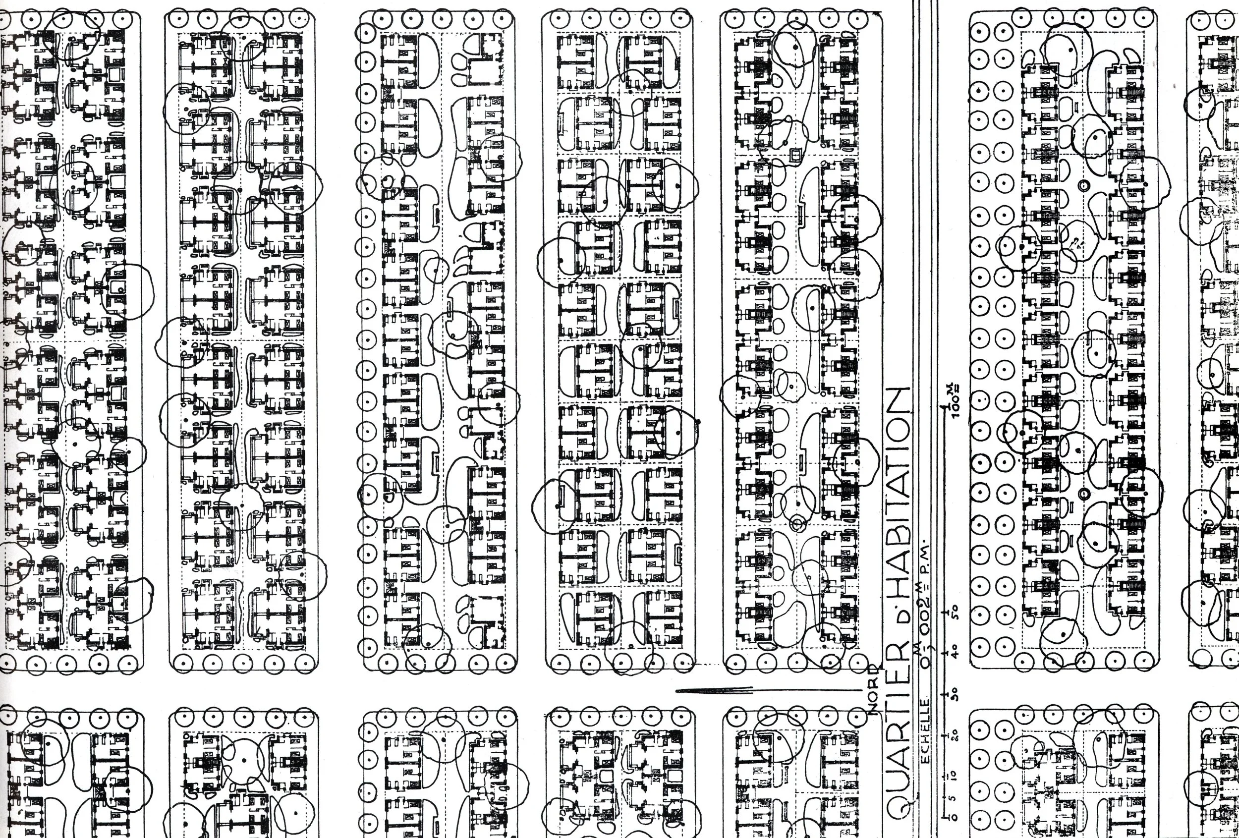
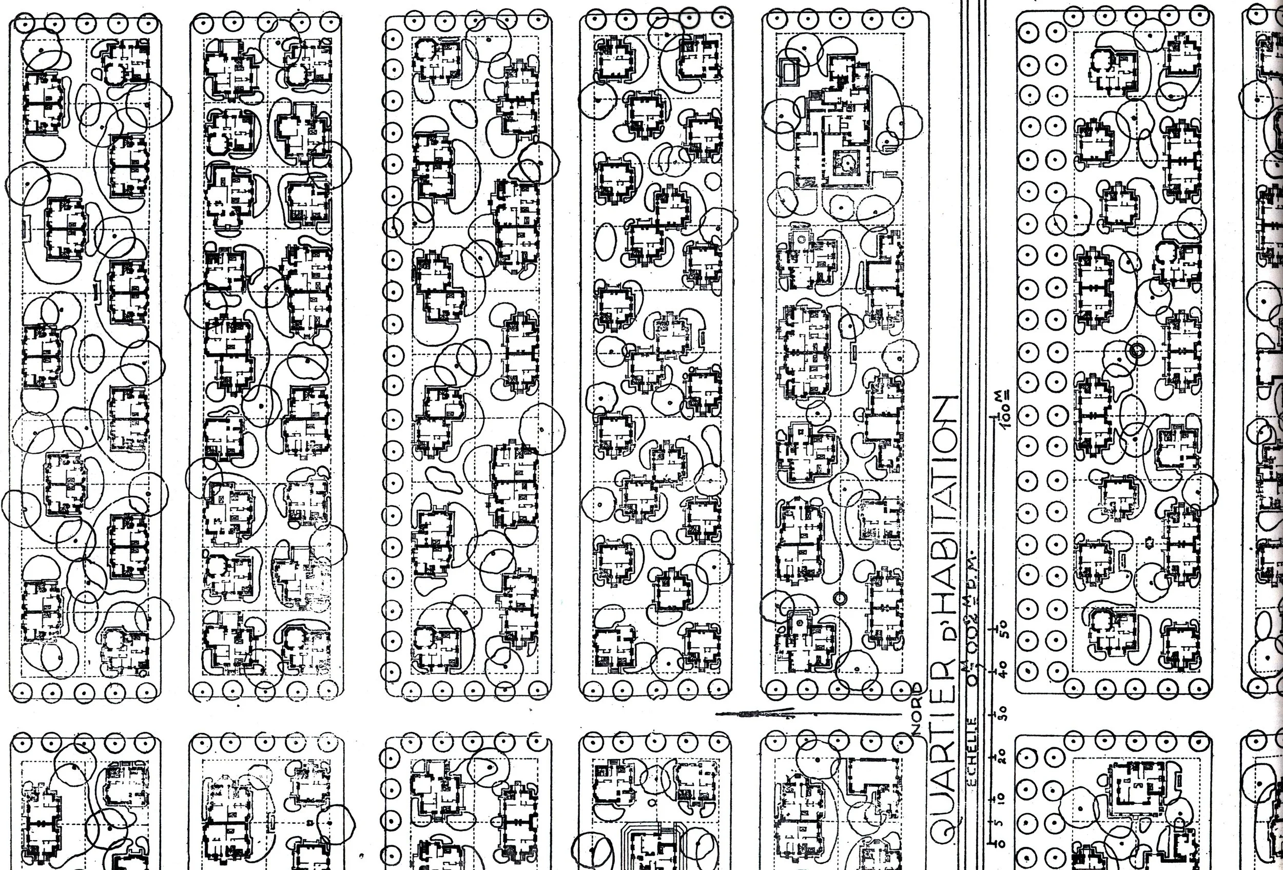
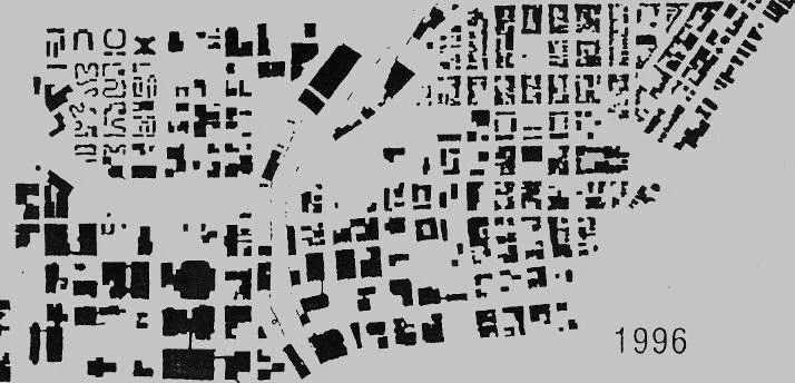
Instead of science and politics, Collage City suggests a more direct examination of a city’s physical form. More specifically, the city is viewed in terms of the “objects” and “texture” of urban form. By understanding the issues of urban objects and texture, Collage City opens a pathway, a new lens, to see some of the problems of city planning. This approach relies heavily on interpreting the geography of cities and relies on “figure-ground” maps using morphological techniques described by M.R.G.Conzen (see below). These maps allow for different critical interpretation for understanding cities in a different way. In a figure-ground map solids are shown as black and voids are shown as white. These simple maps are the x-rays that show the full “context” of urban design decisions. The “objects” in the maps are “cultural facilities” – significant public buildings (figural solids) and places (figural voids). The “texture “ comes from the “property divisions” in the urban plan and includes a continuous pattern of similar size smaller buildings (solids) and streets (voids) that comprise make the city blocks. There are many variations on this theme, each revealing different attributes of the city in question..
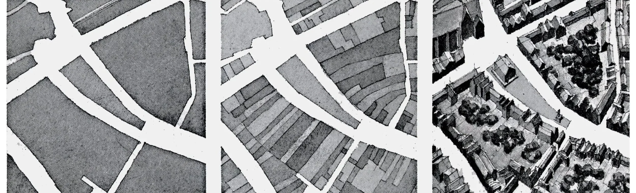
This illustration (below) of Conzen’s concepts comes from Spiro Kostof’s book, The City Shaped. The left image shows full city blocks (buildings and parcels combine leaving all streets and significant circulation elements white). The middle image, called land use, shows the property lines that differentiate ownership, where each shape can take on a different use as defined by the owner (this does not follow American land use conventions). The image on right adds building forms which, using the figure-ground concepts would simply be two-dimensional black shapes. All three modes of representation should be used by city planners — there is no “best” map.
For urban planners drawing a figure-ground map, the major cultural facilities (or urban design “objects”) are usually properties owned by organizations Jane Jacobs refers to as “guardians” – government agencies, universities, and cultural institutions who protect and enhance our communities. These “objects” are surrounded by the everyday “texture” of residential and commercial places – buildings and places controlled by landowners that serve the economic and social life including housing, shops, offices and other transactional activities.
Good professional practice requires that both urban designers and planners, respect the pattern of objects and texture. Objects in the wrong location – both buildings and figural places -- engender bad design and weak planning. For example, eliminating the texture of property divisions to create larger lots (AKA superblocks) may aid a property development concept but diminishes the texture that supports the diversity and variety of social and economic activity. Urban design and city planning can be integrated more effectively by using the same maps, so that both disciplines can expand their understanding of the same community.
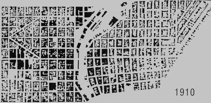
Top row: The two figure ground maps from 1910 and 1996 show Milwuakee’s downtown with the Milwaukee River (through the middle) and Lake Michigan (on the right). During the period of change from 1910 to 1996 you can easily see how the texture of the city was destroyed. In addition you can see the bizarre pattern produced by urban renewal in the upper left corner of the 1996 map — another clear example of the destruction of the urban texture in the name of improvements.
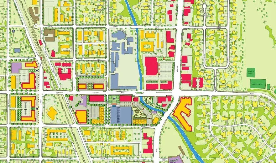
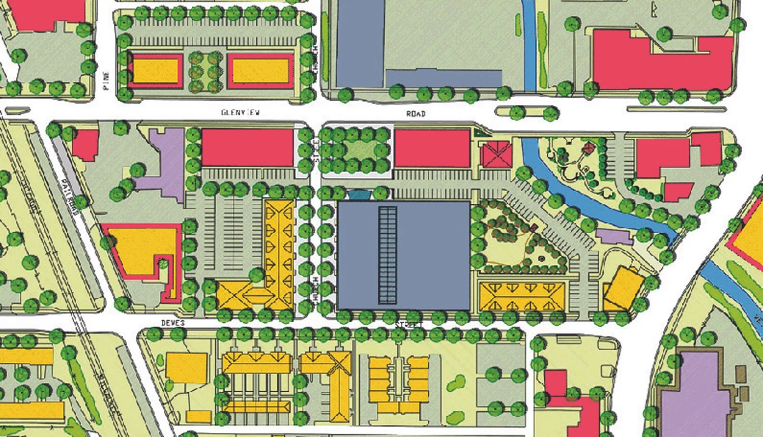
Bottom row: two maps from the 2004 Comprehensive plan for Glenview Illinois — these illustrations adopt drawing conventions that planners can use to show, simultaneously, the street/block plan, the figure ground plan, the land parcels, and the building uses (including mixed uses) — while more difficult to draw they show the range of forms and textures which Rowe and Koetter reference as critical to urban design.
Chaper 4: “Collision City And The Politics Of Bricolage”
As cities grow the impacts of different ideas (as expressed in buildings, places, neighborhoods, and districts) collide with each other, public infrastructure, and changing public interests. Navigating such collisions requires adept civic management, not just for immediate “collisions” but for the long-term endurance of the community. Over time, both urban designers and urban planning practitioners seem to have lost long-term concerns for harmful “collisions” as well as emphasis on long-term positive attributes. Today, most big projects are “siloed”. Increasingly, the professions have narrowed their range of interest in both time and place — goals are short term (just a few yars) and places are confined (sometimes no further than abutting streets).
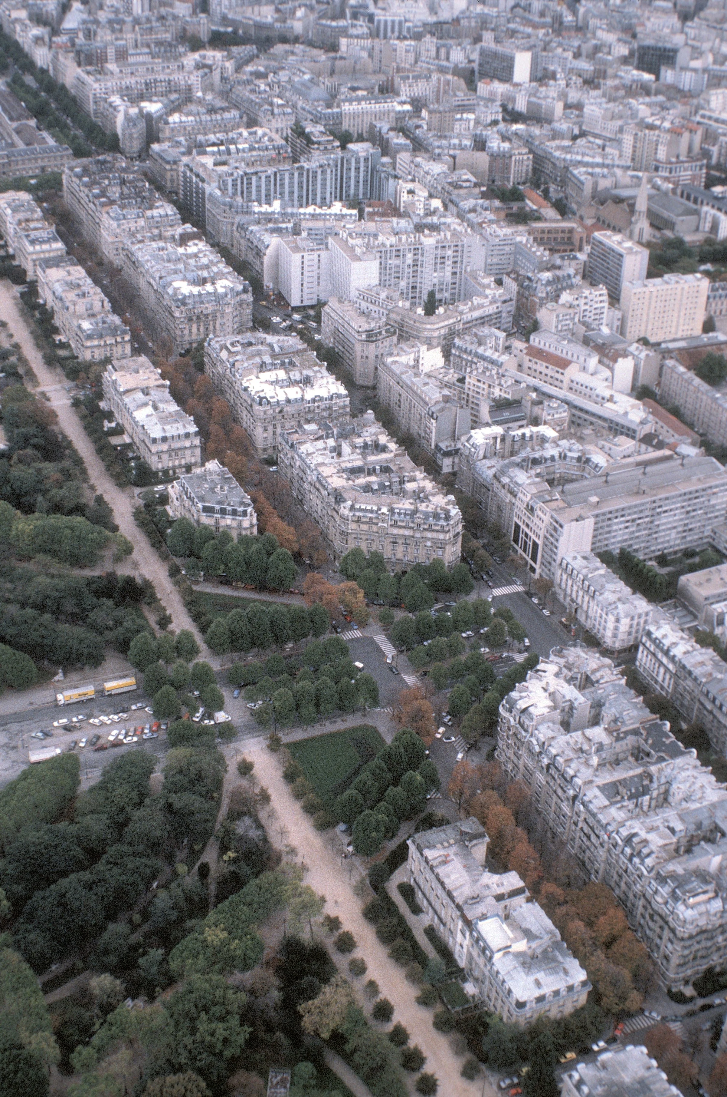
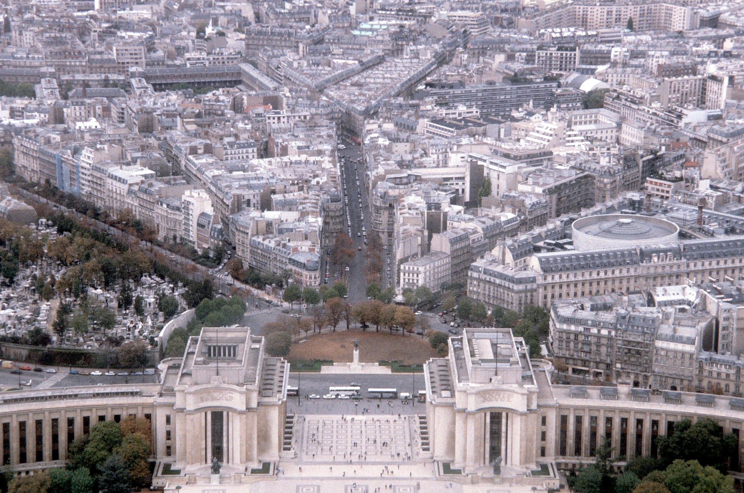
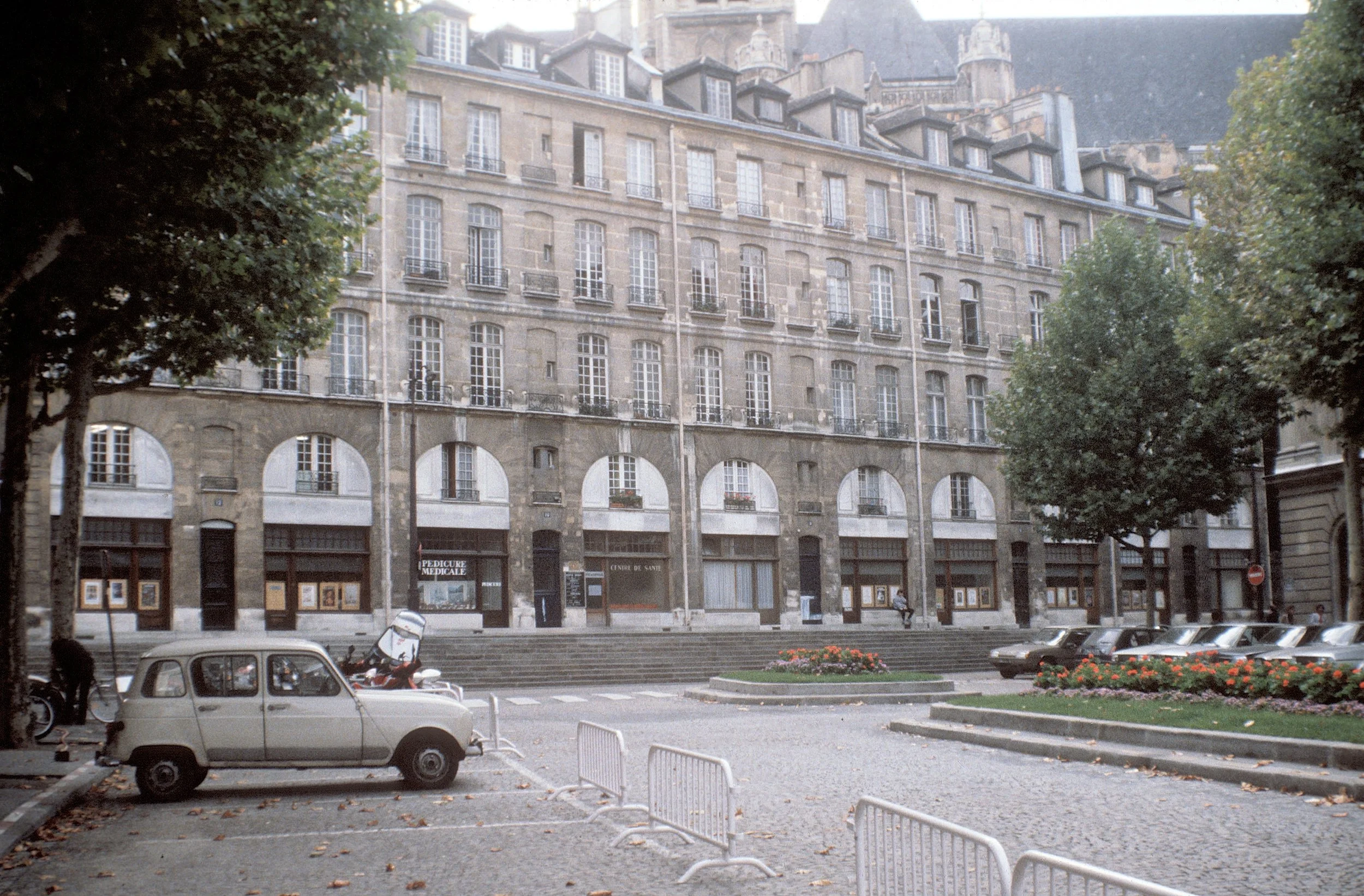
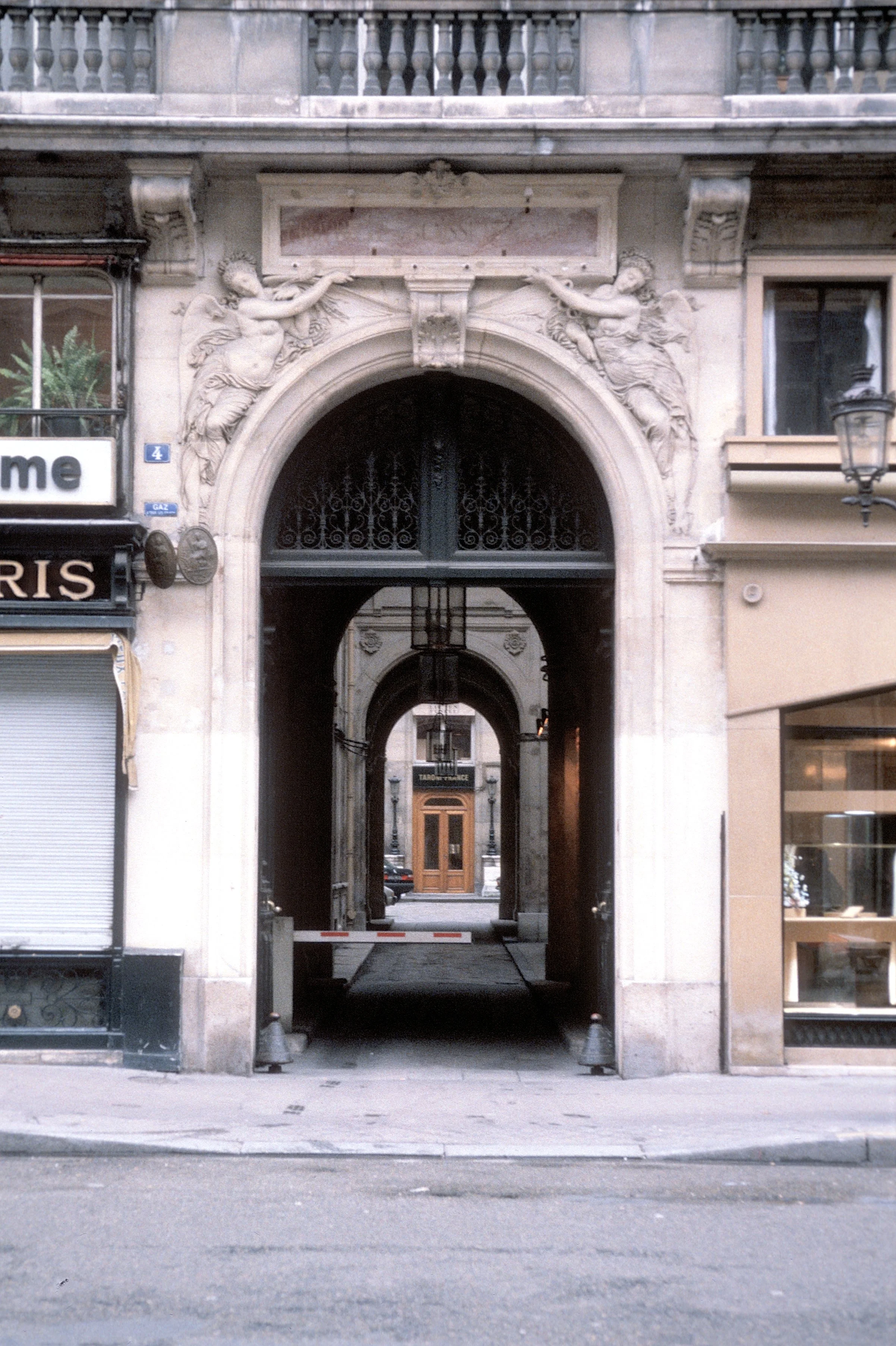
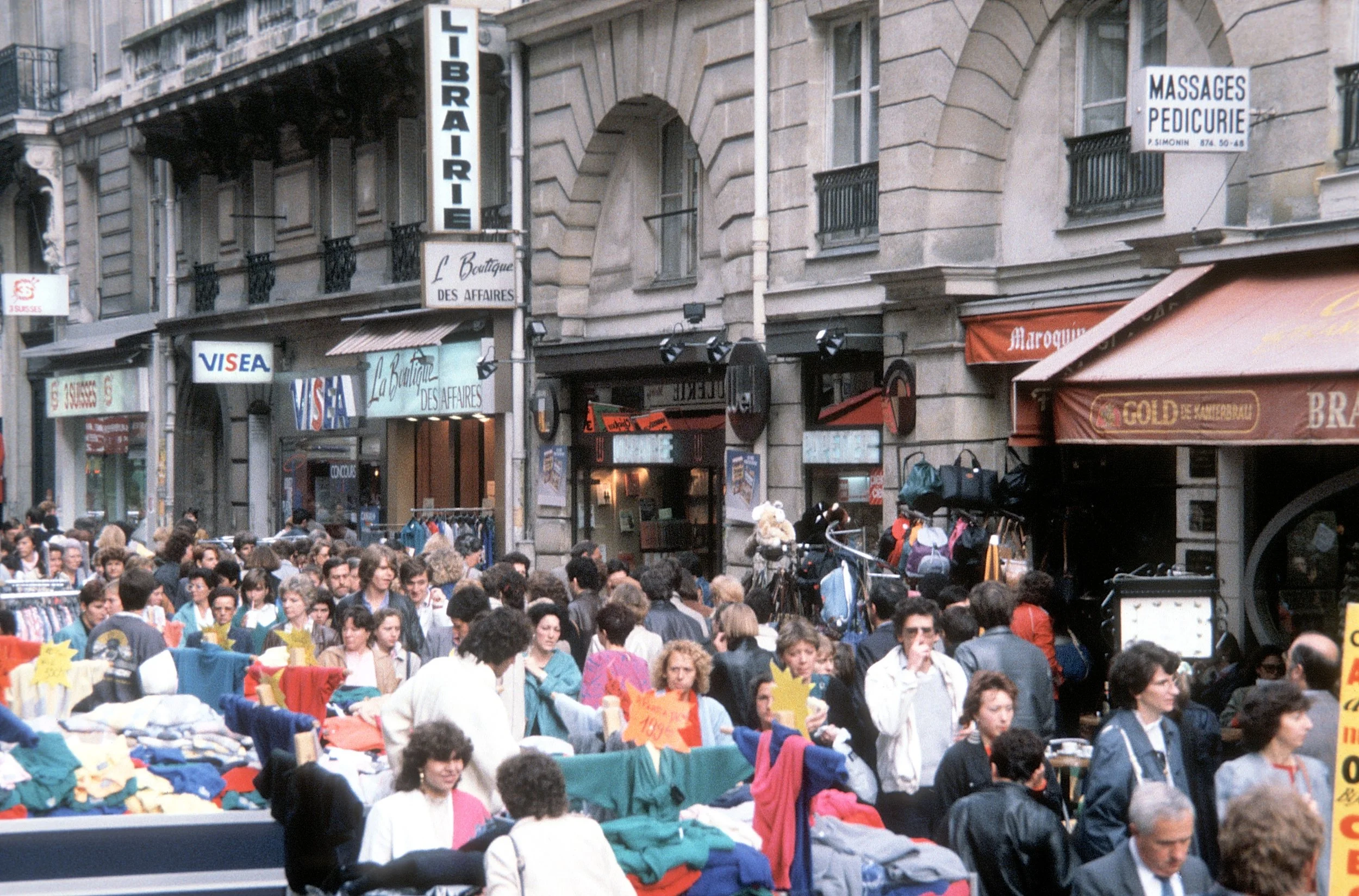
Most designers and planners want to overcome addiction to professional silos but lack effective conceptual models. Some professionals invent bigger silos like “complete streets”. Extending the “complete silos” concept just further segregates urban places by implying that places outside the street right-of-way are less important. This is the opposite outcome that should occur. The social activities on the outside of the right-of-way line are critical to the success of the traffic inside the street. In contemporaneous hindisight, Hausmann’s boulevards were truly complete streets uniting surrounding buildings. At the same time Hausmann’s work generated huge public controversy (he was eventually fired — no good deed goes unpunished).
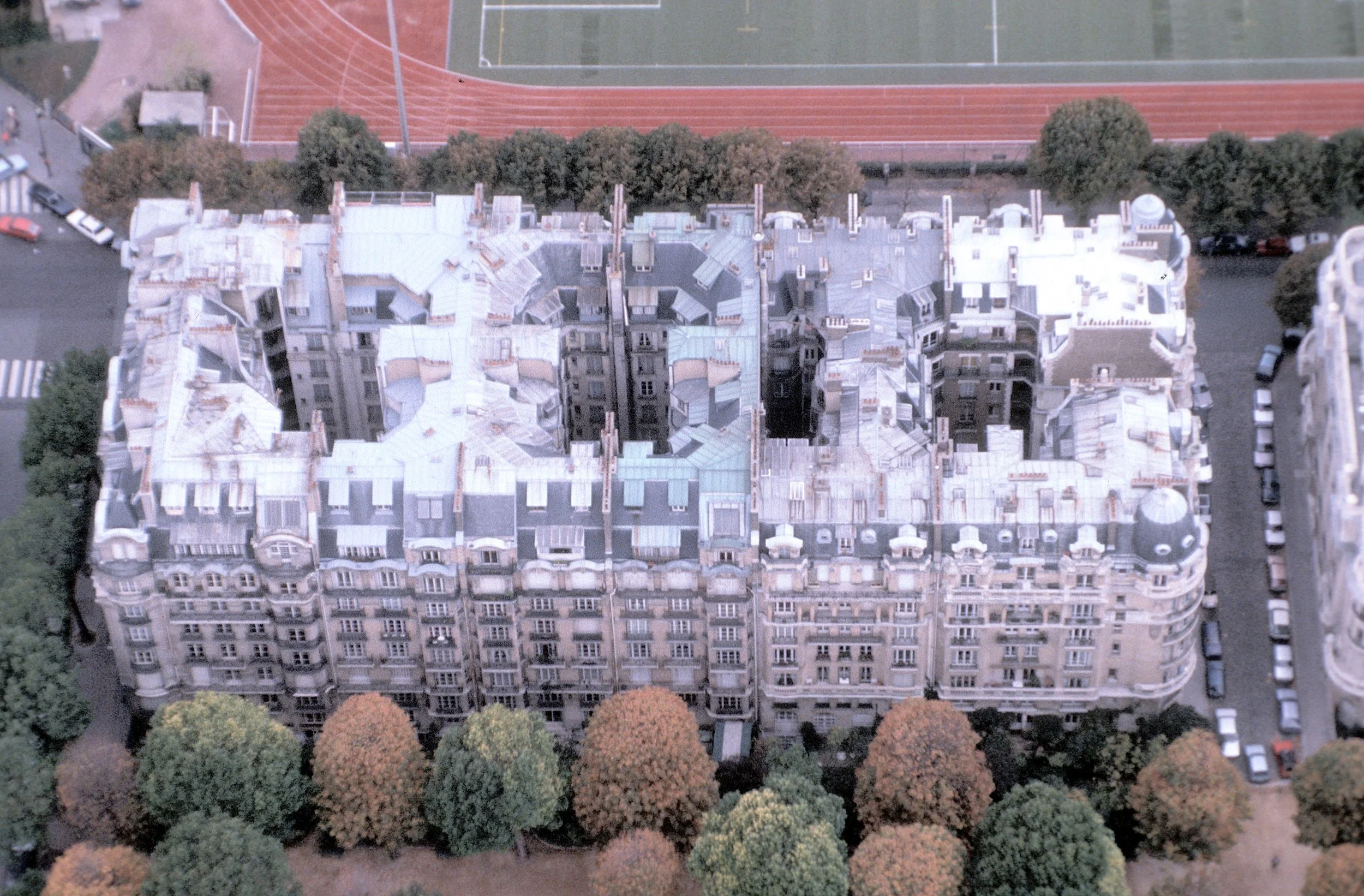
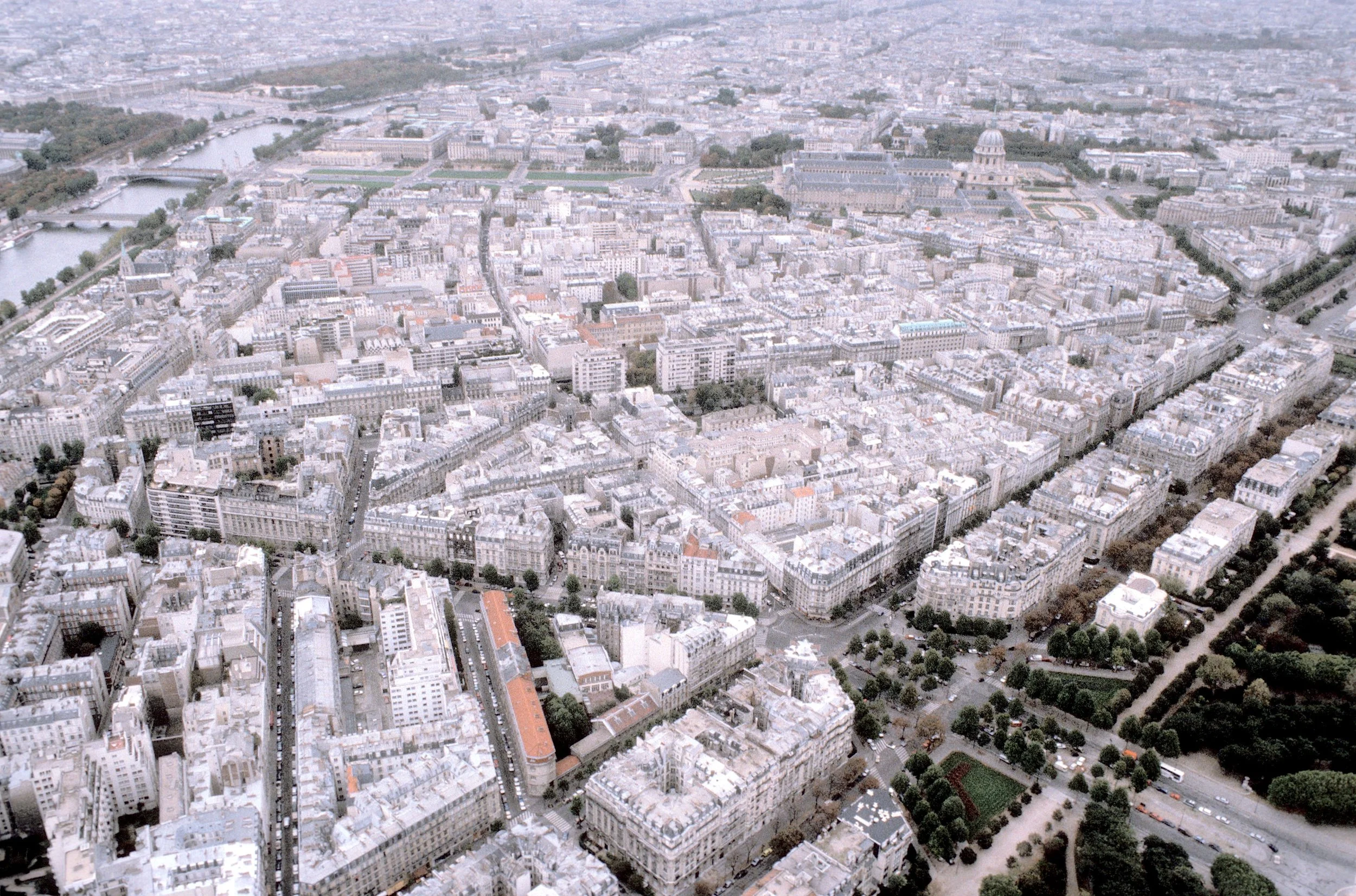
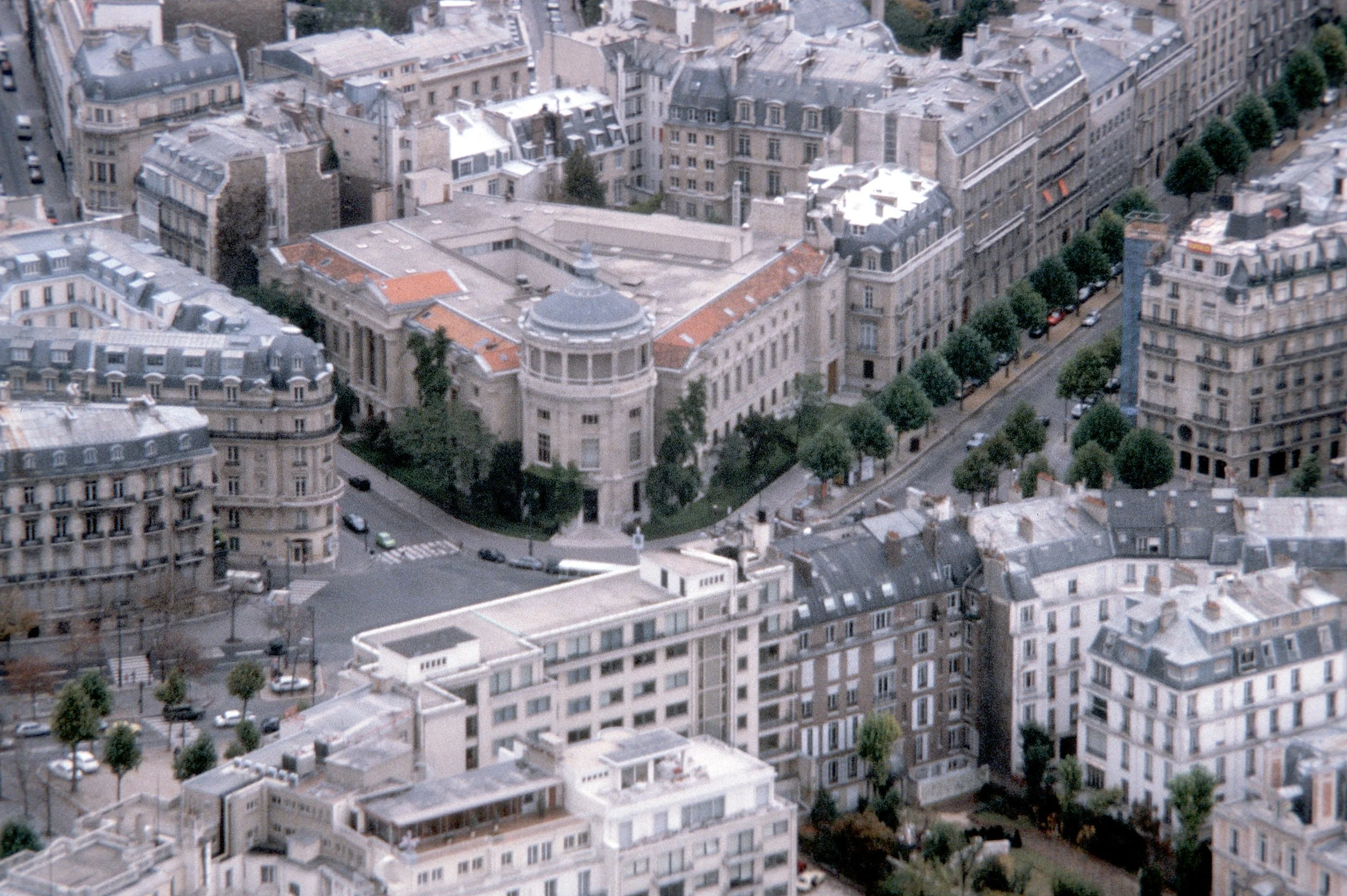
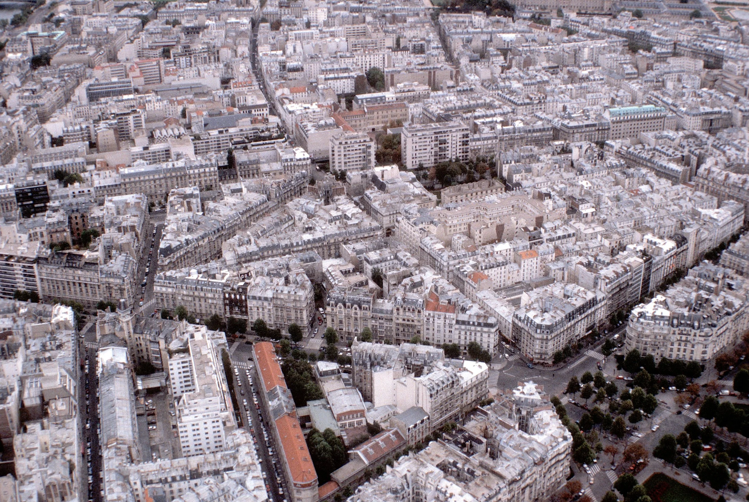
These images below from Paris show the overall character of complete streets along with many of the derivative design elements that make these boulevards beloved (we have no beloved freeways).
As parts of the city collide, urban designers and city planners must use available resources to integrate the components as best they can. In so doing, many questions need to be answered. based on both effective theories and expertise. These issues span the urban mosaic, creating a unique culture in each community. Planners and designers might name some of the following as “good” places: Rockefeller Center, Pioneer Courthouse Square, Central Park, Millenium Park, Bryant Park, the National Mall, the Spanish Steps, Park Citroen, Dumbarton Oaks, the Bath Crescent, San Antonio Riverwalk, Sienna’s Campo, Disney’s Main Street, and New York’s Gramercy Park. All are managed differently, a subject about which designers and planners lack comprehensive knowledge. Implementing and managing a good public place requires a customized analysis with detailed management talent for each place.
Consistent with the concept of bricolage, and derived in part from management science, urban planning literature includes strategies that address the administration of public places as customized practices rather than a singular standard or protocol. Strategy of Decision (1970) by David Braybrooke and Charles E. Lindblom describes how many critical decisions in cities come about through “disjointed incrementalism” – this does not sound glamorous, but it works. There is no “one-size-fits-all” for managing public places. Still used by most planners, this approach dovetails well with the acknowledgement of “collisions” among design concepts and the value of customized planning on a case-by-case basis.
Jane Jacobs’ Death and Life of Great American Cities explains many needs in contemporary urban planning which are also consistent with the ideas of bricolage and the “collisions” of concepts that occur in contemporary cities. For example, the application of “mixed uses” in Jacobs’ view is a planning practice that should be adopted as needed. Other concepts that should be applied as needed include higher density, shorter blocks, overlapping neighborhoods, use of both old and new buildings, and features that occur naturally in a city filled with “good” collisions..
“Advocacy Planning” is yet another planning policy to be applied cautiously, on a case-by-case basis This concept, from the late 1960s, based on the “choice theory of planning”, opposed the top-down autocracy of planners like Robert Moses. Over time, however, advocacy planning, in practice, failed to reverse overly centralized decision-making. To succeed advocacy planning methods require exceptional political talent as well as good design to be effective.
Rowe and Koetter’s following comment about modern architecture might also be a reasonable critique of many urban “collisions”, attempts at “bricolage”, and actual outcomes of city planning efforts for much of the 20th century in America:
… In spite of all the good will and good intentions of its protagonists, it [city planning] has remained either a project or an abortion; and, more and more, there no longer appears to be any convincing reason to suppose that matters will ever be otherwise
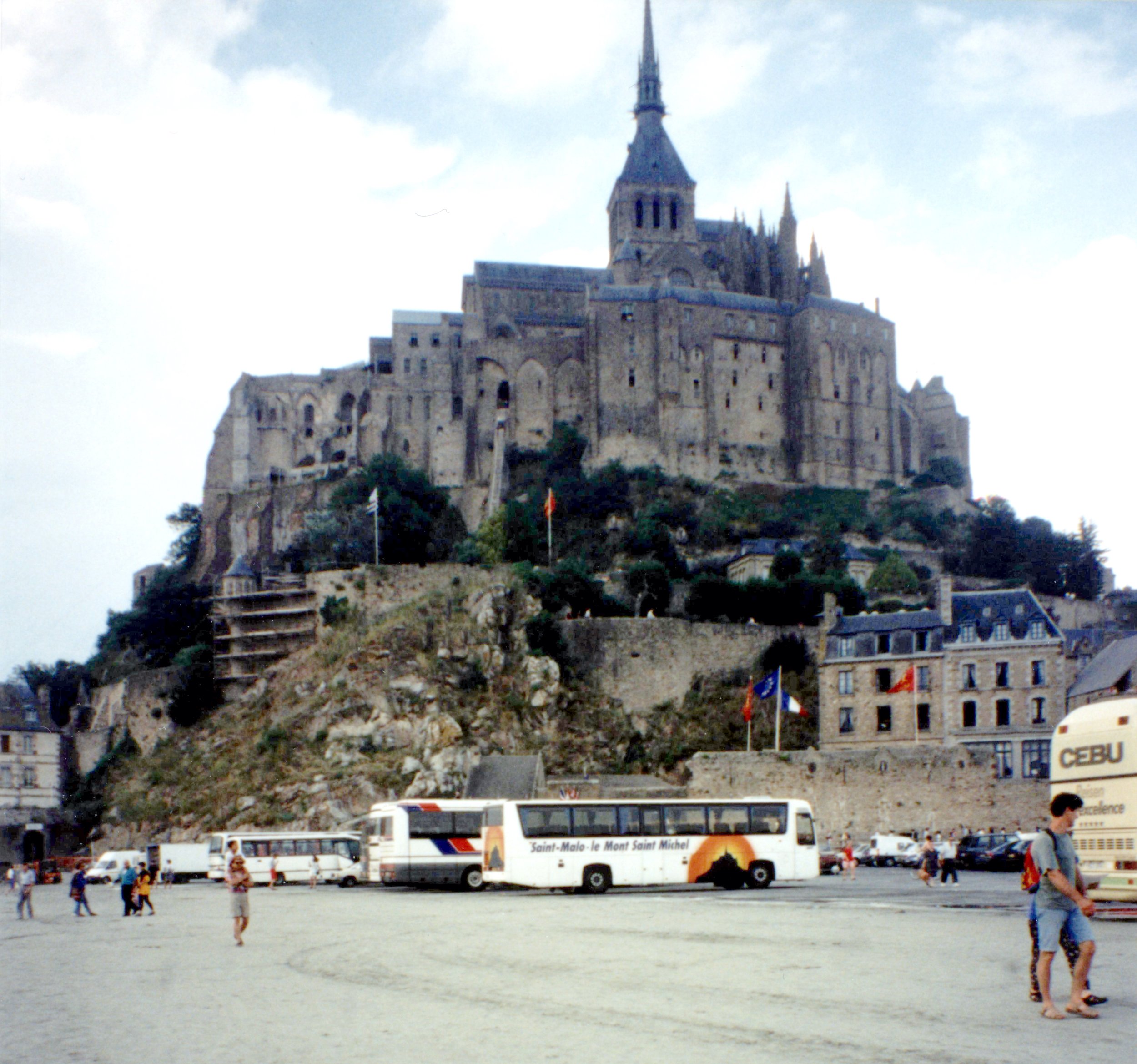
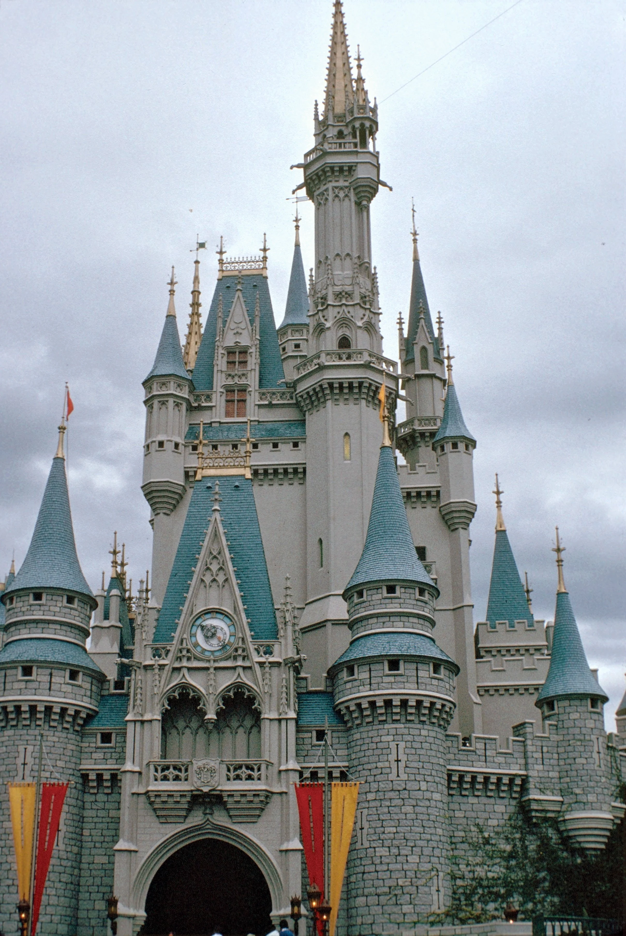
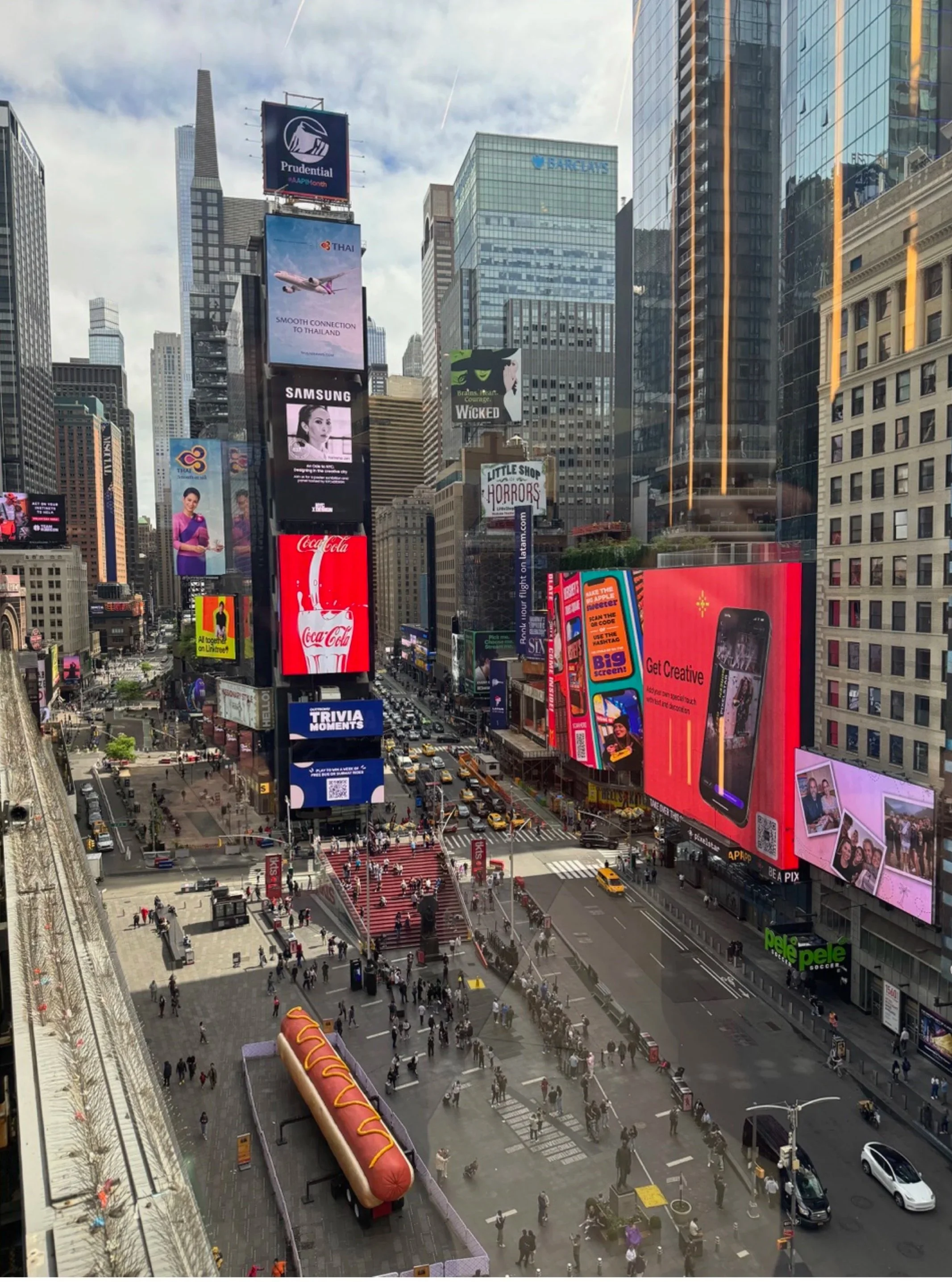
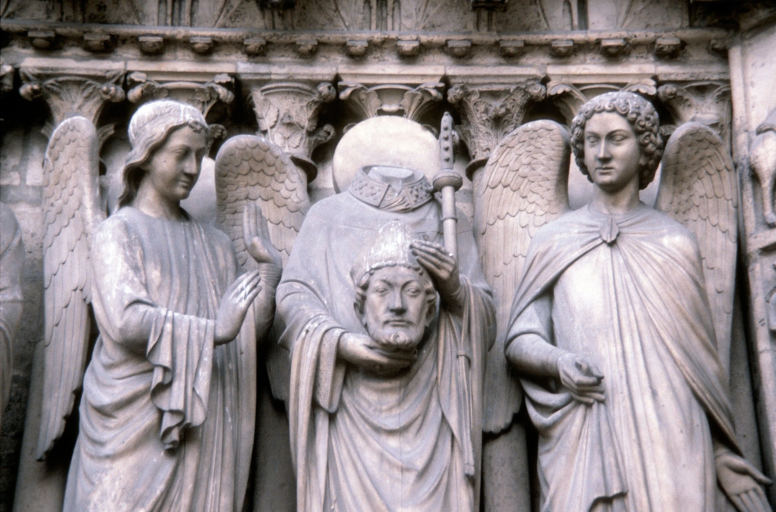
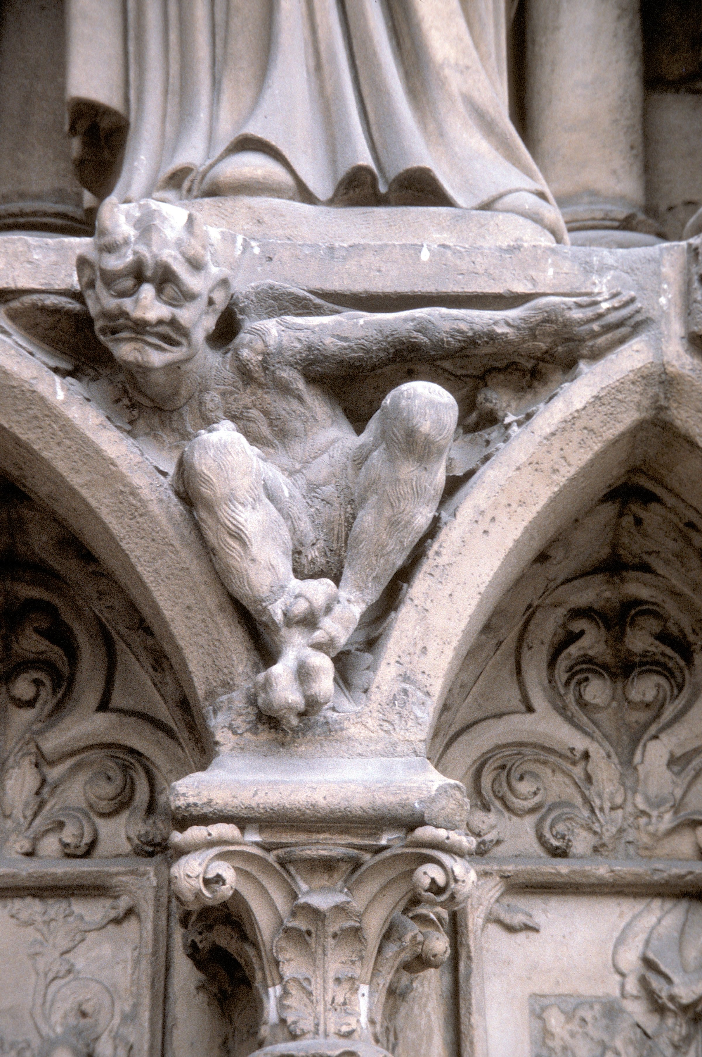
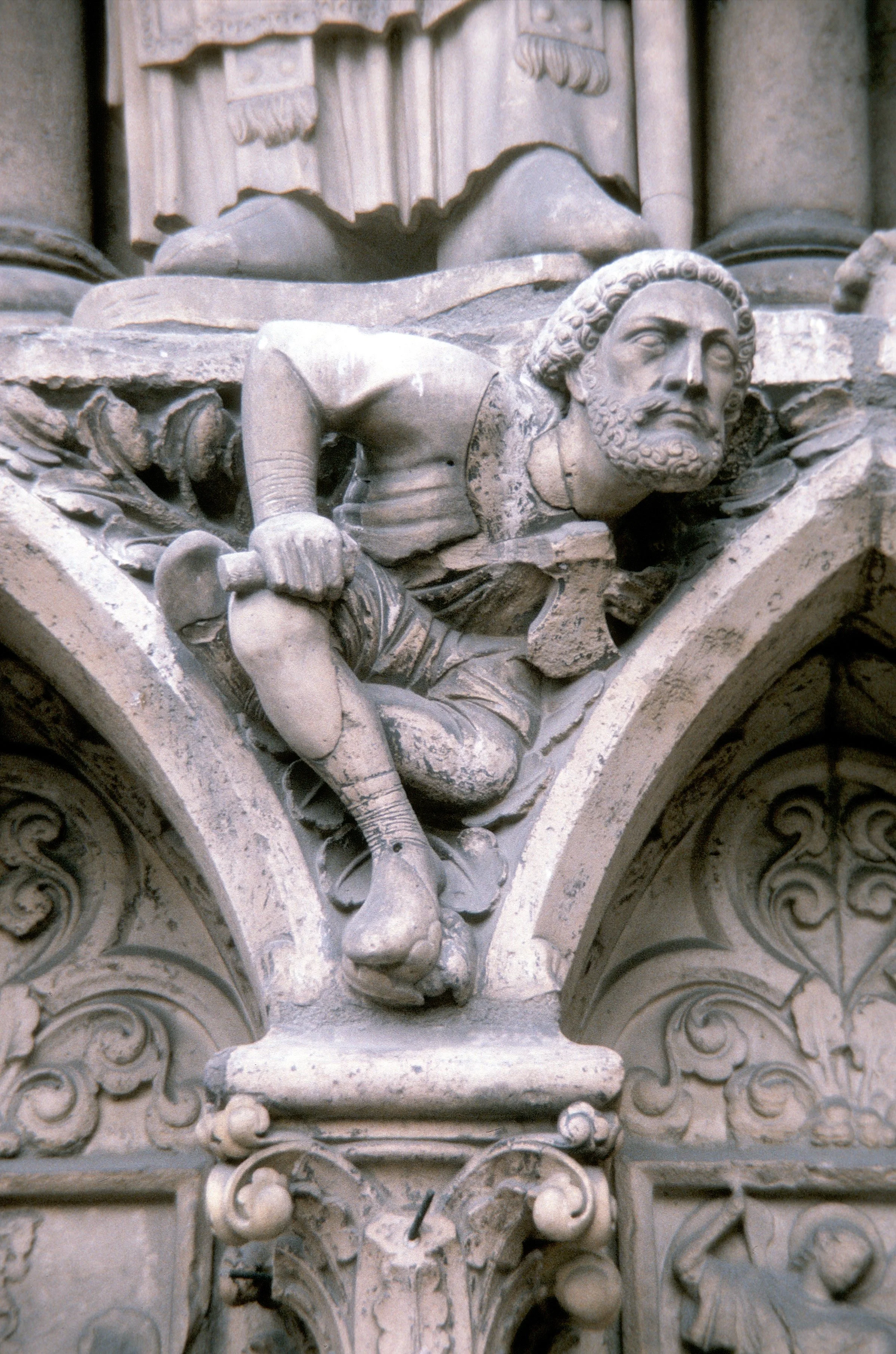
These three icons (Mont Saint-MIchel, Disneyworld, and Times Square) evolved at different times, in different ways, but each can be used to look at the others. Perhaps pilgrimages to Disney say something about the Middle Ages.
Chapter 5: “Collage City And The Reconquest Of Time”
This chapter offers some hope for urban designers and city planners in the 21st century. For me, this hope comes from the a critical metaphor in Collage City that can help dovetail urban design with city palnning – thinking of the “city as museum” in which both the designers and planners act as if they were “curators” and “custodians”. As a city planning practitioner, as well as an educator, the system of words surrounding “collage” make it a meaningful metaphor for urban designers, but not as practical for city planning. In contrast the system of ideas surrounding the “museum” metaphor fits well with the work I have experienced.
Public places in our cities are like the art in the museum galleries — where curators preserve civic art from the past and collect new civic art. When viewed as a collective city or “musuem” we juxtapose all of the changes — from last week, last year, and the last century. We see new places in the light of the old ones and vice-versa. Places designed yesterday and places from centuries ago become contemporaneous, enriching each other.
Some quick on-line searches suggests the word “curators” once referred to the custodians of the roads and infrastructure of Rome. Serving as guardians of the past to preserve things for the future fits well with the “theaters of memory and prophecy” advocated in Collage City. City curators, and those who work for them, should look back and forth at the same time.
In 1967 I was taught that city planners must learn (a) the nature of cities and (b) the methods by which we can plan. City planners as curators must still learn “cities” and “planning” but to make cities we must learn “places” and to plan we must learn “design”. Not all Planners make great places, but all should find, teach, evaluate, collect, arrange and present good places to the public. Planners, as curators, use resources from the private and public sectors. Not everything fits together but it comes closer. Ideas collide and urban collages emerge. For these outcomes to create civic art, curators must find ways to dovetail urban design and city planning.
Chapter 6: “Excursus”
Some of the archetypical places that belong in the Collage City of Rowe and Koetter are described at the end of the book in the chapter entitled “excursus”. An entire city may be one museum piece (like new towns such as Brasilia, Seaside, and Greendale) while in others the city juxtaposes a variety of places within one infrastructure over time (in which case the city is not intended as a singular work of art). Even newborn stand-alone cities grow and become components of larger communities over time. Eventually the city may become an appealing “museum-like” collection of districts, neighborhoods and places. It can also become an unappealing, emotionally disturbing, profoundly dysfunctional collision of incompatible threatening places. The value of the places in the “museum” depends on the talent and skill of the designers and planners who made them. Rowe and Koetter reinforce this key point with a quote from George Santayana
“Man has a prejudice against himself; anything which is a product of his mind seems to him to be unreal or comparatively insignificant. We are satisfied only when we fancy ourselves surrounded by objects and laws independent of our nature.”