Combine The Theories Forms, & Opportunities
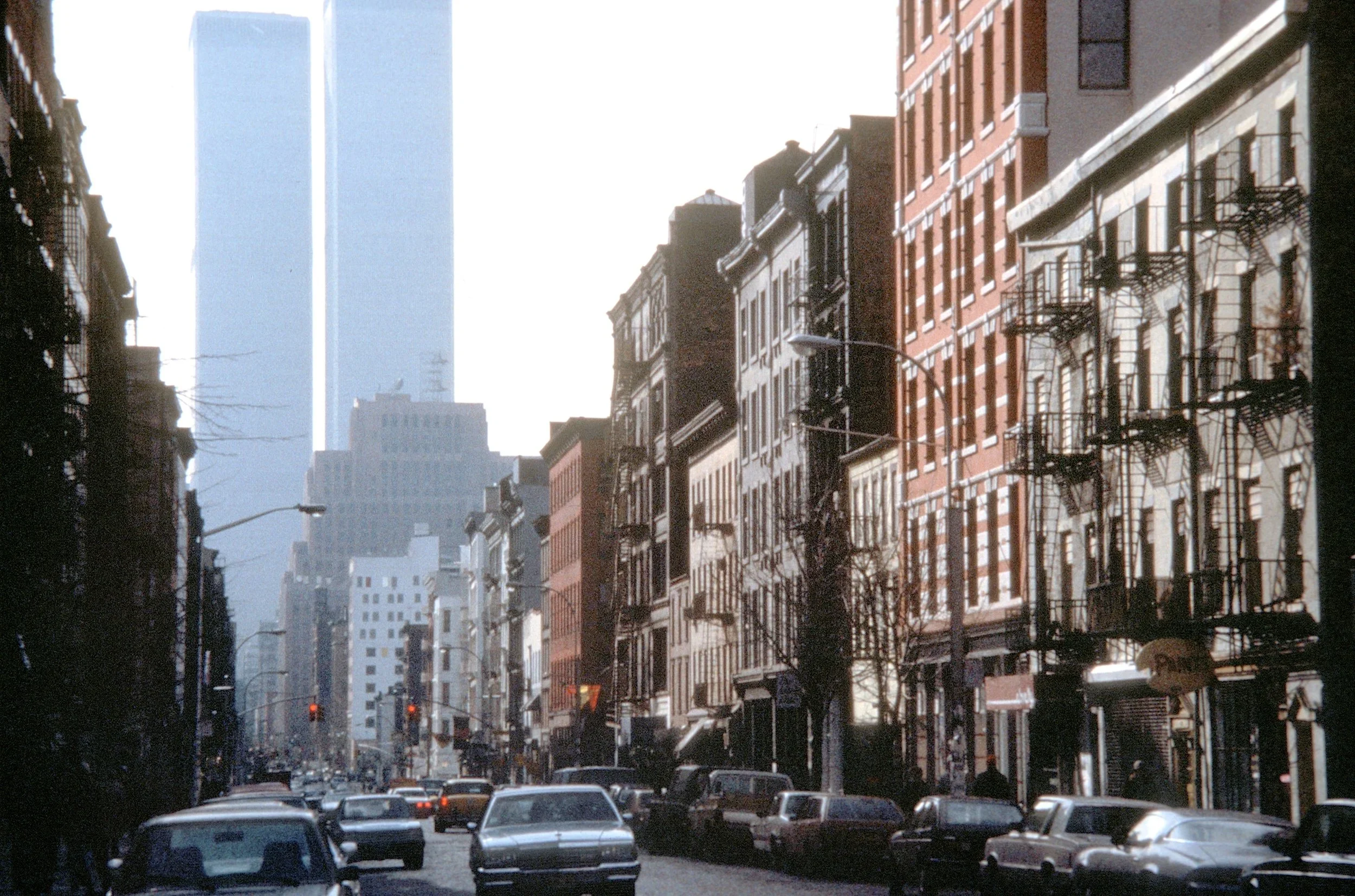
Urban designers and city planners should learn how the form of the city evolves based on culture, context, character and community history. This photograph juxtaposes the ghost-like object of the first World Trade Center, a monumental symbol destroyed with tragic violence, in contrast to the everyday texture of buildings, streets, and vitality of lower Manhattan. After its destruction, planners and designers created a new architectural tower and memorial plaza while the everyday life of the city continues.
Reading both Collage City and the compendium of essays in The Urban Design Legacy Of Colin Rowe compiled by Steve Hurtt and James Tice offers an invaluable understanding of urban design as a wide-ranging discipline rather than a subcategory of architecture or urban planning. As a foundation for urban design these two books reach back historically as well as defining a framework for future conversations. The essays provide a genealogy of theories and interrelationships. These interconnected essays show how good public places require more than effective engineering and infrastructure but an in-depth understanding of urban culture, form and the context of the city.
Too often, urban planners narrow the value of urban design by defining it primarily as a cosmetic, skin-deep face of the city rather than the city’s underlying organization and fundamental cultural condition. This occurs because of a never-ending addiction of planning professionals to non-visual data. Even today, good physical planning and urban design may be overwritten by non-visual, guidelines and checklists, abstracted land uses, jargon, and geographic information systems (GIS) that interpret public places with precise numbers while dismissing the rich geometric diversity revealed through analysis of urban form. Said another way, GIS does not know the difference between trapezoids and rectangles except for measuring their angles, areas, longitude and latitude — just not their place.
With increasing frequency, however, city planners and urban designers, use isolated visual data to show a limited view of key aspects of urban form. At times, this is helpful but it also avoids the difficulty of integrating the critical disciplines and areas of qualitative knowledge with urban form. Many essays In TheUrban Design Legacy of Colin Rowe show how the disciplines of city planning and urban design should be viewed through a broader, combined lens that unifies and focuses, rather than distorts, our vision of cities. That broader view underlies the rest of this essay.
Learn Multiple Theories About Urban Places
City planning practice strives to make good places within the character of urban patterns in each community and cultural tradition. Finding a “good place” in one community and assuming that it can be easily replicated in another city shows a fatal lack of understanding of urban form and context. There is no “one-size-fits-all” for good urban places. Pattern Language, as discussed below, offers one approach, within limits, for refining the same concept (or “pattern”) in different communities. Planners can and should borrow ideas from one place for another, but effective “transplants” always require enormous talent and skill. Urban social patterns are not the same as a retail francise the thrives of congruence from one store to another. Planners and designers have to make work to gather to customize good places, based on a valid theories and reliable knowledge of conditions in each neighborhood, district, or corridor..
Kurt Lewin has been attributed with the thought that there is “nothing as practical as a good theory”. The hidden gem in this view is that there is no single best theory in urban planning. City planners and urban designers learn a range of tools for decision making. Finding a “good theory” leads to reliance on many of the concepts found in TheUrban Design Legacy of Colin Rowe. This way of thinking begins by learning diverse philosophical concepts, as well as patterns and precedents, from designers and planners that change slowly over decades if not centuries. However, this approach is also a warning to city planners to avoid picking the same “favorite” theory over and over.
Often theories are recycled ideas from prior generations, each time with a new twist.. For example, city planning theories always recognize the importance of public health, but just as clearly, the ensuing theories of the physical forms that support public health do not remain constant. Hippocampus built cities upwind of foul odors. Corbusier wanted building footprints to have a precise northern axis. Excessive overcrowding is still unhealthy. Walkability is precisely a 15 minute or ¼ mile circle. A lack of air conditioning, not community networks, was the culprit in heat deaths. Over time a theory which was once considered the “truth” turns out to be fallacious or at best probabilistic. From my perspective, after 50 years of planning, the way to begin learning the culture of a community and avoid fallacies and missteps is through a broad historical and intellectual lens rather than a narrow technical or singular issue.
Planners should learn the history, culture and contradictions of communities through multiple forms of observation: big data and small data, objective and subjective knowledge, broad theory and detailed observations, art and science, long term history and yesterday’s gossip -- all contribute to a community’s culture. In that spirit, I have listed several concepts from classroom reading lists (some debatable, some from my teachers) that can help planners understand local community culture.
Steven Hurtt and Stuart Cohen, students of Rowe, coined the term “contextualism” subsequently described by Thomas Schumacher, Contextualism: Urban Ideals and Deformations (1971). The understanding of urban context, as the basis for urban planning (and therefore the basis of good places), remains the most important lesson for linking urban design to urban planning through the morphology of urban areas. The need for a dense context is often ignored by practicing planners, especially in suburban and rural areas. Moreover, the conventional definition of “context” has been diminished by many planners to refer solely to pubic opinion. Hurtt, Cohen and Schumacher establish the need to view context as the fundamental starting point for effective city planning.
Patrick Geddes, a celebrated planner who practiced in the early 20th century was a major influence on planning theorists like Lewis Mumford ( Culture of Cities). Geddes championed preservation of built and natural environments and promoted social activities that brought people together. He is the only planner I have read who suggested local celebrtory parades as a good social activity for communities. Some suburbs and small villages still have small parades. Many neighborhoods also have street and block parties that bring people together. Geddes advocated a broad range of social opportunities, as well as careful physical development, as critical to making good cities.
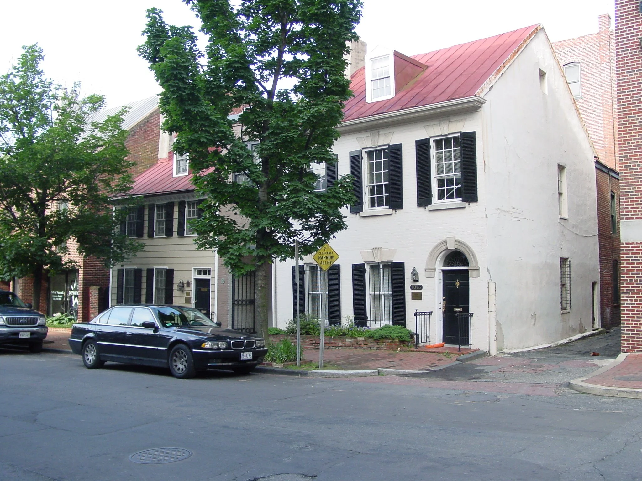
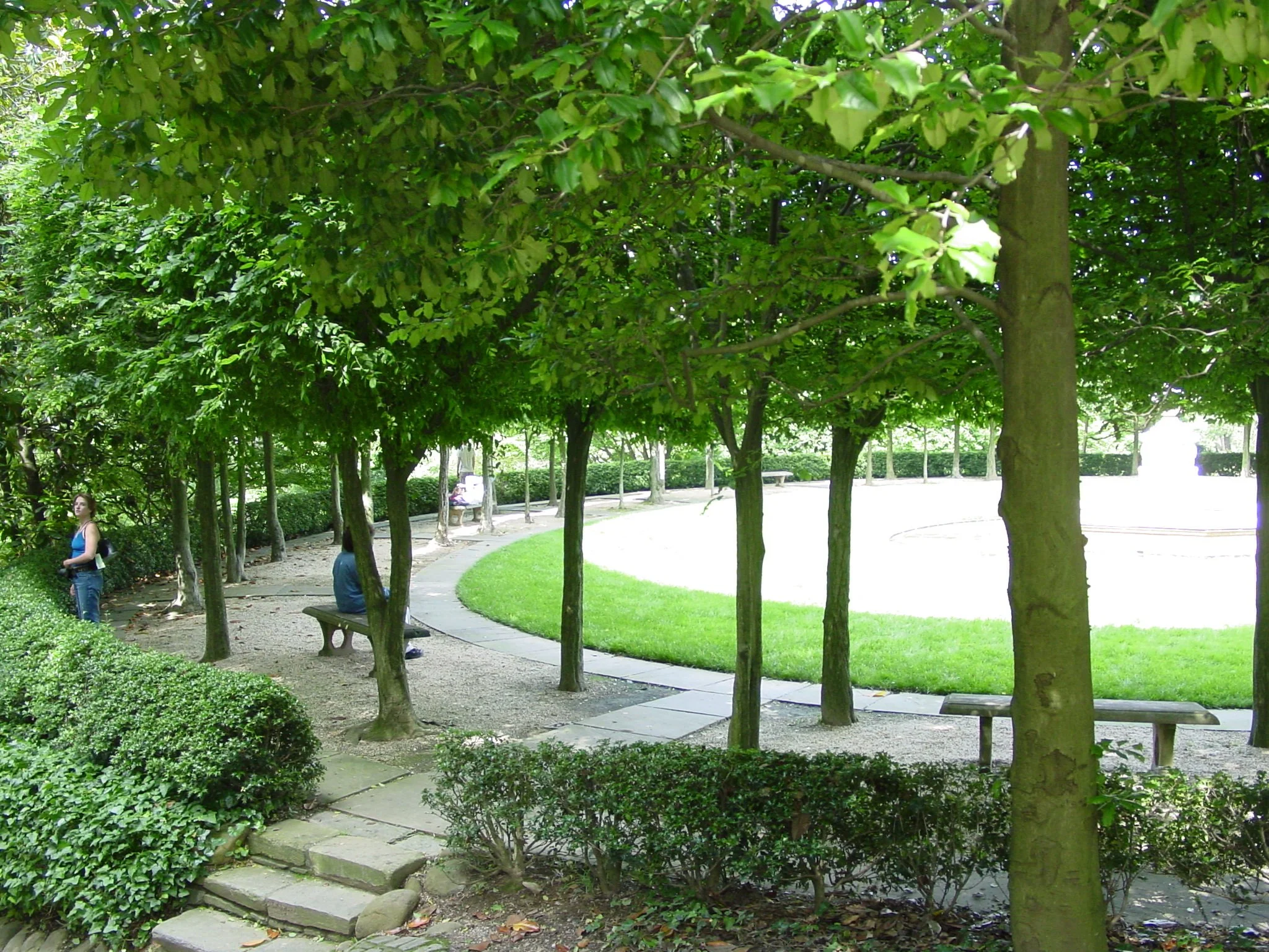
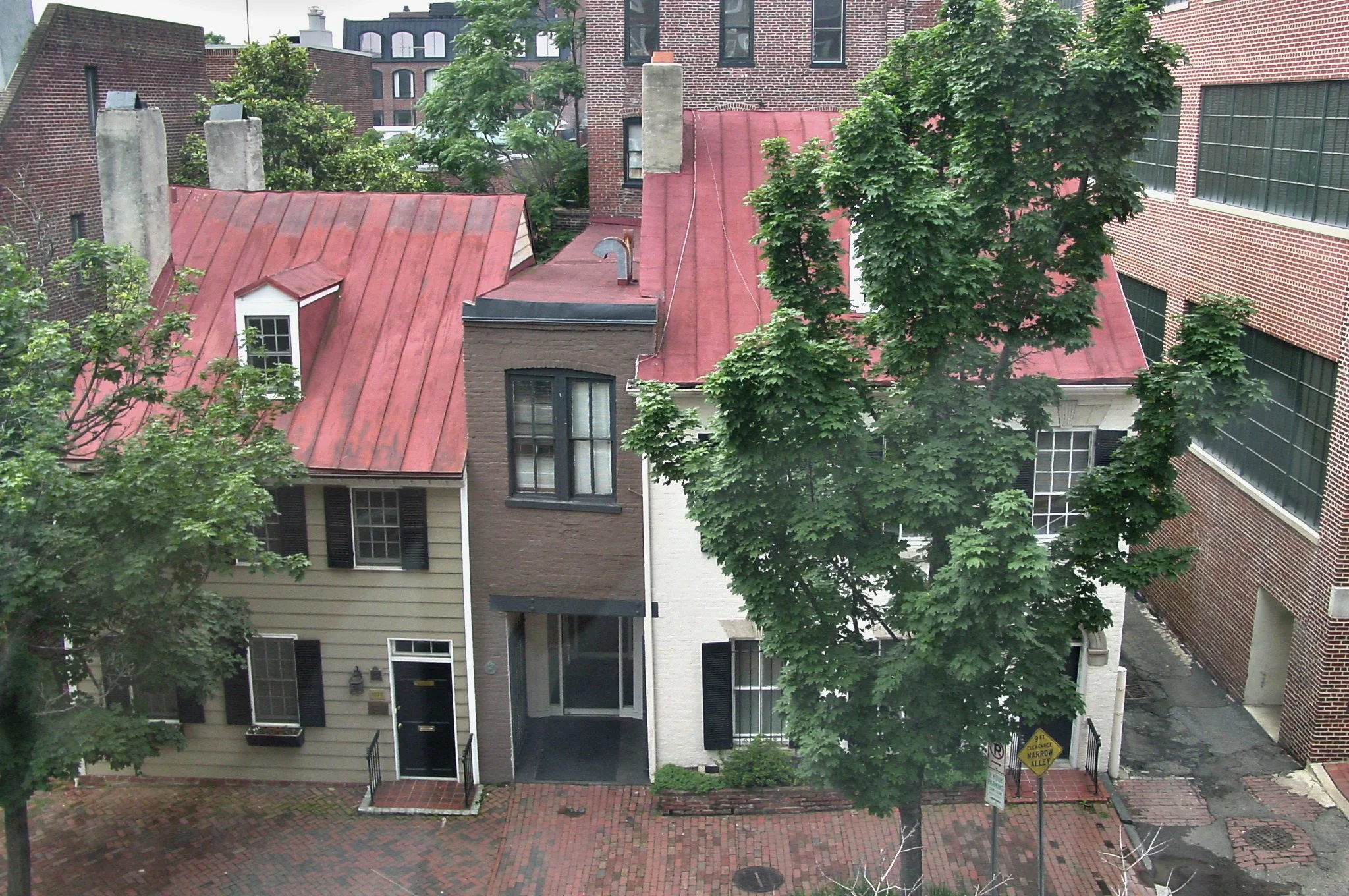
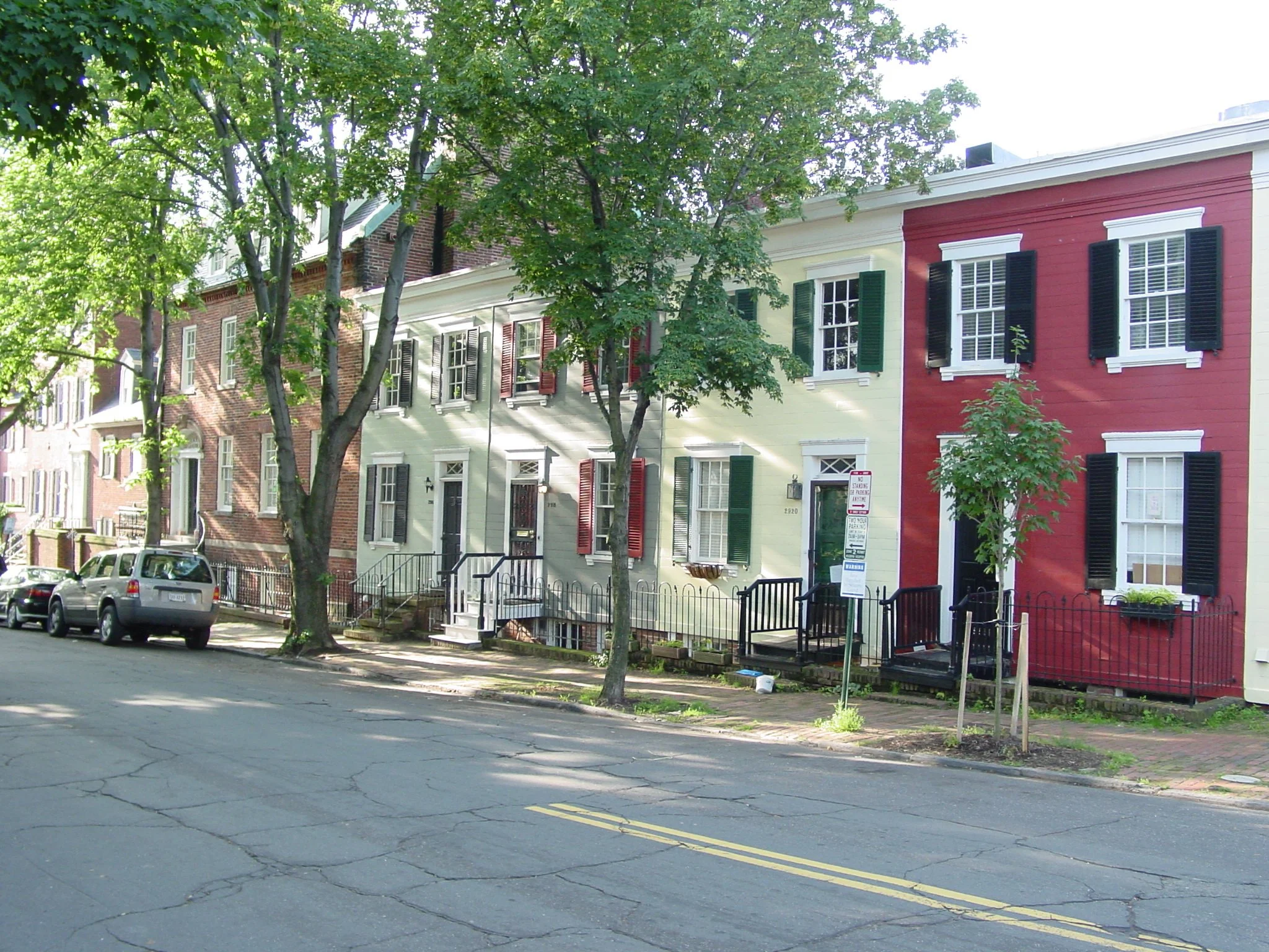
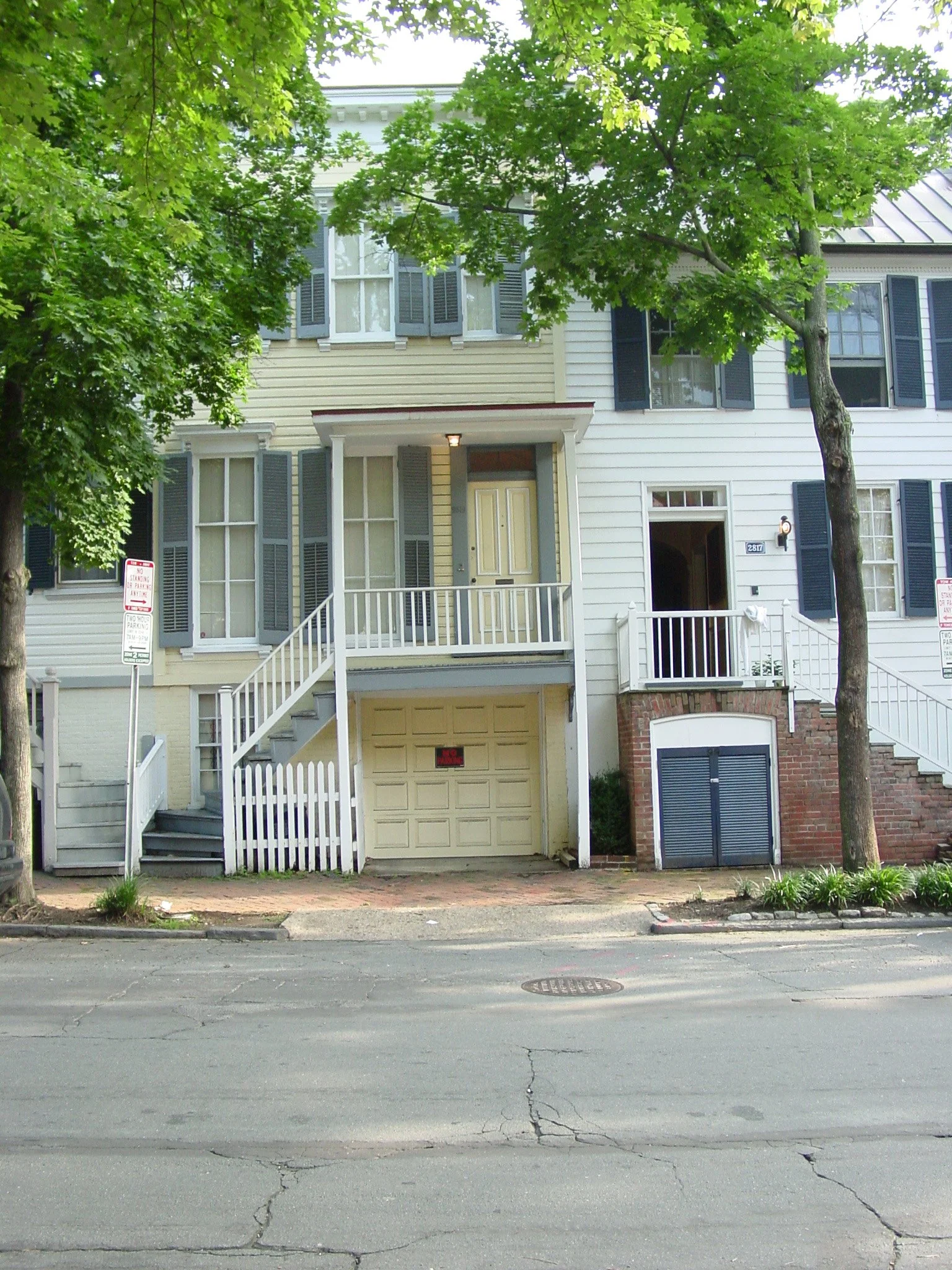
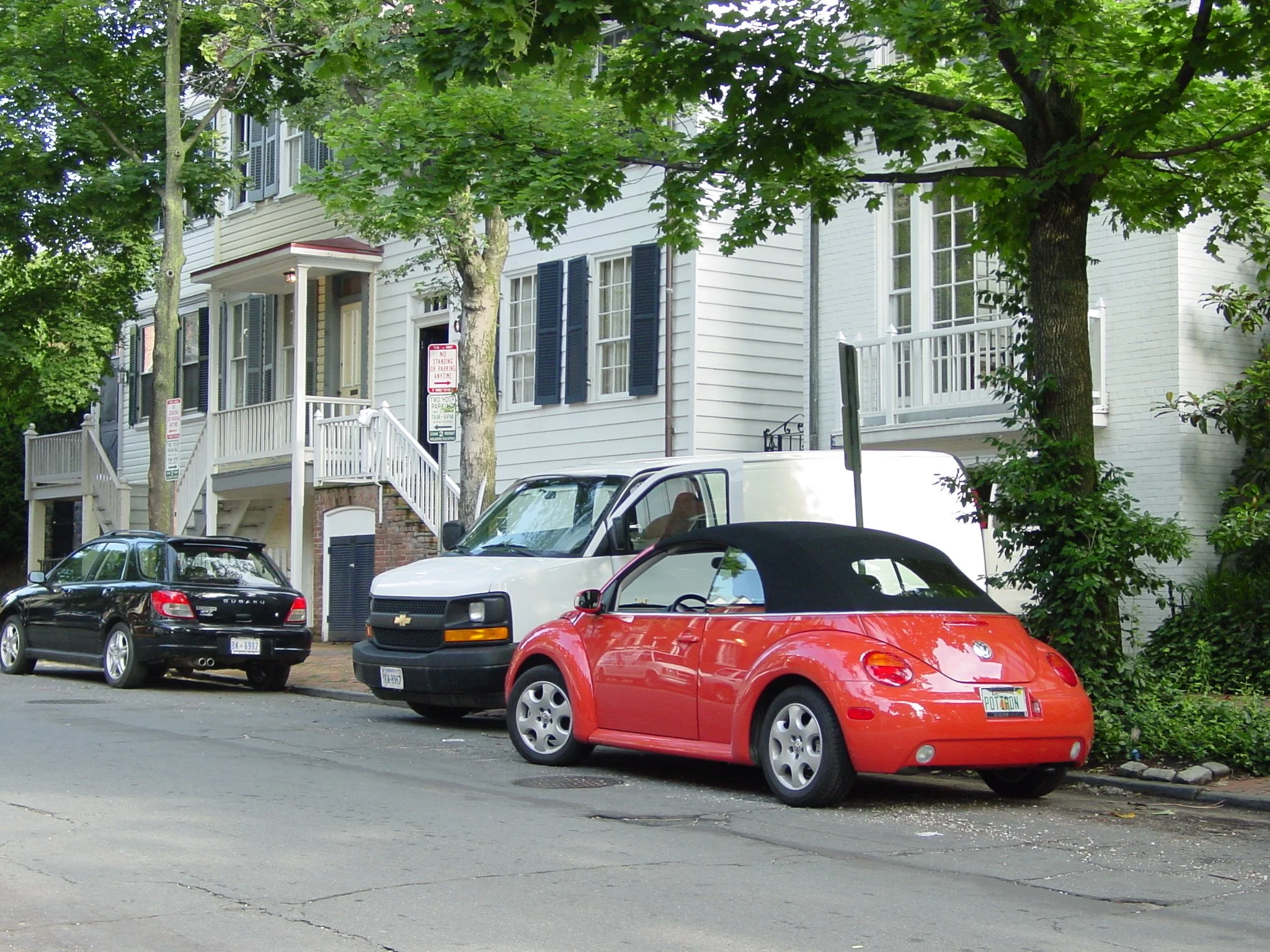
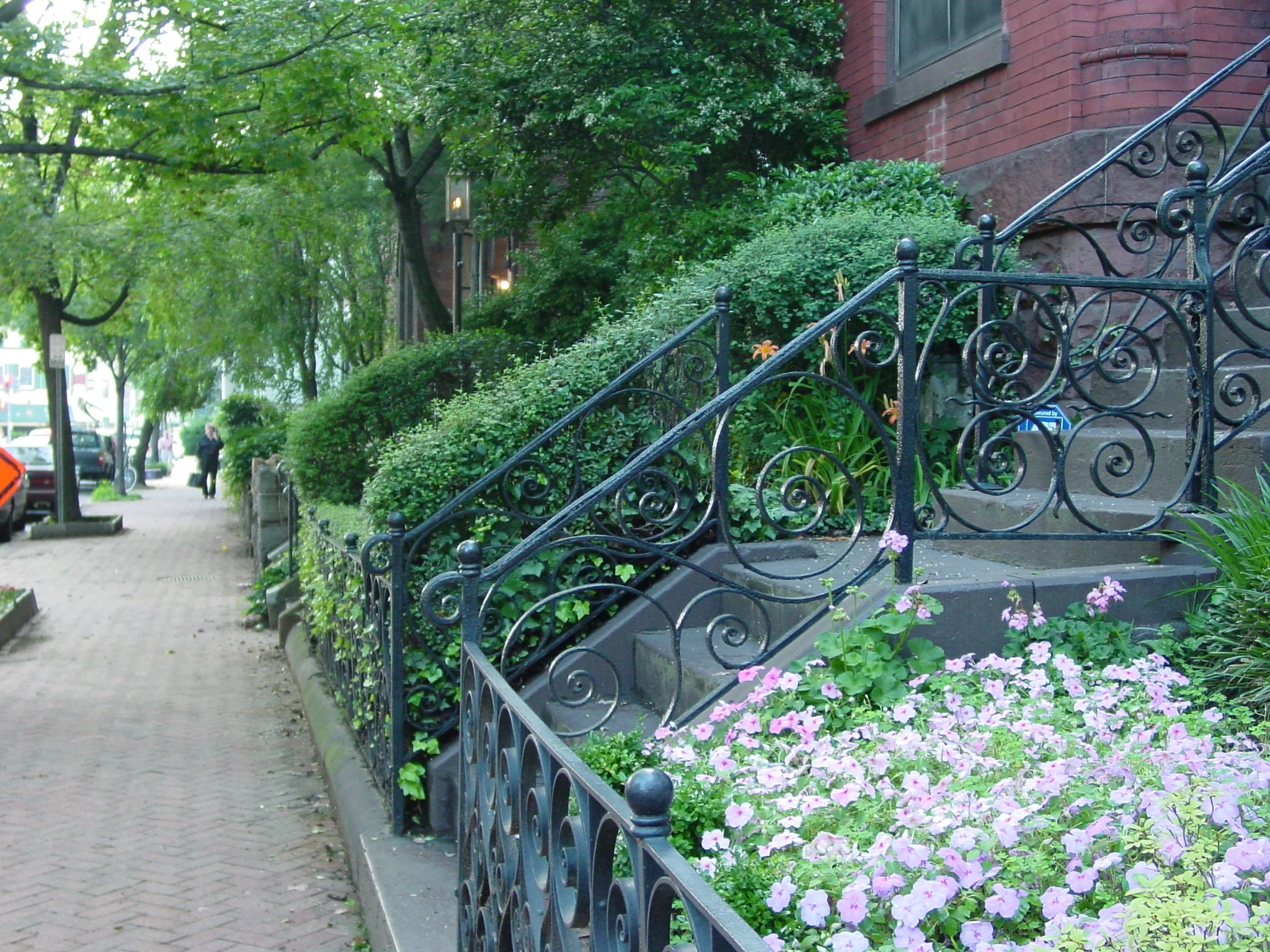
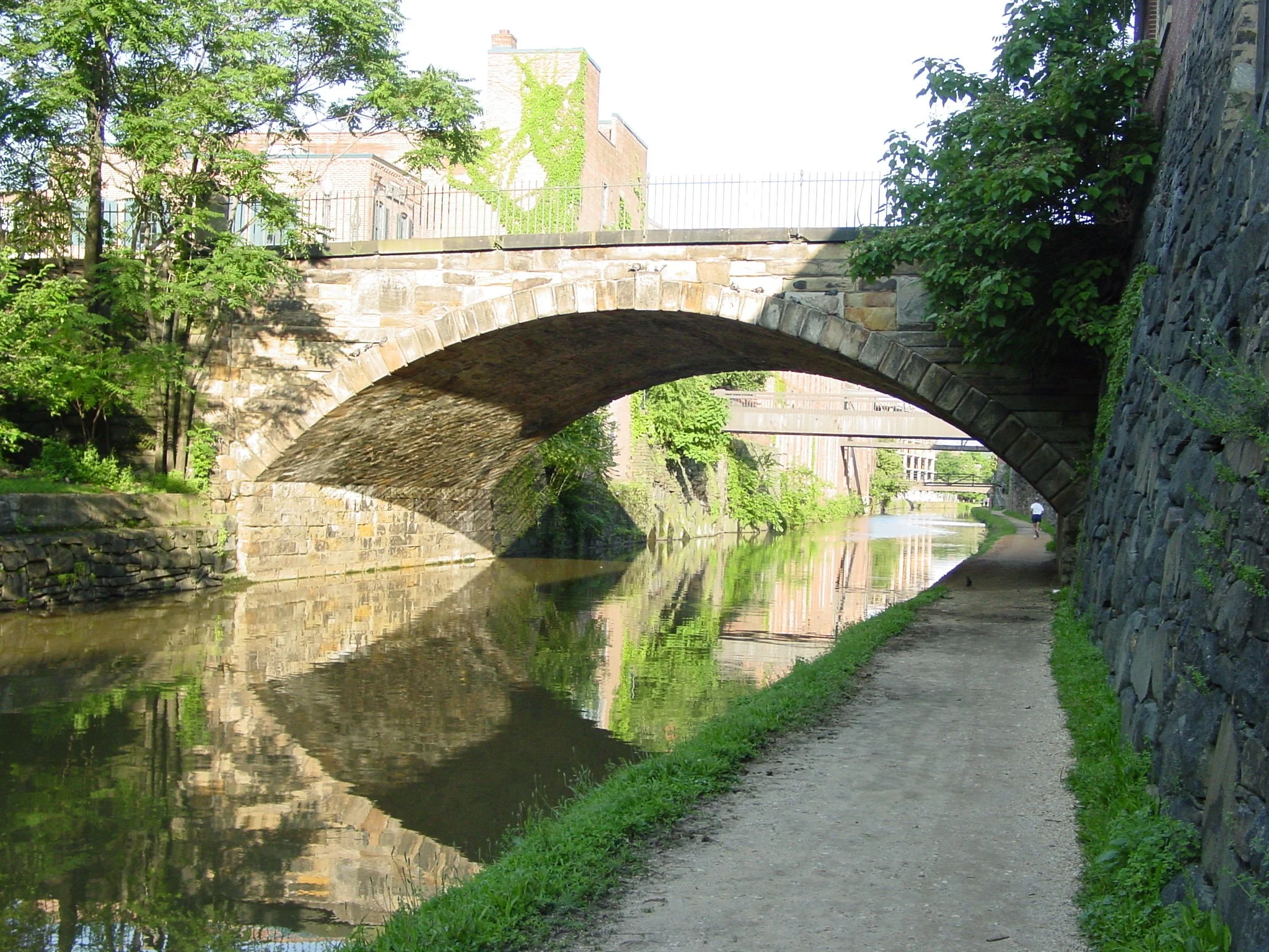
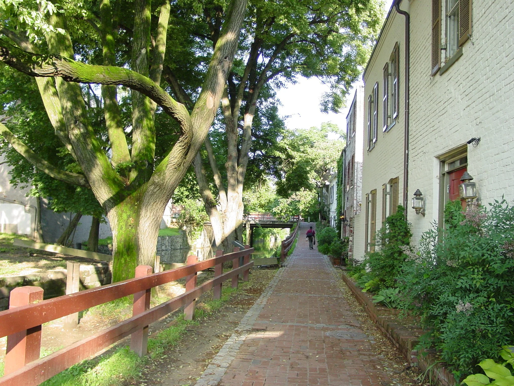
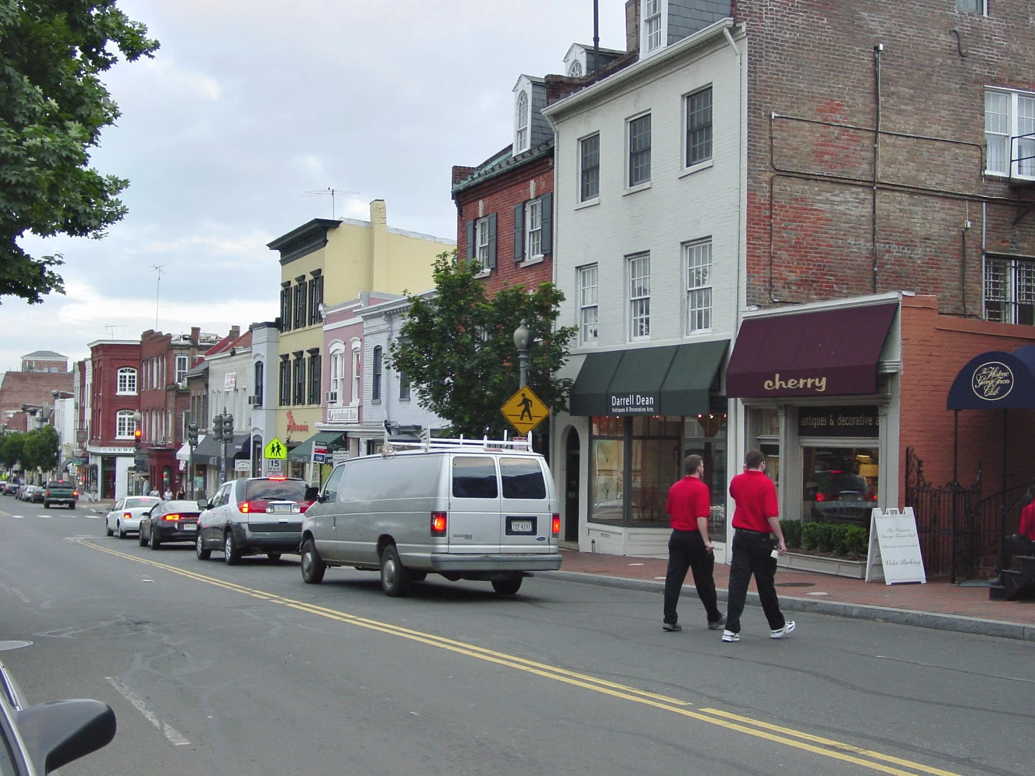
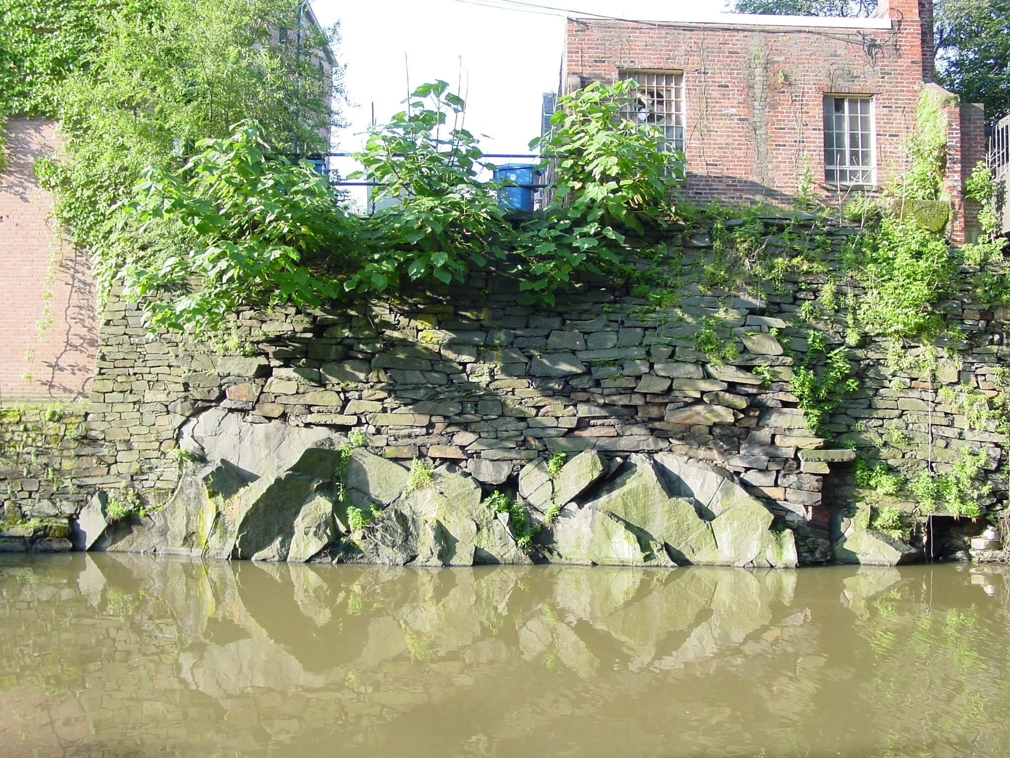
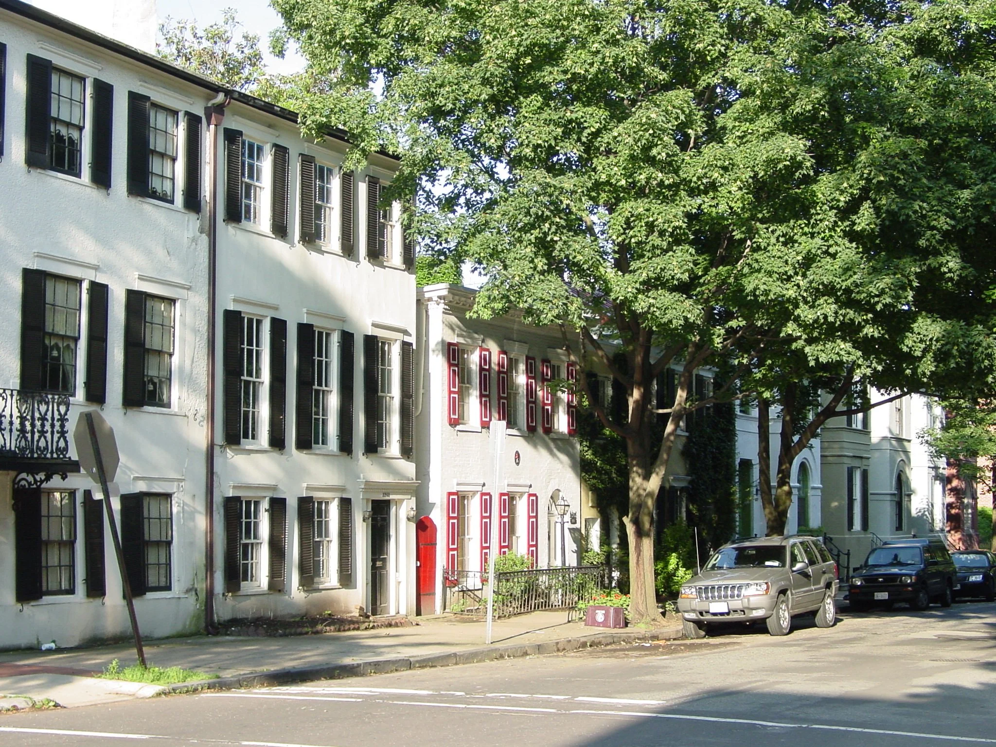
The historic Georgetown neighborhood (depicted below) provides a great examplar of how theories, forms, and opportunities combine to produce a great neighborhood filled with good public places.
Richard Sennett’s, the Conscience of the Eye: The Design and Social Life of Cities (1991) describes how everyday city life changes in response to shifting social and economic forces. Planners who work in different types of communities should practice such critical obervations, look for cultural change, and recognize the variations in attitudes arising from different periods of history and geographic character. For example, residents in an older midwestern suburb will embrace ideas about landscape and townscape that are completely different than those of new younger occupants in high-density downtowns.
Edmund Burke, discusses aesthetic theory in the Sublime and Beautiful (1757). His concepts can help planners explain differences in aesthetic value. Burke argues that we are enculturated to call something “beautiful” as opposed to inheriting taste biologically. In contrast ,however, scenes like an ocean or mountain range, are so overpowering that, without being taught, they are instinctively awesome, overwhelming and “sublime”. City planners need to learn how visual conditions are perceived in each city in different ways by different groups. For example, from my viewpoint, a view of historic buildings along a riverwalk (without trees) might be beautiful but an isolated tree in a parking lot is unappealing.
Many designers consider John Ruskin’s Seven Lamps of Architecture (1849) as too aristocratic and classist. However, some “lamps” can be useful to today’s planners. For example, the lamp of memory instructs us to plan items which, in the future, will be remembered favorably. Ruskin also recommends viewing “vernacular” buildings as visually appropriate, but not as culturally valuable or significant compared to buildings created via architectural talent.. This is a valid distinction for city planning and contributes to understanding zoning and the urban texture of many suburbs.
Walter Benjamin, best known for The Work of Art in the Age of Mechanical Reproduction (1935), also prepared insightful essays in an unfinished book called the Arcades Project (1927-1944). He critiqued changes in Paris and other cities from the end of the nineteenth through the early twentieth century and explained community behavior in terms of broad philosophical and cultural foundations. His insights into the nature of urban life provide a great example that city planners can follow when looking at the places where we work and where they propose new interventions.
J.B. Jackson’s American Space (1972) offers unique views of how we define public places. He refers to the “front yard”, for example, as America’s collective national space. In other writings he offers useful definitions of “baroque” versus “romantic” cities roughly as follows::
the baroque city is filled with active public places at street level and principal private space is located above the street on the Piano Nobile
the romantic city is separated on the land horizontally (the impetus for zoning) by unbuilt nature following the enlightenment’s ideals and there is no other public space
In practice, Jackson’s view might lead to creating dual land use plans – one for street level (incorporating aspects of the Nolli map) and one above street level – each of which might have its own policy, regulations, and goals.
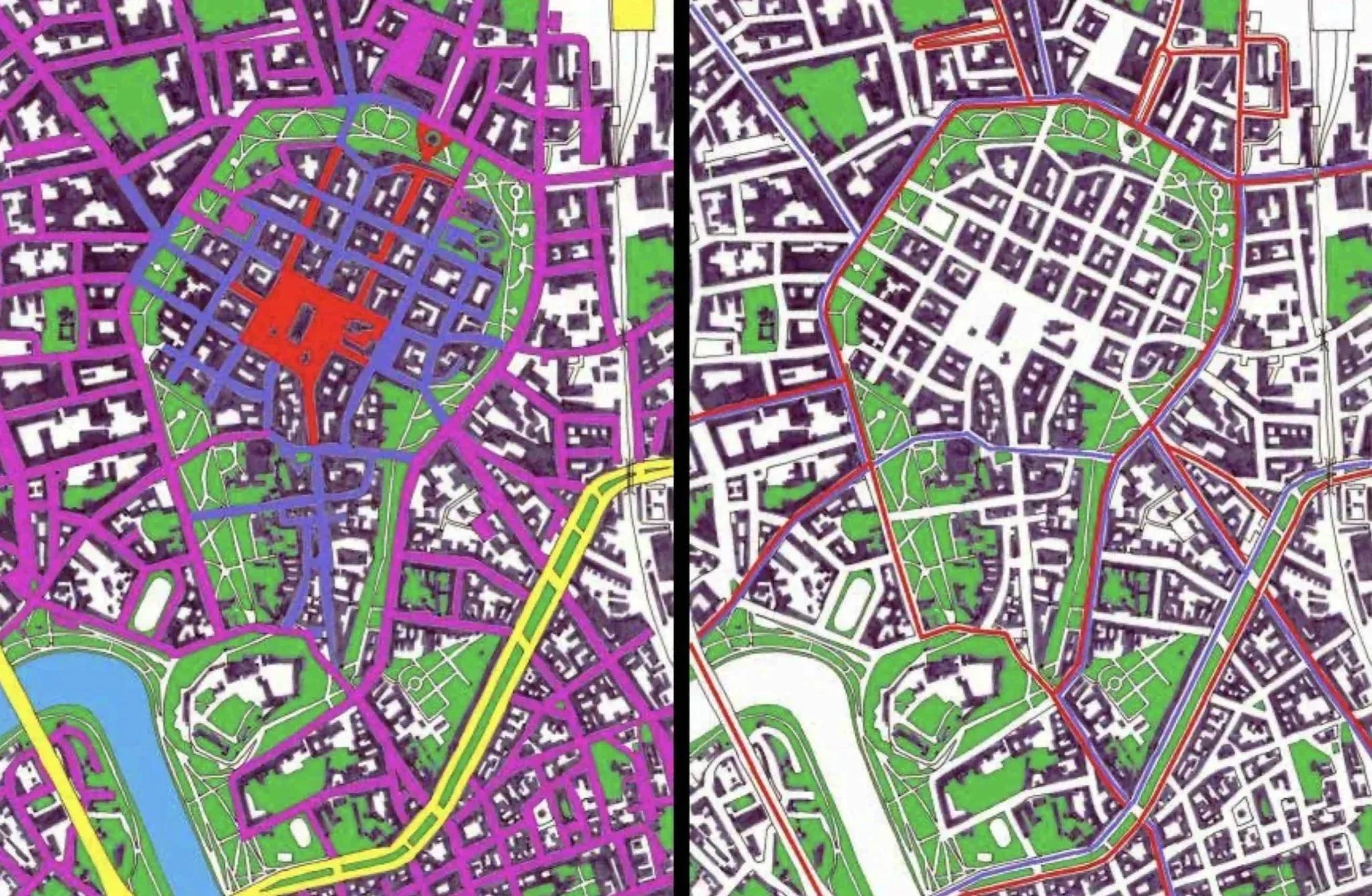
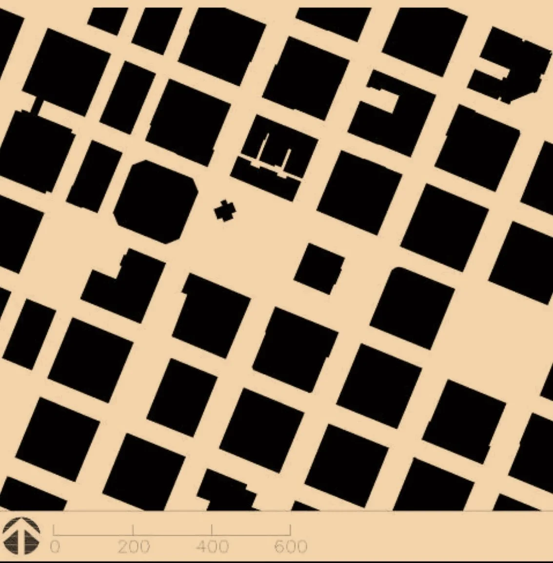
A student in my urban design class visited Krakow’s city center and, as part of her project, produced this insightful sequence of figure-ground maps depicting different views of solids and voids: streets, major transportation arteries, pedestrian only streets, reduced traffic streets, major greenways and/or significant public buidlings. There is no ‘best’ map, just different ways planners can explain the form of the city in relation to different social opportunities.
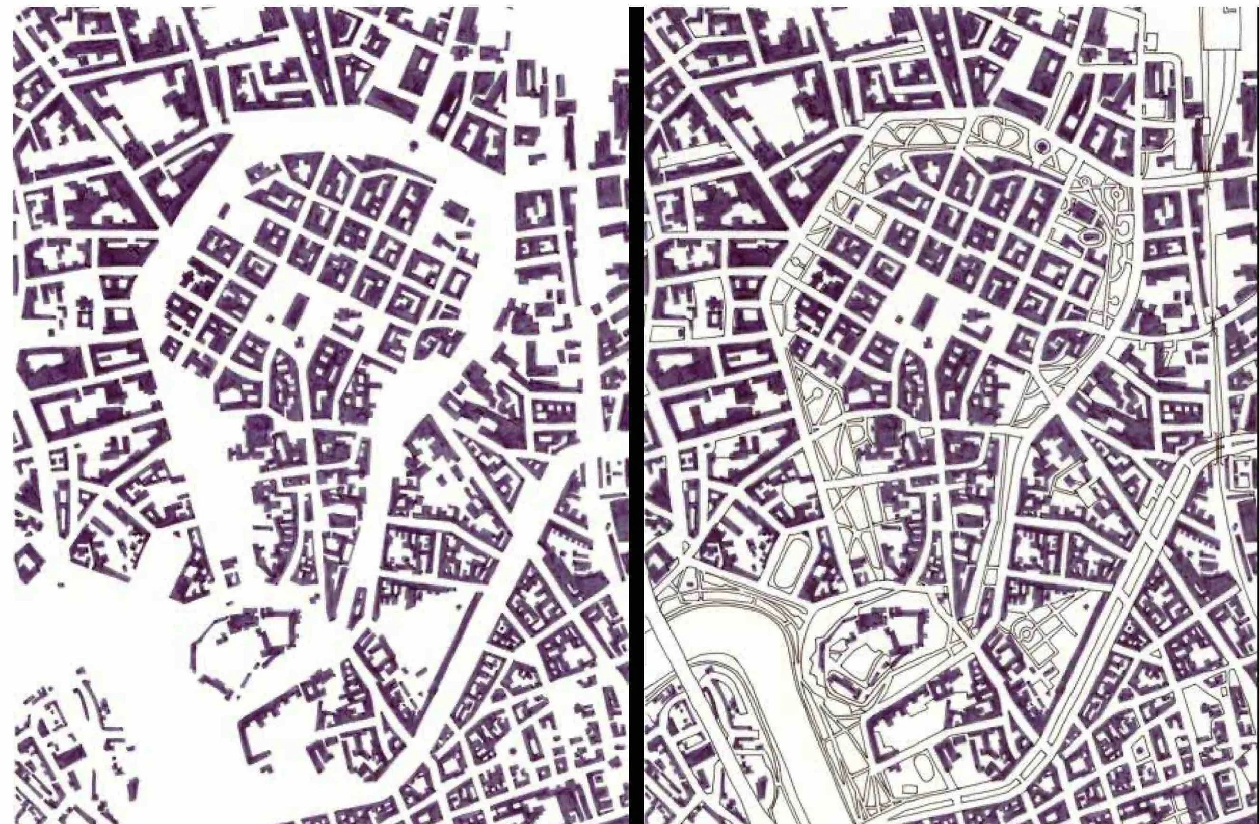
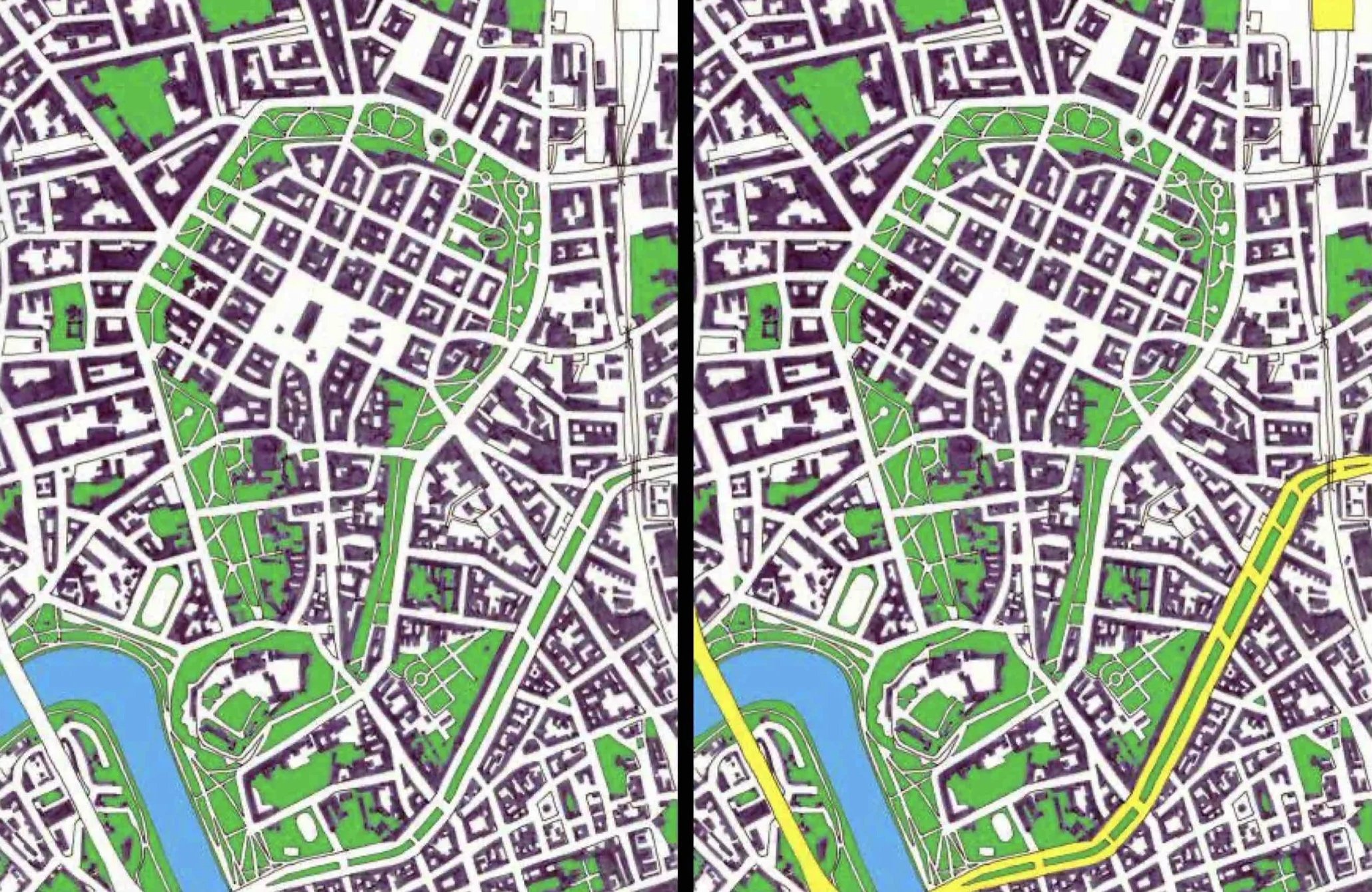
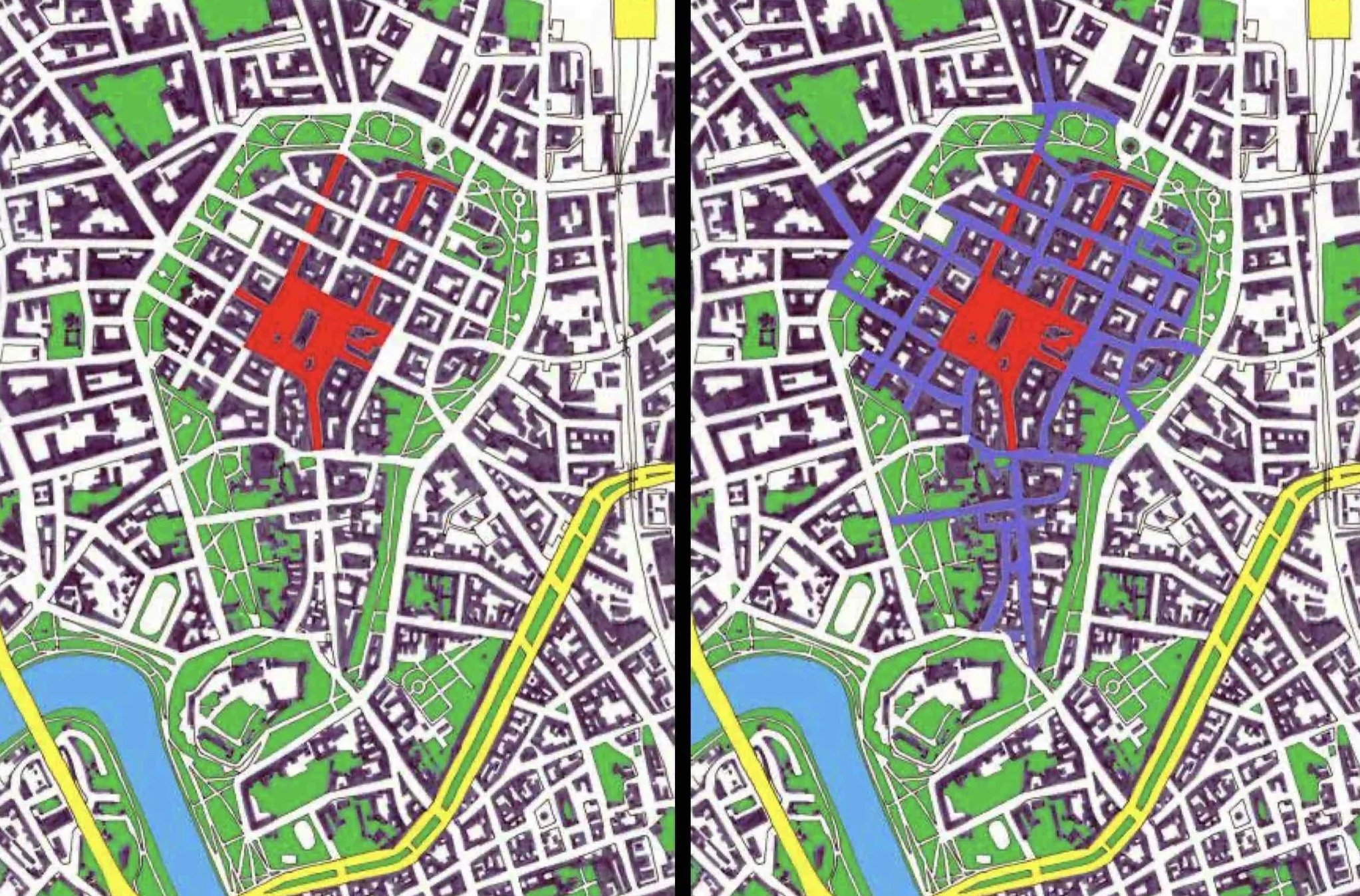
Learn The Forms In Figure Ground Analysis
Urban planners have spent decades attempting to make good cities but still produce some major failures: red-lining, urban renewal, slum clearance, overbuilt freeways and other efforts that began with “good intentions” but ended with harmful outcomes. When good outcomes occurred, they often were due to an understanding of urban form — not land use — that facilitated reasonable social and economic opportunities. Successful city plans still tout land use maps as evidence of good planning but, upon deeper analysis land use maps are superficial and show only the investment intentions of landowners. Instead, successful city plans build on the social and economic opportunities of places that are embedded in the urban form and culture of the city.
Of the many ways to analyze urban form, the use of figure-ground maps, instead of land use, is essential. Reading figure-ground maps is a form of literacy that many city planners have not learned (as shown above with Conzen’s concepts of morphology). Even more problematic has been the devaluation of urban form by professionals who interpret urban form based on public opinion or quantitative measurement rather than critical analysis of cultural history.
Along with ignorance of urban form, failures in city planning also come from misreading or ignoring the urban context. Geographic Information Systems (GIS) appear to represent urban context with quantitative data sets (which appear valid because they are precise) rather than narrative insights into the patterns of urban form that arise from studying figure-ground geography. These incompetencies should diminish as urban planners, who become familiar with figure-ground analysis, unveil more significant social and cultural patterns. A good starting point is the chapter in TheUrban Design Legacy of Coin Rowe by Charles Graves that expands, substantially the meaning and context of figure-ground maps. One of the common starting points for interpreting figure-ground maps is to look of critical patterns and distinctions such as the “objects” and “texture” patterns first described by Colin Rowe.
Objects That Become The Form For Critical Cultural & Commercial Places
The objects in a figure-ground analysis can be buildings (shown as “solids”), well-configured outdoor places (shown as “voids”), or combinations of the two (the plaza in front of cityhall). Large institutional or cultural facilities consist of major urban forms for multi-use places. A large hospital or university might include a campus of buildings and outdoor places for health/medical practice, administrative offices, building maintenance facilities, lawns and parks, cafés and food service, stormwater management, parking, energy production, ecological conservation, and historic preservation. City planners should represent such multipurpose facilities and places as distinct but linked entities rather than a single formless land use color with little significance (like the label “institutional”.
Urban planners need to maximize the diversity of activites in such places rather than conformance to overly strict zoning categories. Even single public buildings (libraries, police and fire stations, schools) include meeting rooms and outdoor places for public use. These activities can be linked to neighborhood places like a small café garden or play area. Urban maps should show such “objects” with a full range of activities.
Key public “objects” also include major commercial structures ranging from market halls to large office buildings and corporate headquarters. If combined, these groupings of “solids” and “voids” create cental business districts and small commercial centers. City planners need to further diversify mapped activities to include different housing forms (not zoning categories) that add to the cultural vitality of urban places. As such areas take root, they may become unique “districts” for the arts and entertainment, professional enclaves, retail, and historic preservation.
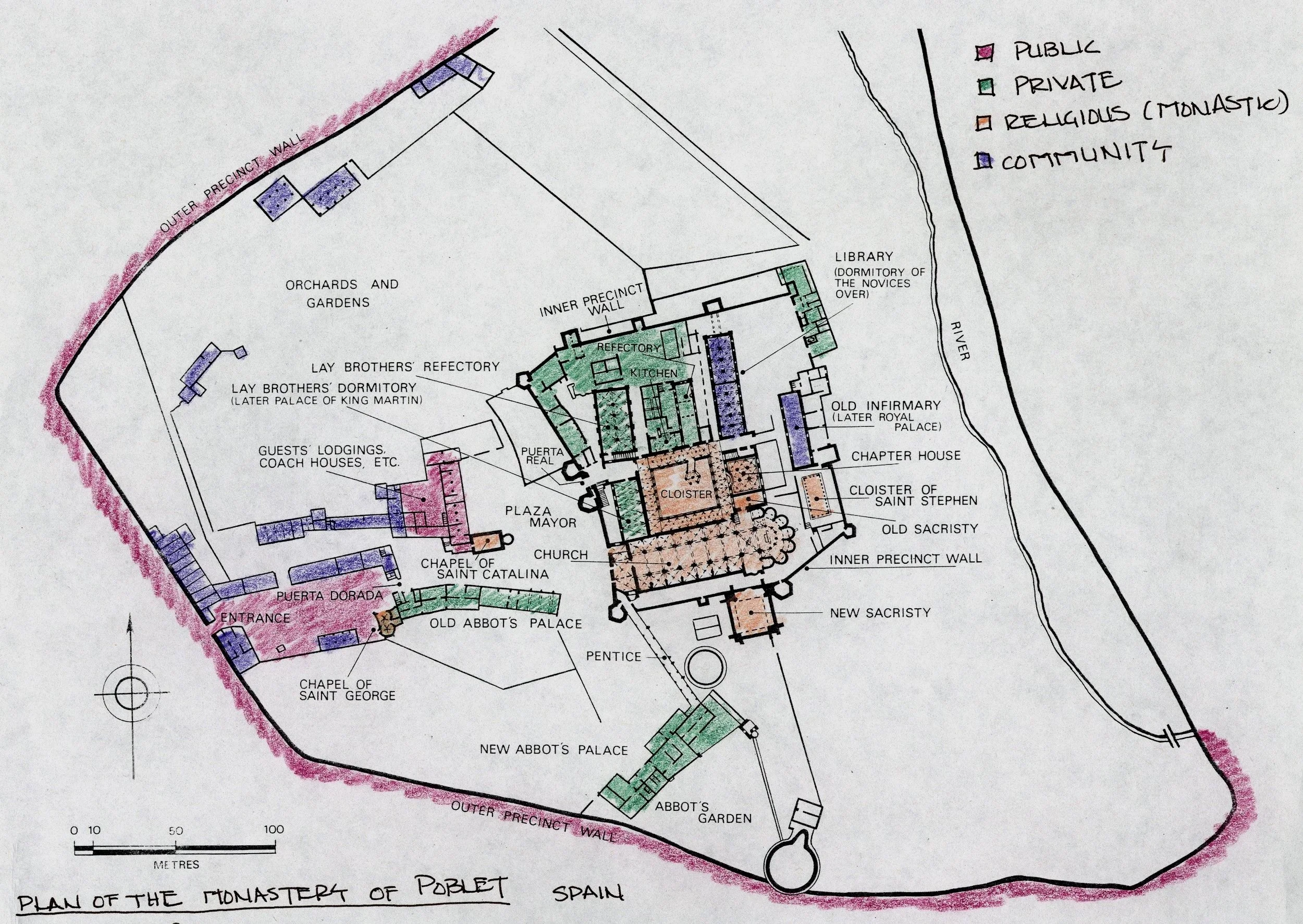
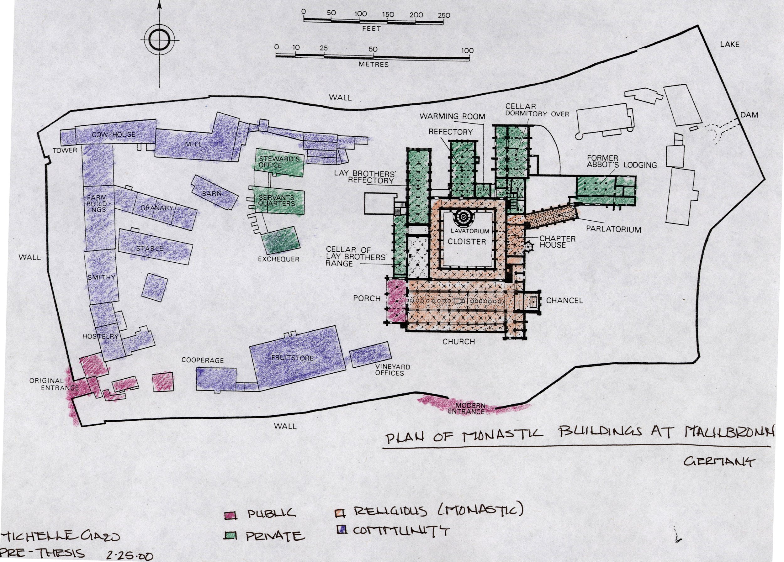
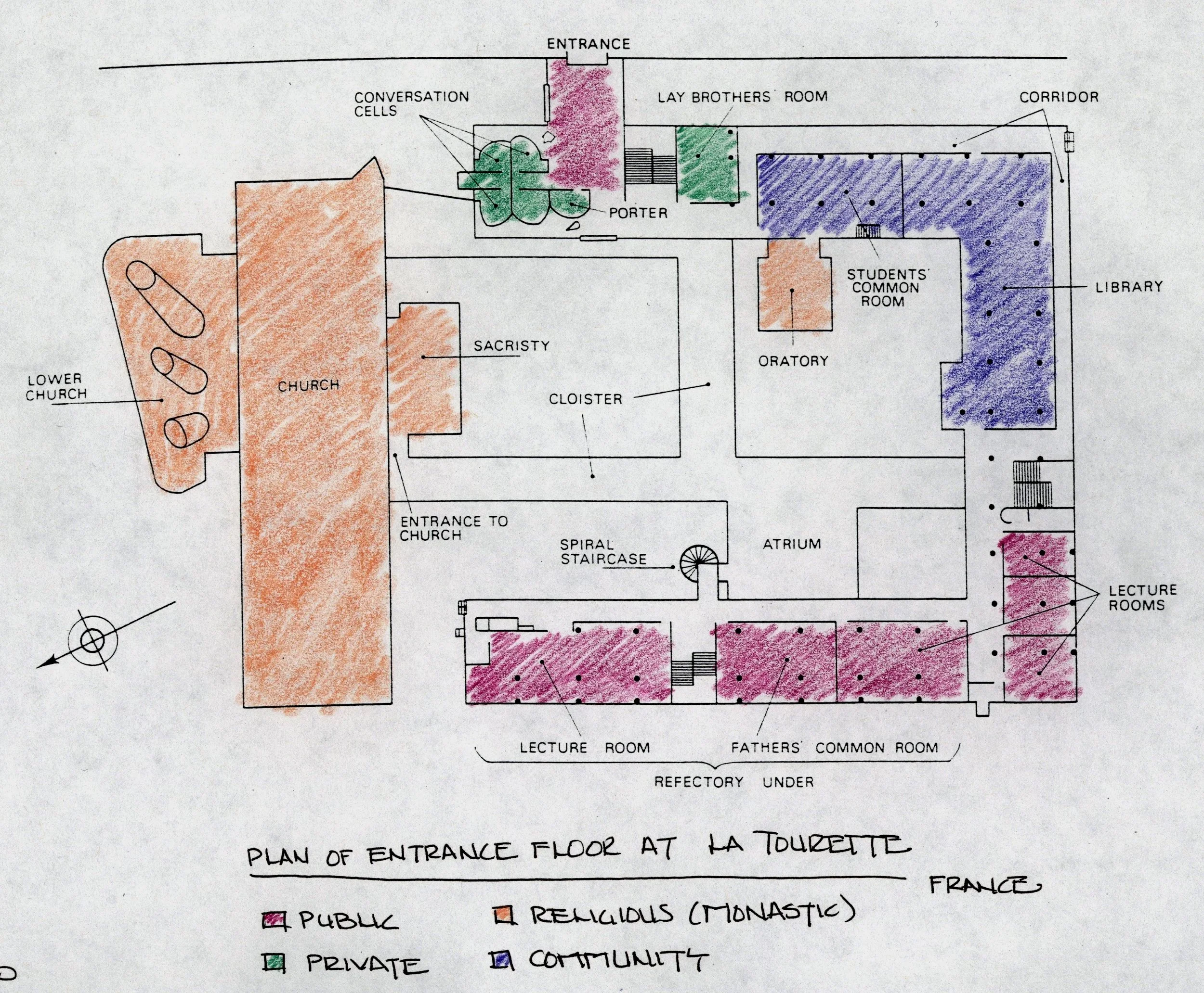
As part of a UWM assignment I asked the student to color code the building uses in well known religious places from different periods (including La Tourette by Corbusier). The results (below) show a type of community analysis that could benefit planners today — a truly mixed use pattern with both objects and texture, all with different patterns of form configured into significant community places.
Texture That Becomes The Form For Housing & Density
Every city seems to have a housing history surrounded by debate. Within such “collisions” city planners must recognize the positive patterns of housing, and how each pattern reflects a different set of activities and constraints. Often debate centers on the property value of housing – small stand-alone structures with values differing from larger apartment-style buildings. Such conflicts often come from major underlying social animosities among residents. City planners also confront analogous conflicts in rural areas among property owners who have lived there for decades.
Buildings textures on streets have a major impact on residential form. For example, multifamily buildings use group entrances that allow different tenants to gather and chat, while individual homes with small front yards foster street-based activities with a different social structure. Both housing forms have major value. Planning streets and buildings that effectively structure activities should focus on (and map) ground level places as a unique condition. Not every activity is mapped easily. In my neighborhood Halloween was a powerful, street-based social occasion, bringing out more families with more demographic diversity than any other annual activity and yet I have never seen Halloween mentioned in any land use, zoning code, or GIS analysis.
The concepts of housing patterns shown in “transect” maps are yet another highly useful methodology for displaying the texture of urban housing forms and structure of opportunities. City planners should look at transect patterns and use them – not as a precise template, but with modification to fit the context and texture of their community in terms of block size, lot width and depth, yard size, building heights, use of alleys, ancillary structures and related forms.
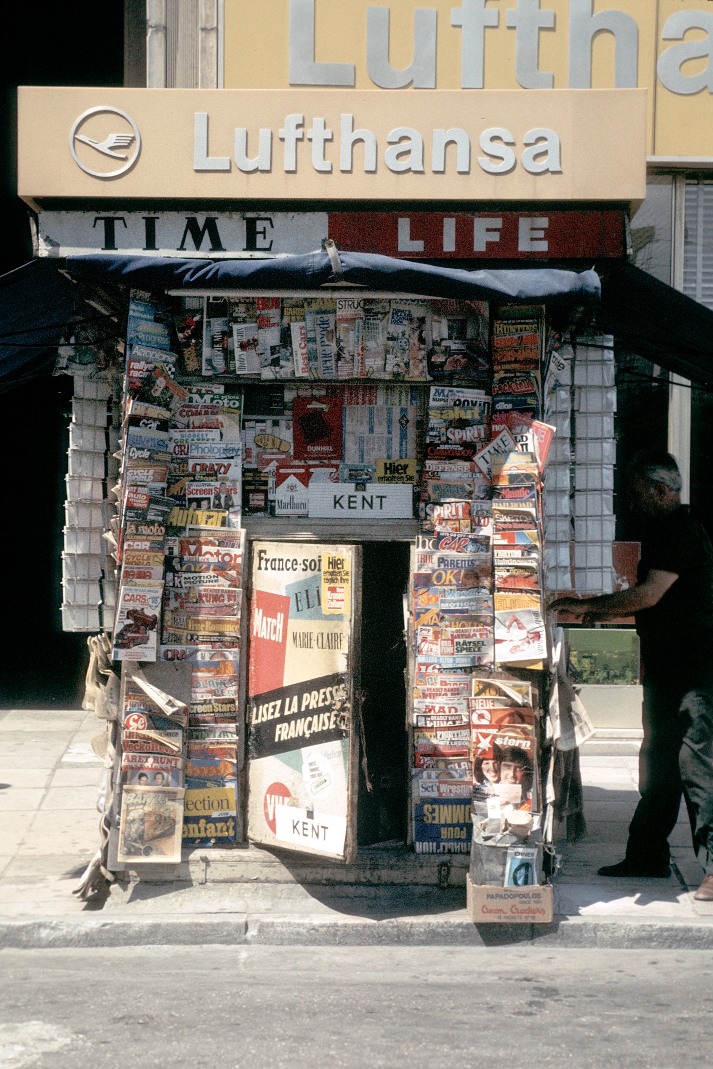
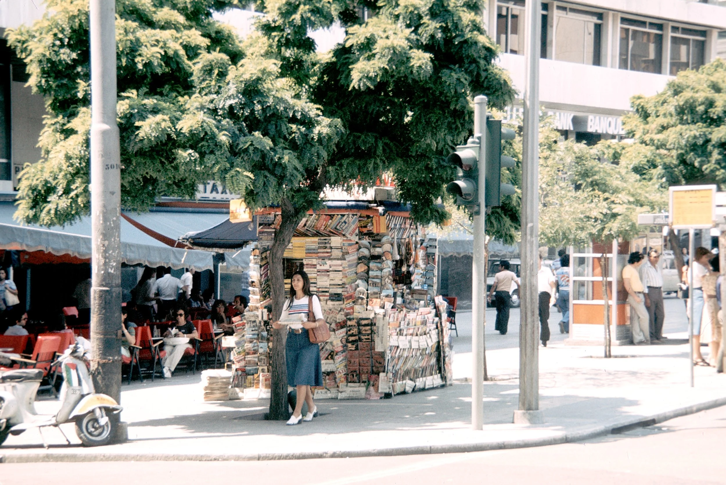
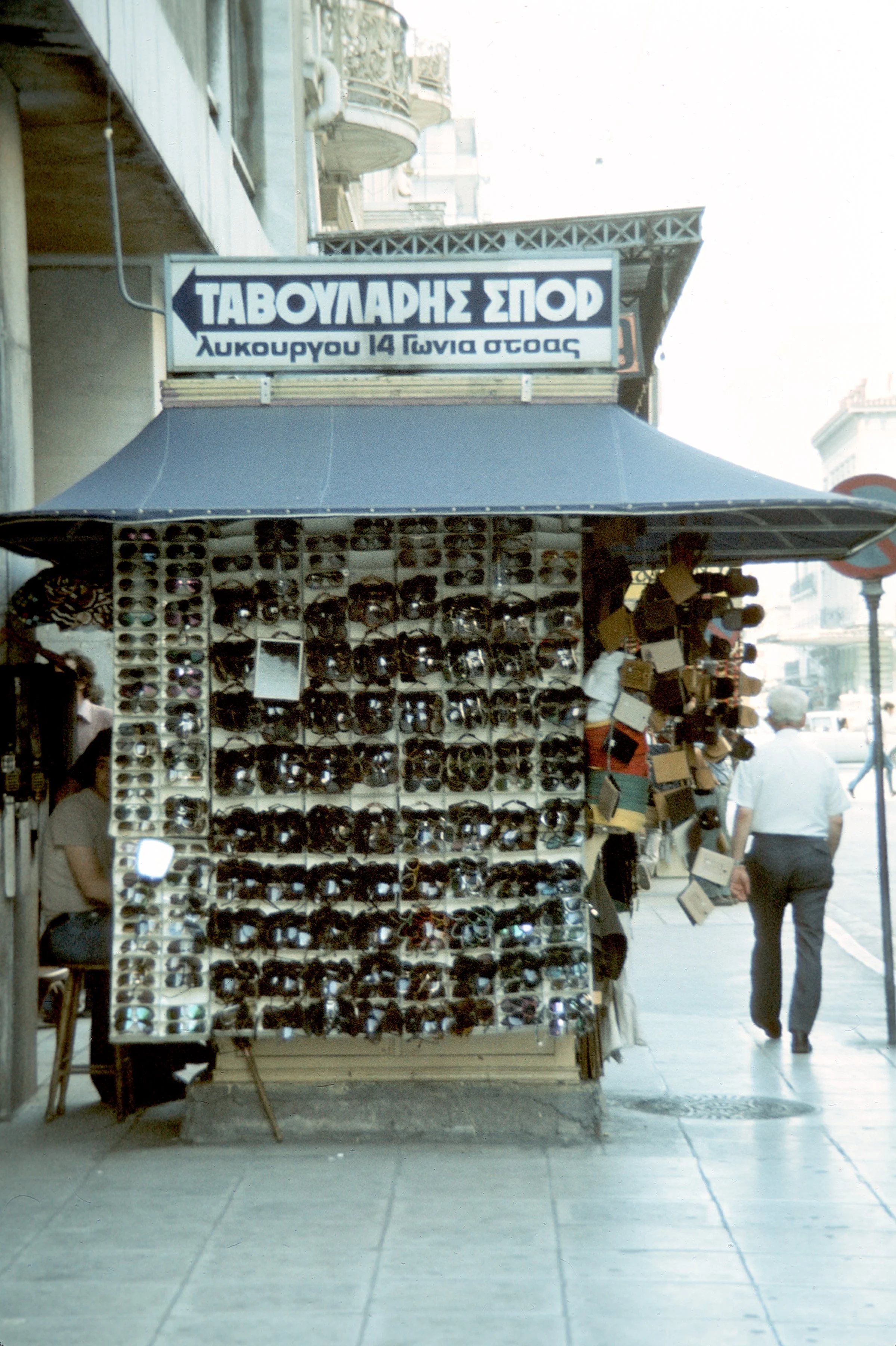
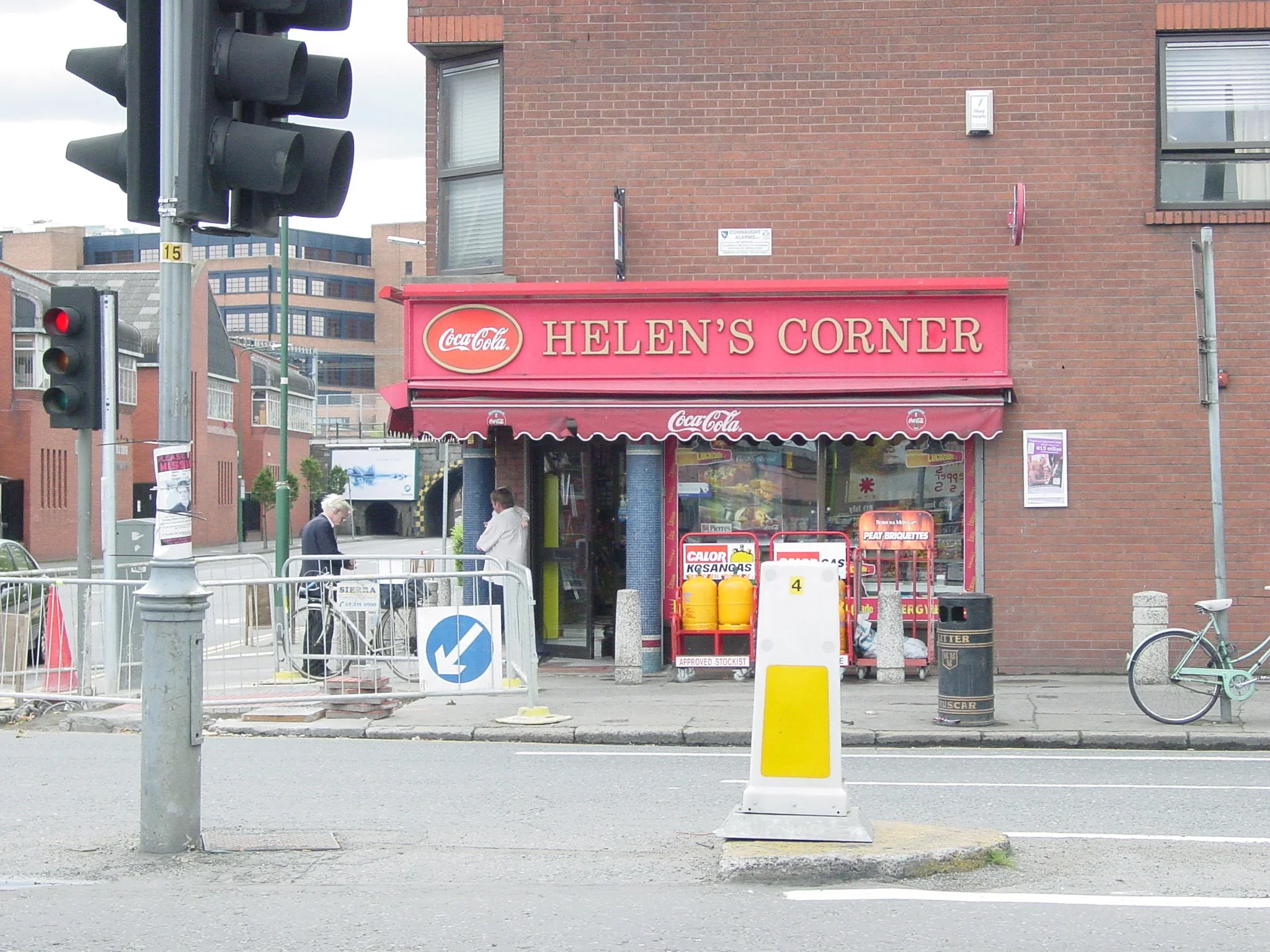
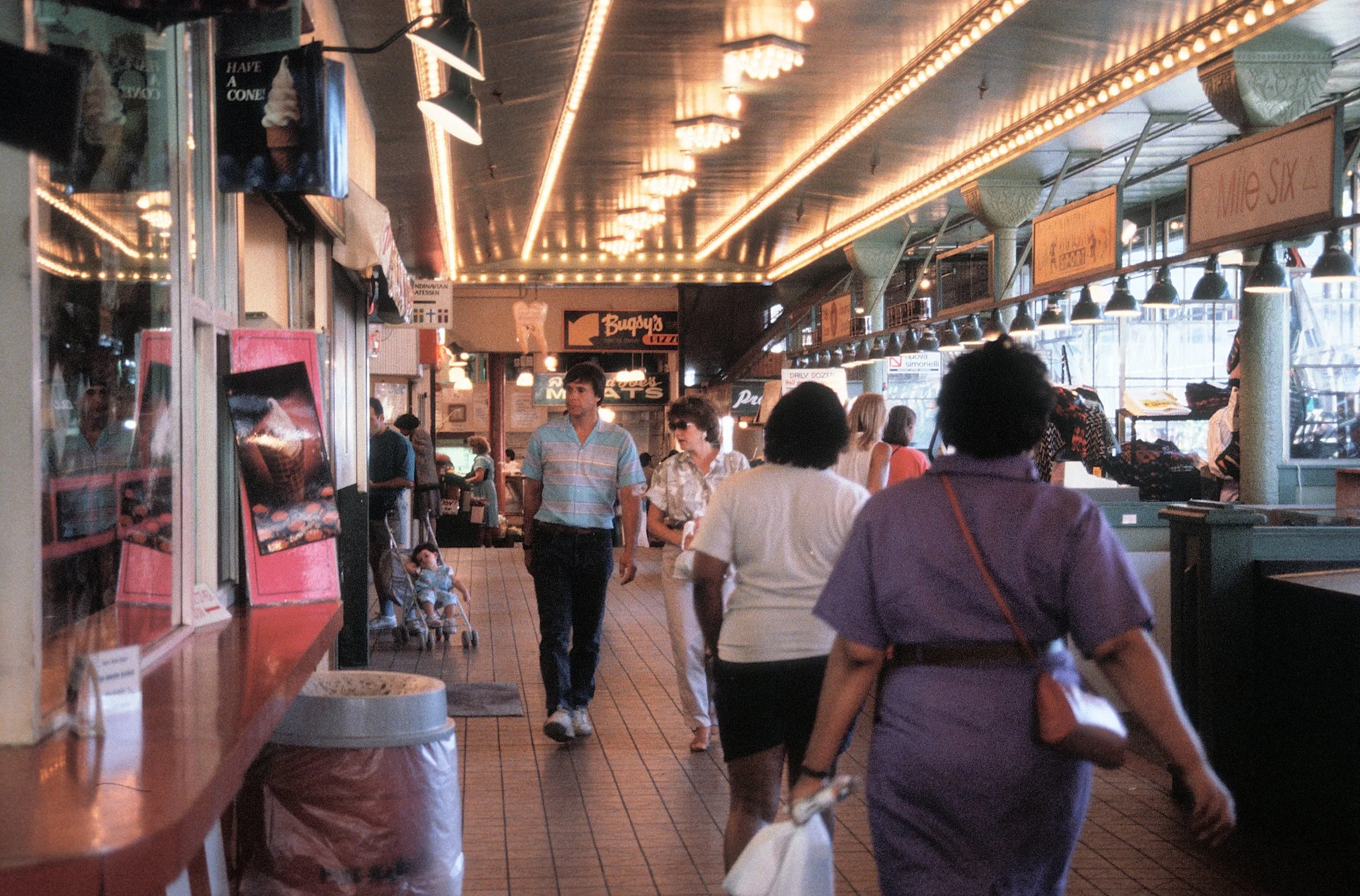
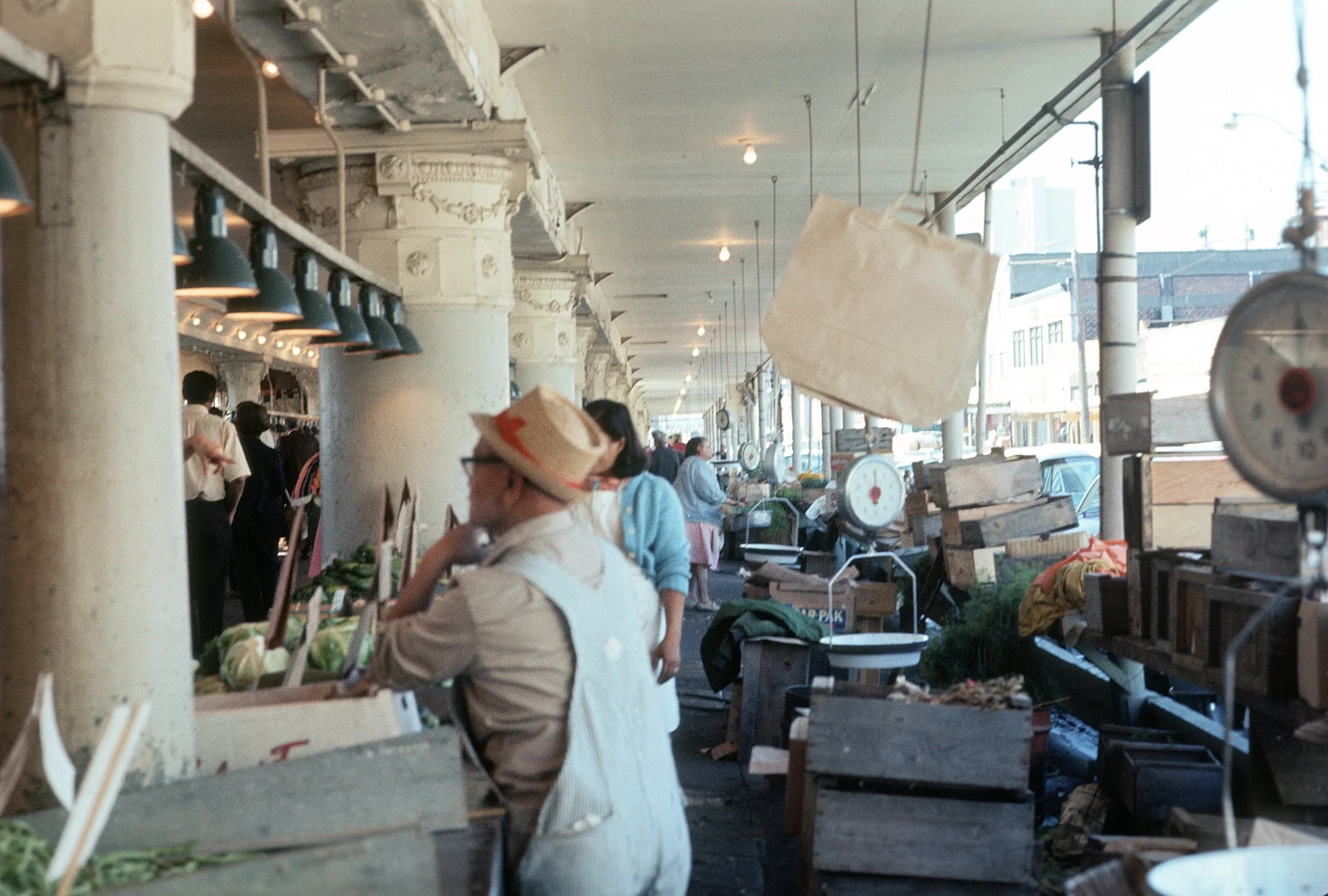
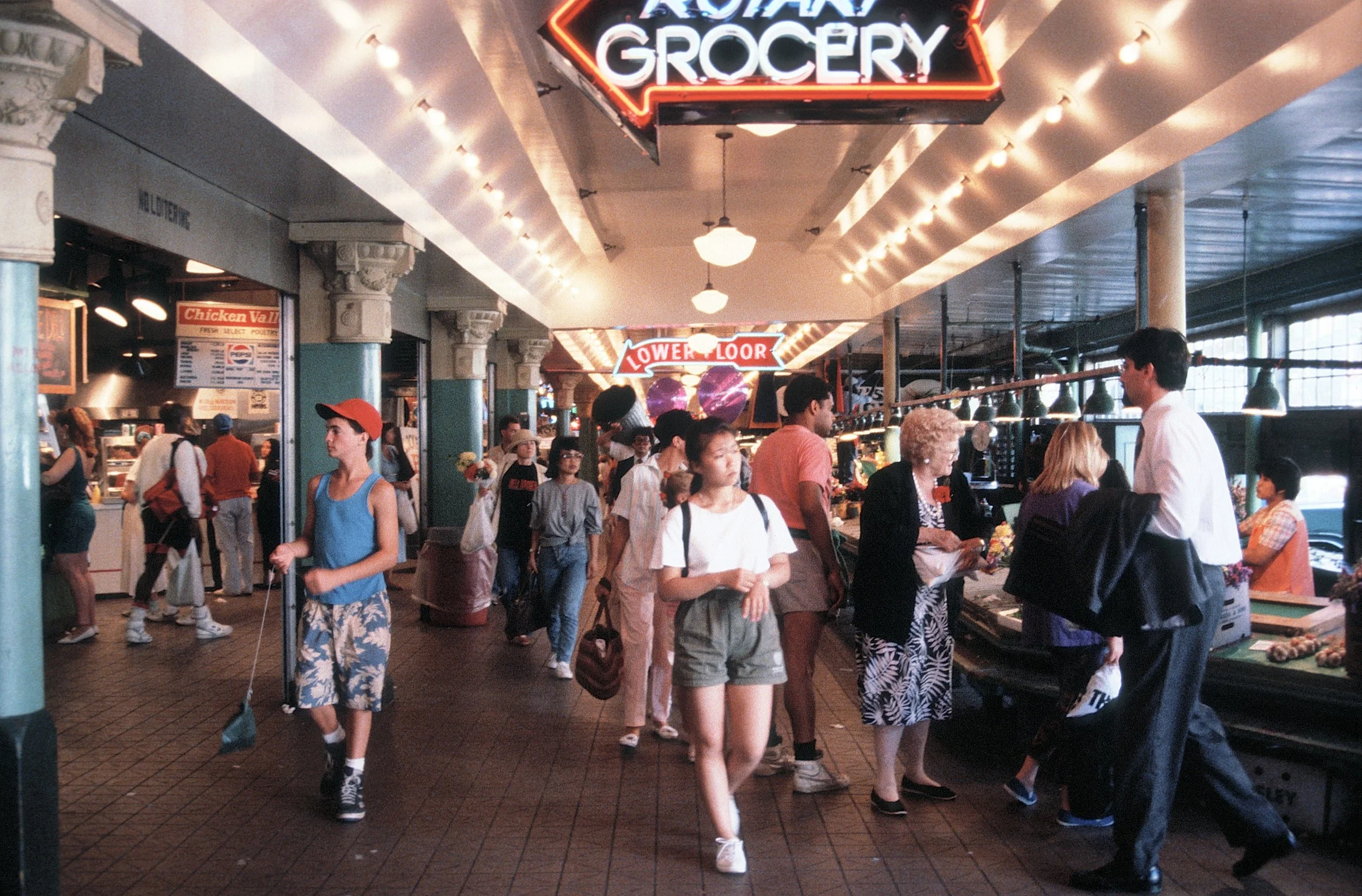
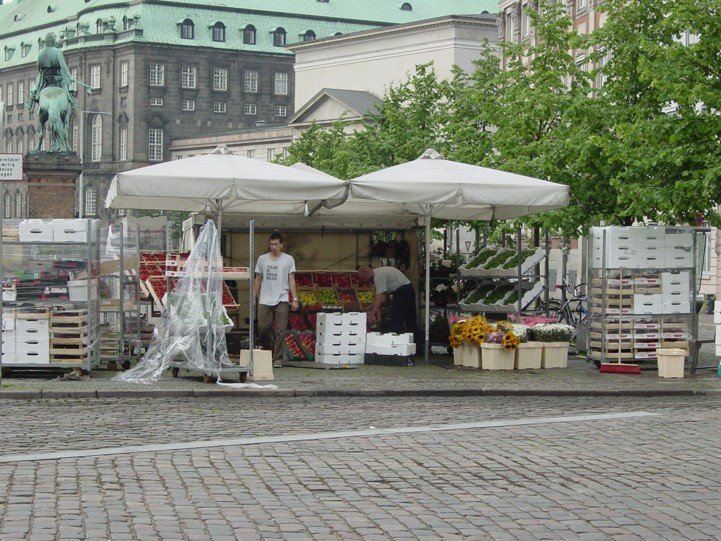
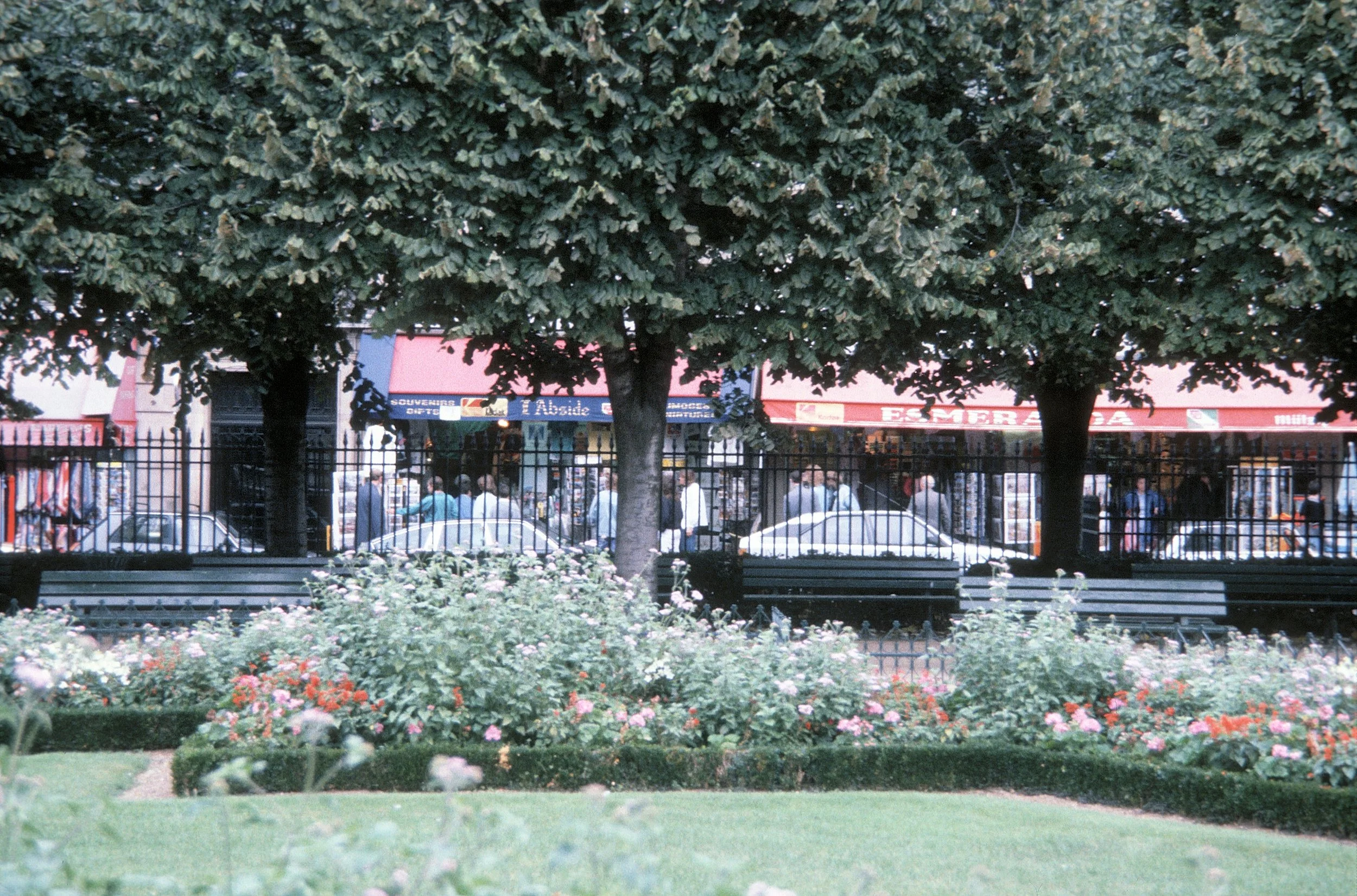
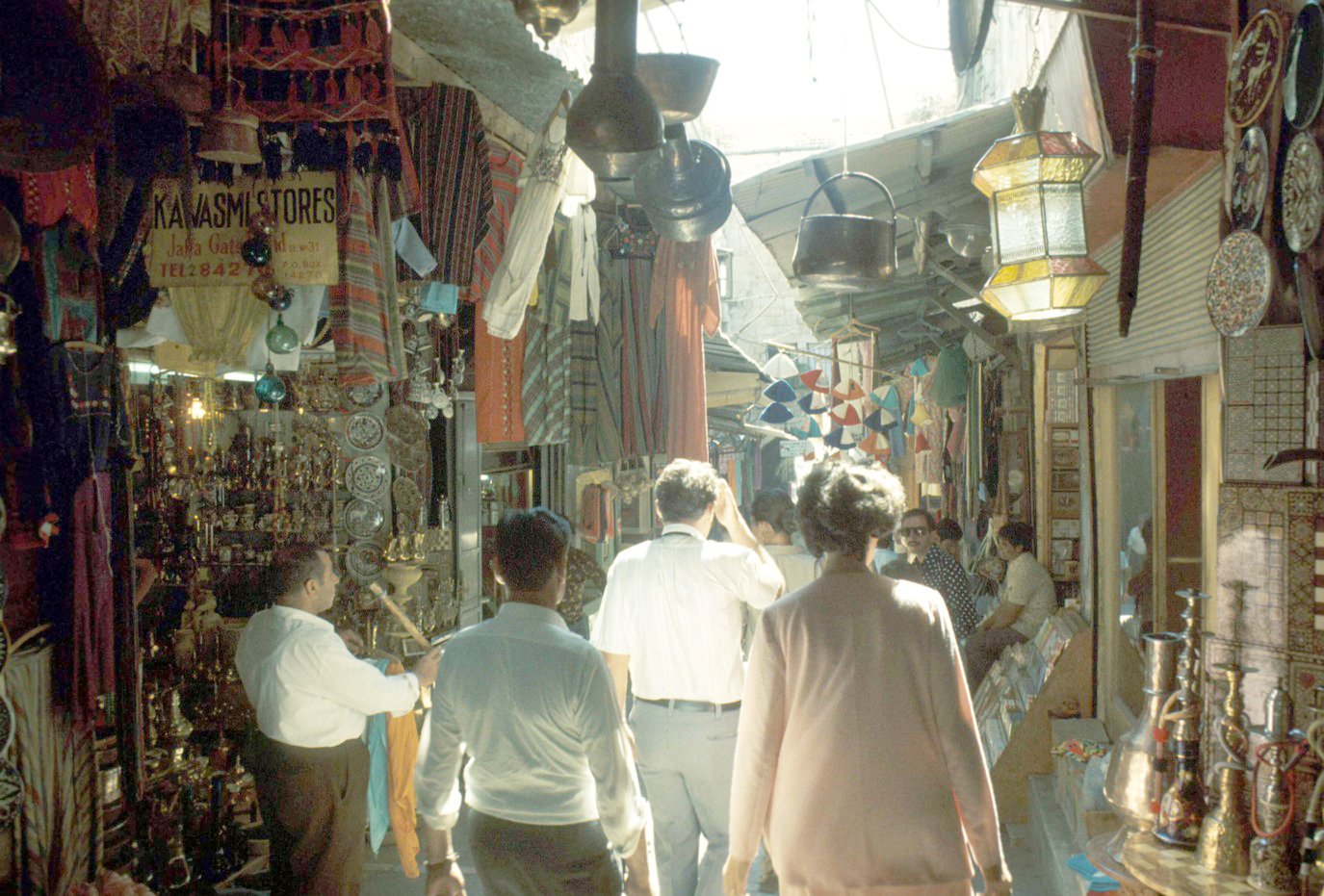
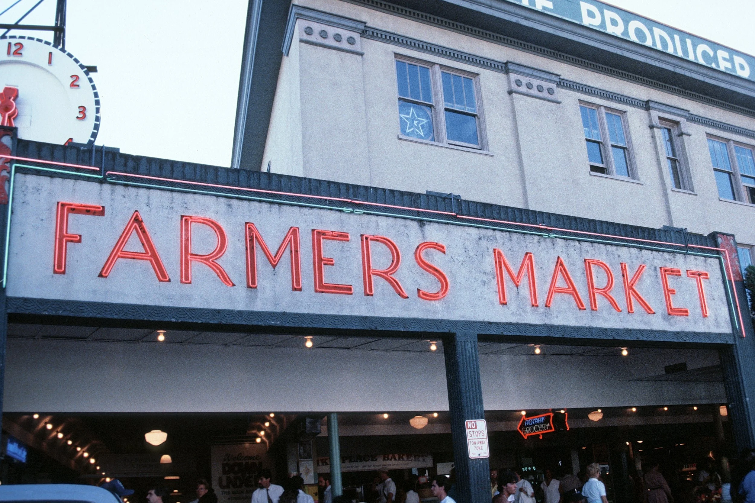
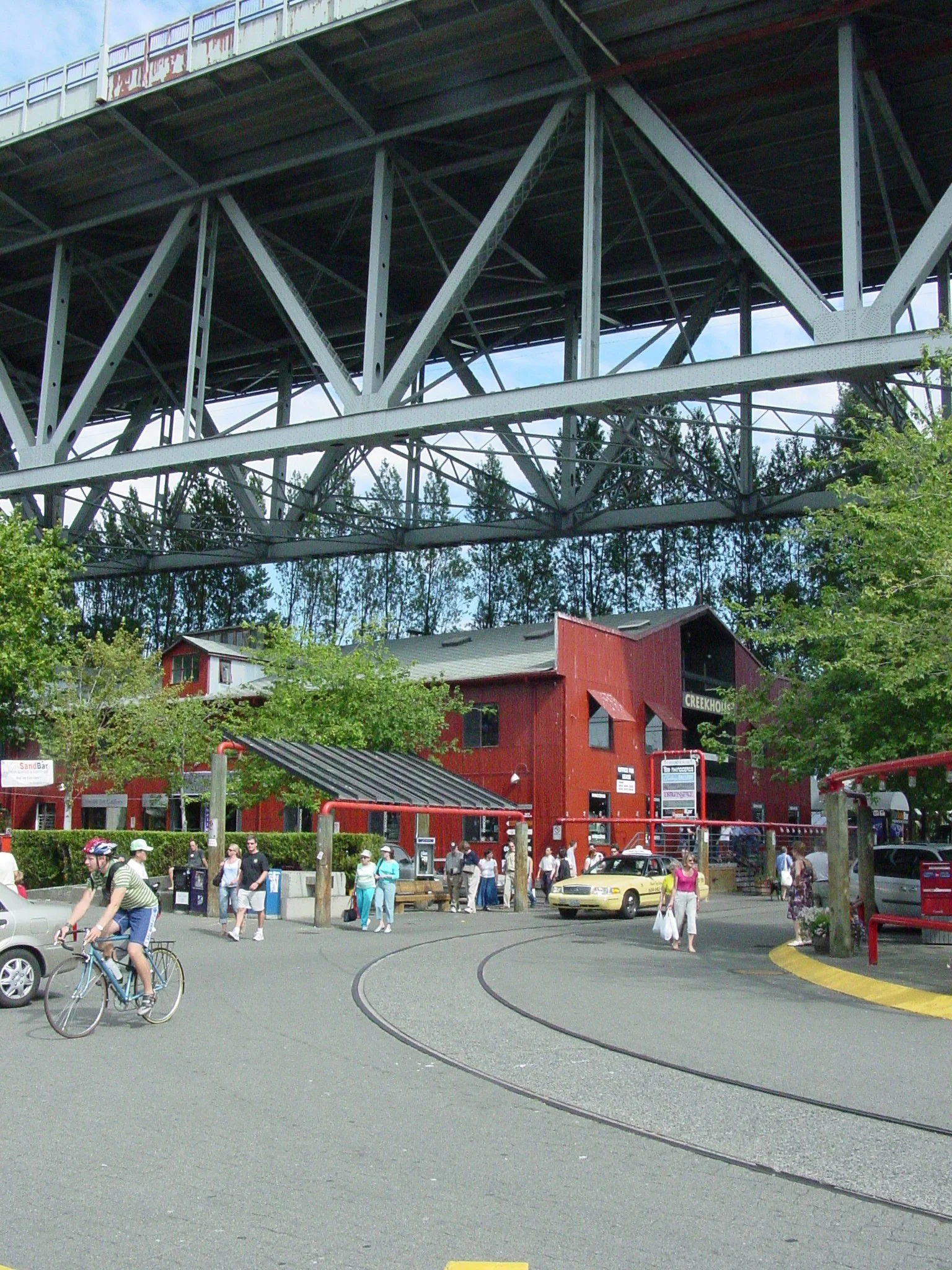
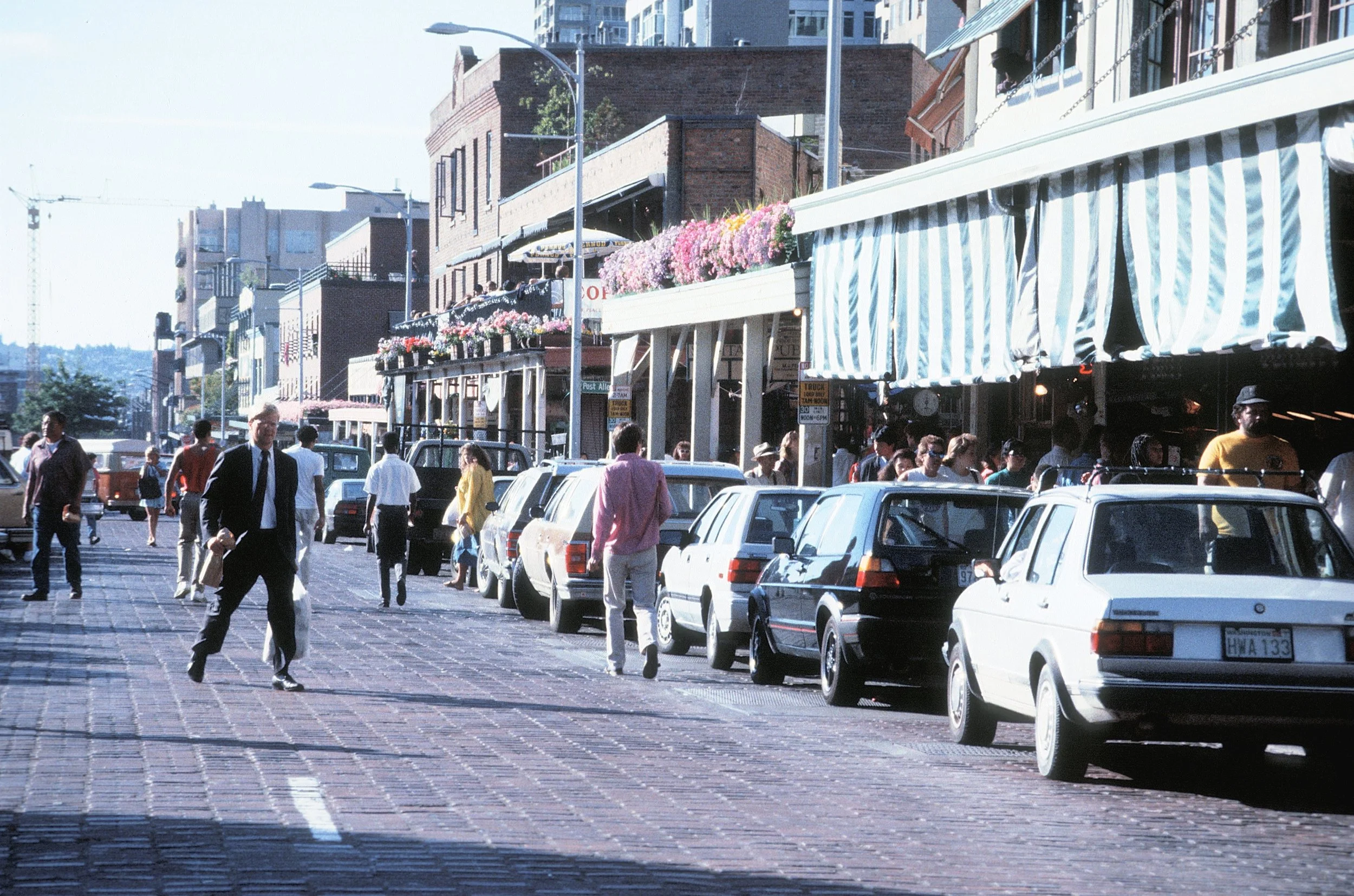
The photographs below illustrate how markets and economic activity are actually social opportunities — toady’s online buying culture will only increase the demand for traditional social buying. If online buying provided the same social opportunity as occurs in a public place then we would have increasingly fewer cafes, not more. We can see that without a GIS study. Types of street-based social market activities are rarely mapped as a traditional component of district plans.


Learn The Opportunities In The Urban Form
Planners should map, along with the urban form of a figure ground map, the social, psychological, economic and cultural opportunities which define urban places. In Nolli’s famous map of Rome, in addition to urban form, the map includes key building interiors based on cultural history rather than geography. Unfortunately, today urban form and opportunity is often trivialized by professional city planners. Frequently planners present overly abstract summaries of form and opportunity. When details are offered, they usually measure irrelevant attributes precisely – details that sound important but offer no insight. Planners might say that a place needs “activation” and show photographs of great places – a good start. But the photographs do not explain how good places can be implemented physically. Good places have to be embedded into the real physical form and activity of the city. Good places, as described below, should become the objects, texture and attributes of cities.
Spontaneous Every-day Public Opportunities
For planners in thriving cities, the best public places usually are those with high levels of human activity with a diverse population that requires minimal levels of pre-planning, management, or environmental intervention. Here again, places (with or without density-driven activity) do not show up in most codes, but should still be mapped as significant:
a city street, with parked cars, where kids play “stick ball”
sidewalks where adults play cards
front porches to meet visitors
block parties that stop traffic
back yards with a rummage sale
parking lots where friends tailgate
cafés or beer gardens where people meet old friends
gas stations where teenagers hand out
neighbors passing by your garden
These activities all “take place” in the “voids” of figure-ground maps. They may be “temporary” or “interim” uses as listed in a zoning code, but they are not of secondary importance — just the opposite. They are the social glue that holds communities together. These places may occupy a small, intimate setting (like a small café area with outdoor seating). Such opportunities also occur in larger neighborhood parks (mislabeled as “passive” parks) where individuals stroll, look around, walk their dog, engage in unorganized sports (frisbee, tag, catch, sledding, using the playground, flying a kite, swimming at the lake or river). Pattern Language (discussed below) offers many examples. The key to these places is that they offer high levels of “every-day” activity for individuals and small groups without any event planning – they are personal, spontaneous, unpredictable, choices.
Programmed Public And Semi-Public Opportunities
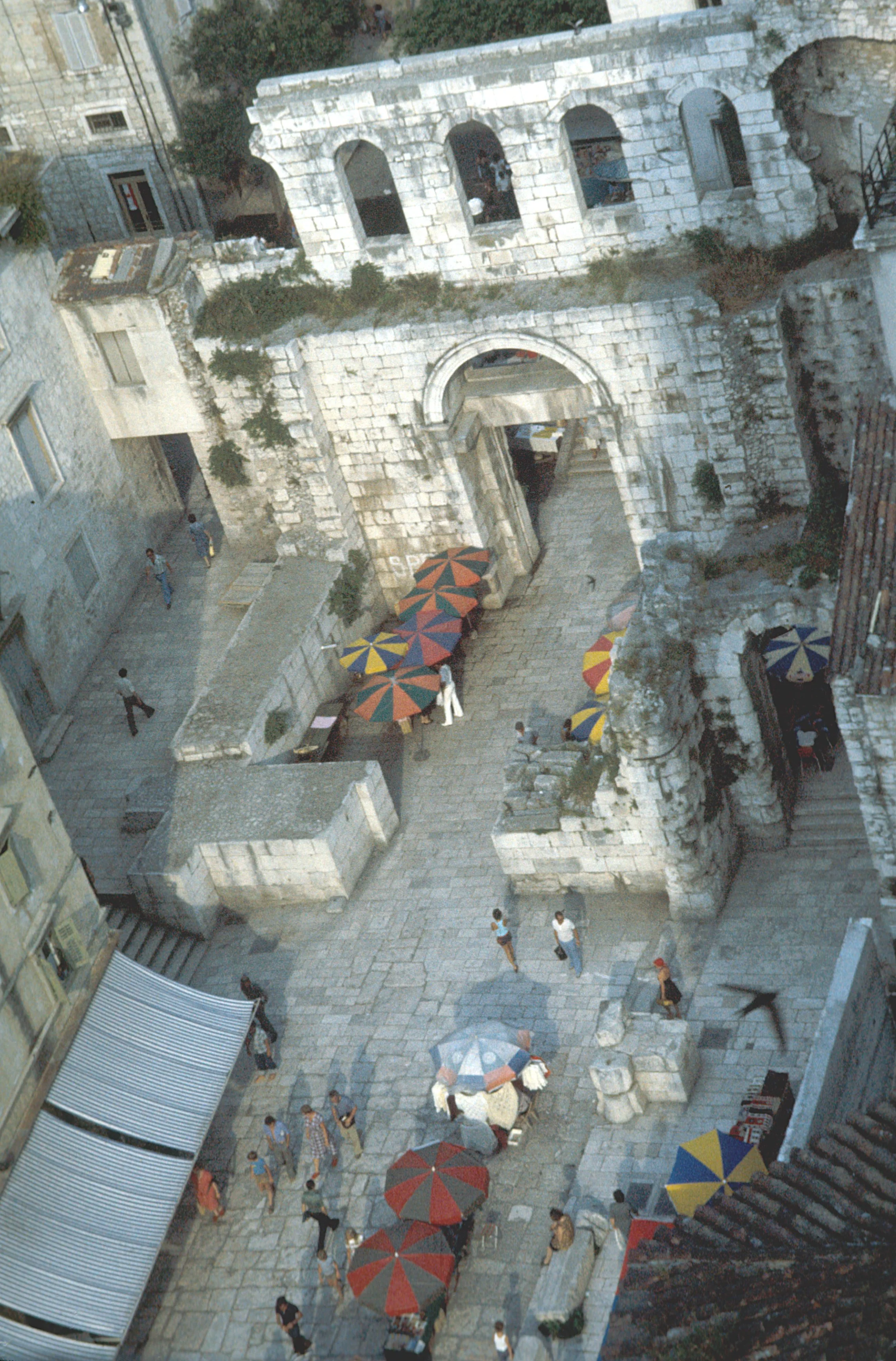
Some large “voids” in figure-ground map contain opportunities for social engagement with people and nature (whether it is picturesque, sublime, beautiful or ecological). Larger parks and gardens capture a full gamut of opportunities — typical of Olmsted’s major city parks and most of the great European urban gardens. Even smaller “voids” like the well-known vest pocket park – Paley Plaza – in Manhattan includes open outdoor seating, a small café, and a wide waterfall which almost feels sublime.
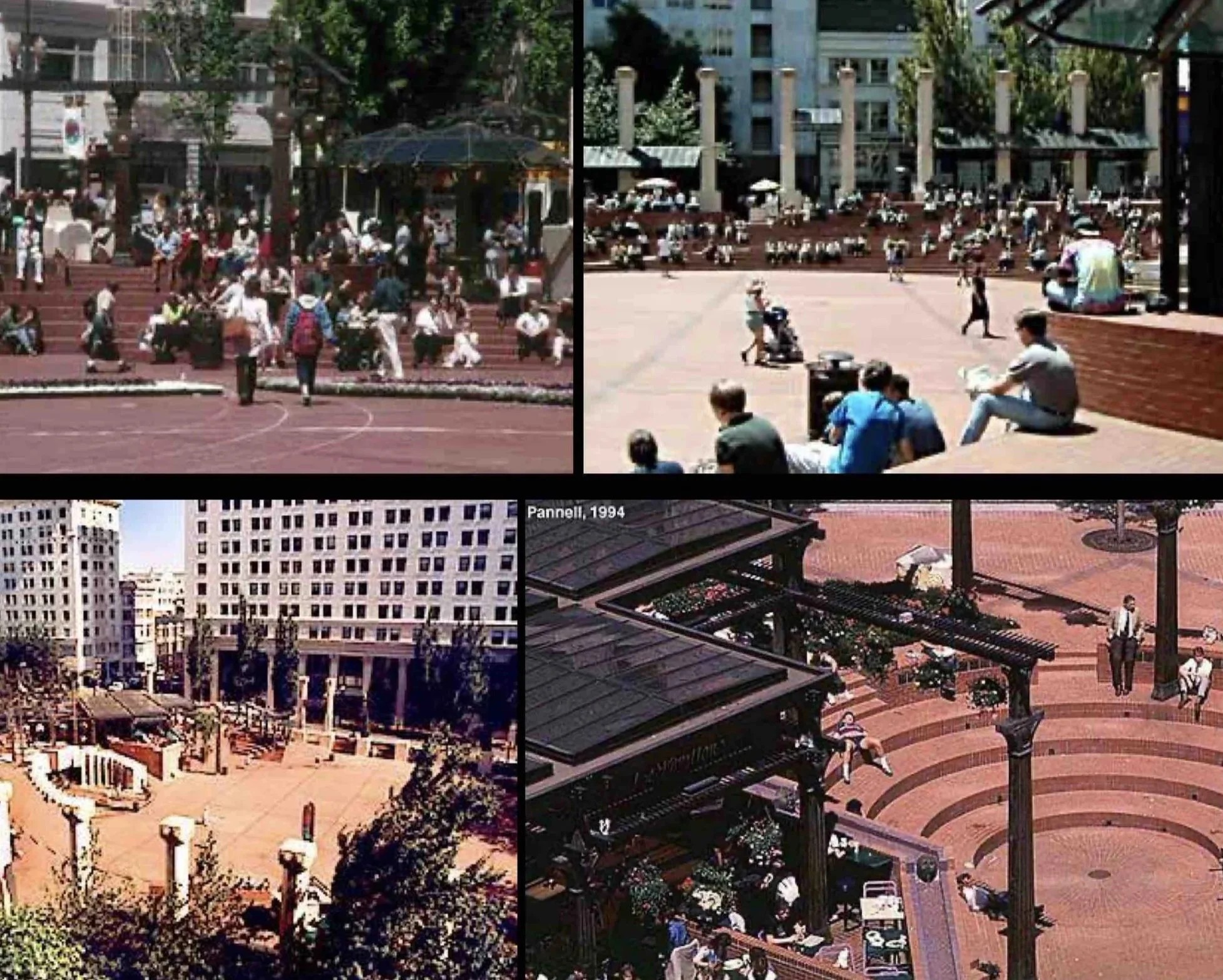
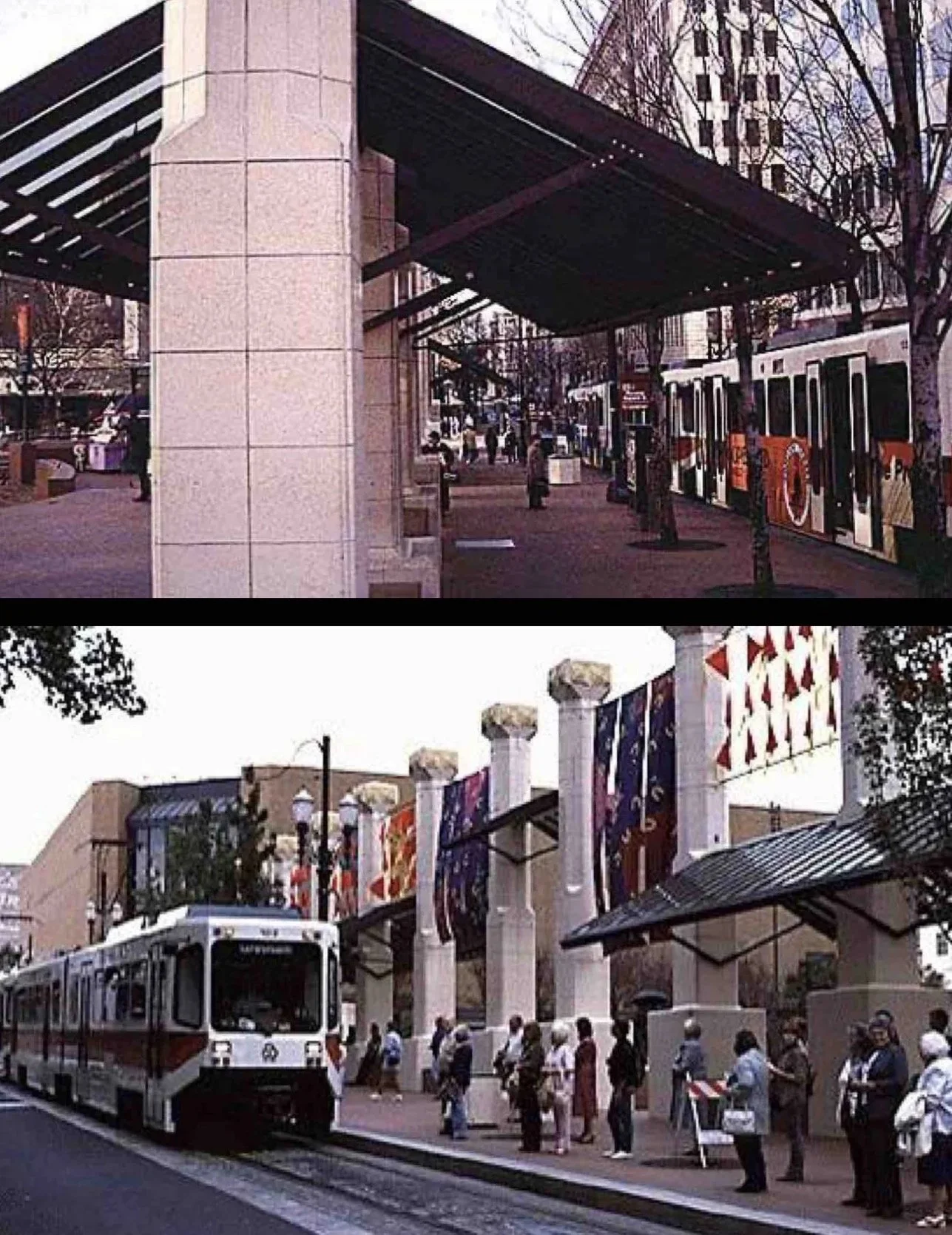
These type of places, like the everyday places described above, are open to all, but they do require significant special programming. A good neighborhood example is a farmers market, block party, or street festival. City-wide places must also be developed. Well known American examples of programmed places include Rockefeller Cnter, Pioneer Courthouse Square (below) and Millenium Park. Some of these parks require admission fees (like theme botanical gardens, zoos and aquariums) but remain open on a year-round schedule. Other special venues remain closed except for entertainment or sports or events. In these places, when no event occurs, large empty areas can create negative emotional responses.
Pioneer Courthouse Square in Portland fulfills many of the key criteria for a successful urban place: it allows for both spontaneous and programmed activities, it supports pedestrians, cyclists and transit riders, it provides activities night and day and in all seasons — but it requires resources and managmeent. Around 1996, when this study occurred, the annual budget for staff and expenses was approximately $800,000 and the annual revenue was over $1,000,000. This place works well because urban design and city planning were dovetailed effectively.
Natural Environmental Opportunities
Americans value natural features, often with conflicting attitudes. When I show pictures of European plazas with no trees (such as the Campo in Siena) students appreciate the social and aesthetic opportunity and value of the place. Yet those students still recommend “green” space as the most important attribute of a successful public place. Integrating these two attitudes requires city planners to design places for environmental socialization, often associated with urban gardens and conservatories well suited to denser cities. City planners must also provide places programmed for environmental preservation & conservation not intended for high visitor volumes but consistent with national parks and campgrounds on large tracts of undeveloped land. Some cities, however, do create larger ecological facilities with restricted access to protect the natural environment and, at the same time, socialize the idea within the local community.
Learn Precedents, Types & Archetypes
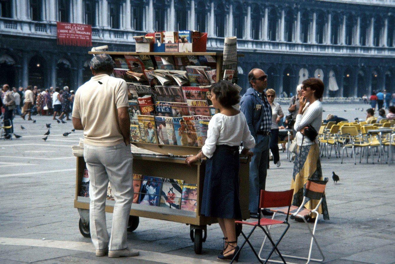
Over time some urban places – spontaneous and programmed, solids and voids – become so dominant that they evolve, in Max Black’s language, into archetypes or places that reveal “a systematic repertoire of ideas”. For example, St. Mark’s square in Venice or the Campo in Siena may be considered archetypes. These places have been the subject of many conflicts: politically, socially, economically and spiritually. Few good public places avoid debates altogether. If a public urban places do not encounter any social conflict, it probably does not work as a social experience. Again, The Urban Design Legacy of Colin Rowe is filled with powerful examples of types, precedents and paradigms useful to city planners.